Fisk, Missouri
| Fisk, Missouri | |
|---|---|
| City | |
|
City Hall of Fisk, October 2014. | |
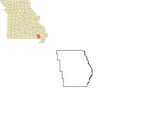 Location of Fisk, Missouri | |
| Coordinates: 36°46′56″N 90°12′22″W / 36.78222°N 90.20611°WCoordinates: 36°46′56″N 90°12′22″W / 36.78222°N 90.20611°W | |
| Country | United States |
| State | Missouri |
| County | Butler |
| Area[1] | |
| • Total | 0.33 sq mi (0.85 km2) |
| • Land | 0.32 sq mi (0.83 km2) |
| • Water | 0.01 sq mi (0.03 km2) |
| Elevation | 331 ft (101 m) |
| Population (2010)[2] | |
| • Total | 342 |
| • Estimate (2012[3]) | 341 |
| • Density | 1,068.8/sq mi (412.7/km2) |
| Time zone | Central (CST) (UTC-6) |
| • Summer (DST) | CDT (UTC-5) |
| ZIP code | 63940 |
| Area code(s) | 573 |
| FIPS code | 29-24328[4] |
| GNIS feature ID | 0717961[5] |

Fisk is a small city[6] in Butler County in Southeast Missouri in the United States. It is located right along the Butler-Stoddard County line on U.S. Highway 60 along the St. Francis River. The population was 342 at the 2010 census.
Fisk is included within the Poplar Bluff Micropolitan Statistical Area.
History
A post office called Fisk has been in operation since 1899.[7] The community was named after Samuel J. Fisk, the proprietor of a local sawmill.[8]
Geography
Fisk is located at 36°46′56″N 90°12′22″W / 36.782253°N 90.206198°W.[9]
According to the United States Census Bureau, the city has a total area of 0.33 square miles (0.85 km2), of which, 0.32 square miles (0.83 km2) is land and 0.01 square miles (0.03 km2) is water.[1]
Demographics
| Historical population | |||
|---|---|---|---|
| Census | Pop. | %± | |
| 1920 | 466 | — | |
| 1930 | 387 | −17.0% | |
| 1940 | 386 | −0.3% | |
| 1950 | 542 | 40.4% | |
| 1960 | 498 | −8.1% | |
| 1970 | 503 | 1.0% | |
| 1980 | 450 | −10.5% | |
| 1990 | 422 | −6.2% | |
| 2000 | 363 | −14.0% | |
| 2010 | 342 | −5.8% | |
| Est. 2015 | 339 | [10] | −0.9% |
2010 census
As of the census[2] of 2010, there were 342 people, 163 households, and 88 families residing in the city. The population density was 1,068.8 inhabitants per square mile (412.7/km2). There were 180 housing units at an average density of 562.5 per square mile (217.2/km2). The racial makeup of the city was 99.42% White and 0.58% from two or more races. Hispanic or Latino of any race were 0.29% of the population.
There were 163 households of which 25.8% had children under the age of 18 living with them, 36.8% were married couples living together, 14.1% had a female householder with no husband present, 3.1% had a male householder with no wife present, and 46.0% were non-families. 40.5% of all households were made up of individuals and 17.2% had someone living alone who was 65 years of age or older. The average household size was 2.10 and the average family size was 2.80.
The median age in the city was 46 years. 19.9% of residents were under the age of 18; 6.6% were between the ages of 18 and 24; 21.9% were from 25 to 44; 32.7% were from 45 to 64; and 18.7% were 65 years of age or older. The gender makeup of the city was 47.1% male and 52.9% female.
2000 census
As of the census[4] of 2000, there were 363 people, 169 households, and 102 families residing in the city. The population density was 1,099.8 people per square mile (424.7/km²). There were 189 housing units at an average density of 572.6 per square mile (221.1/km²). The racial makeup of the city was 98.35% White, 0.83% African American, 0.55% Native American, and 0.28% from two or more races. Hispanic or Latino of any race were 0.83% of the population.
There were 169 households out of which 25.4% had children under the age of 18 living with them, 42.0% were married couples living together, 14.8% had a female householder with no husband present, and 39.6% were non-families. 35.5% of all households were made up of individuals and 18.3% had someone living alone who was 65 years of age or older. The average household size was 2.15 and the average family size was 2.80.
In the city the population was spread out with 23.7% under the age of 18, 6.1% from 18 to 24, 24.8% from 25 to 44, 24.8% from 45 to 64, and 20.7% who were 65 years of age or older. The median age was 42 years. For every 100 females there were 80.6 males. For every 100 females age 18 and over, there were 75.3 males.
The median income for a household in the city was $19,886, and the median income for a family was $27,000. Males had a median income of $20,500 versus $16,250 for females. The per capita income for the city was $11,577. About 17.0% of families and 30.7% of the population were below the poverty line, including 53.3% of those under age 18 and 18.6% of those age 65 or over.
Climate
Climate is characterized by relatively high temperatures and evenly distributed precipitation throughout the year. The Köppen Climate Classification subtype for this climate is "Cfa" (Humid Subtropical Climate).[12]
| Climate data for Fisk, Missouri | |||||||||||||
|---|---|---|---|---|---|---|---|---|---|---|---|---|---|
| Month | Jan | Feb | Mar | Apr | May | Jun | Jul | Aug | Sep | Oct | Nov | Dec | Year |
| Average high °C (°F) | 21 (70) |
7 (45) |
10 (50) |
16 (60) |
22 (71) |
26 (79) |
31 (88) |
33 (91) |
32 (90) |
29 (84) |
23 (73) |
15 (59) |
22.1 (71.7) |
| Average low °C (°F) | −4 (25) |
−2 (29) |
3 (37) |
8 (47) |
13 (56) |
18 (64) |
20 (68) |
19 (66) |
15 (59) |
8 (47) |
2 (36) |
−2 (28) |
8.2 (46.8) |
| Average precipitation mm (inches) | 91 (3.6) |
79 (3.1) |
119 (4.7) |
117 (4.6) |
119 (4.7) |
100 (4) |
91 (3.6) |
89 (3.5) |
91 (3.6) |
84 (3.3) |
100 (4) |
99 (3.9) |
1,179 (46.6) |
| Average precipitation days | 8 | 7 | 9 | 10 | 10 | 8 | 7 | 7 | 7 | 7 | 8 | 8 | 96 |
| Source: Weatherbase [13] | |||||||||||||
References
- 1 2 "US Gazetteer files 2010". United States Census Bureau. Archived from the original on January 24, 2012. Retrieved 2012-07-08.
- 1 2 "American FactFinder". United States Census Bureau. Retrieved 2012-07-08.
- ↑ "Population Estimates". United States Census Bureau. Archived from the original on June 17, 2013. Retrieved 2013-05-30.
- 1 2 "American FactFinder". United States Census Bureau. Archived from the original on September 11, 2013. Retrieved 2008-01-31.
- ↑ "US Board on Geographic Names". United States Geological Survey. 2007-10-25. Retrieved 2008-01-31.
- ↑ "Cities & Municipalities". Official Missouri State Website. Retrieved 18 July 2016.
- ↑ "Post Offices". Jim Forte Postal History. Retrieved 6 September 2016.
- ↑ "Butler County Place Names, 1928–1945 (archived)". The State Historical Society of Missouri. Retrieved 6 September 2016.
- ↑ "US Gazetteer files: 2010, 2000, and 1990". United States Census Bureau. 2011-02-12. Retrieved 2011-04-23.
- ↑ "Annual Estimates of the Resident Population for Incorporated Places: April 1, 2010 to July 1, 2015". Retrieved July 2, 2016.
- ↑ "Census of Population and Housing". Census.gov. Archived from the original on May 11, 2015. Retrieved June 4, 2015.
- ↑ Climate Summary for Fisk, Missouri
- ↑ "Weatherbase.com". Weatherbase. 2013. Retrieved on August 6, 2013.
External links
- Historic maps of Fisk in the Sanborn Maps of Missouri Collection at the University of Missouri
Municipalities and communities of Butler County, Missouri, United States | ||
|---|---|---|
| Cities | 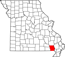 | |
| Townships | ||
| CDP | ||
| Other unincorporated communities | ||
| Ghost town | ||
| Footnotes | ‡This populated place also has portions in an adjacent county or counties | |