Coon Island Township, Butler County, Missouri
| Coon Island Township | |
|---|---|
| Township | |
 | |
| Coordinates: 36°33′04″N 090°23′56″W / 36.55111°N 90.39889°WCoordinates: 36°33′04″N 090°23′56″W / 36.55111°N 90.39889°W | |
| Country | United States |
| State | Missouri |
| County | Butler |
| Area | |
| • Total | 38.19 sq mi (98.91 km2) |
| • Land | 38.17 sq mi (98.87 km2) |
| • Water | 0.01 sq mi (0.03 km2) 0.03% |
| Elevation[1] | 299 ft (91 m) |
| Population (2000) | |
| • Total | 219 |
| • Density | 5.7/sq mi (2.2/km2) |
| FIPS code | 29-16264[2] |
| GNIS feature ID | 0766352 |
Coon Island Township is one of ten townships in Butler County, Missouri, USA. As of the 2000 census, its population was 219.
Geography
Coon Island Township covers an area of 38.19 square miles (98.9 km2) and contains no incorporated settlements. It contains one cemetery, Coon Island.
Allred Lake is within this township. The streams of Big Hunting Slough, Caney Slough and Little Hunting Slough run through this township.
References
- ↑ "US Board on Geographic Names". United States Geological Survey. 2007-10-25. Retrieved 2008-01-31.
- ↑ "American FactFinder". United States Census Bureau. Archived from the original on 2013-09-11. Retrieved 2008-01-31.
External links
Municipalities and communities of Butler County, Missouri, United States | ||
|---|---|---|
| Cities | 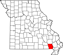 | |
| Townships | ||
| CDP | ||
| Other unincorporated communities | ||
| Ghost town | ||
| Footnotes | ‡This populated place also has portions in an adjacent county or counties | |
This article is issued from Wikipedia - version of the 11/30/2016. The text is available under the Creative Commons Attribution/Share Alike but additional terms may apply for the media files.