Farrington's Grove Historic District
|
Farrington's Grove Historic District | |
|
Church in the Farrington's Grove Historic District, July 2011 | |
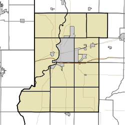   | |
| Location | Roughly bounded by Poplar, S. Seventh, Hulman, and S. Fourth Sts., Terre Haute, Indiana |
|---|---|
| Coordinates | 39°27′22″N 87°24′35″W / 39.45611°N 87.40972°WCoordinates: 39°27′22″N 87°24′35″W / 39.45611°N 87.40972°W |
| Area | 230 acres (93 ha) |
| Built | 1850 |
| Architect | English, Reese P.; Et al. |
| Architectural style | Late 19th And 20th Century Revivals, Italianate, Queen Anne |
| NRHP Reference # | 86000270[1] |
| Added to NRHP | February 27, 1986 |
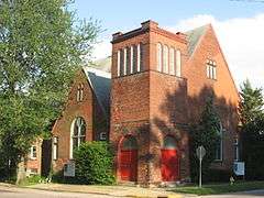
Farrington's Grove Historic District is a national historic district located at Terre Haute, Vigo County, Indiana. It encompasses 1,110 contributing buildings in a predominantly residential section of Terre Haute. It developed between about 1850 and 1935, with most built between 1890 and 1920, and includes representative examples of Greek Revival, Italianate, Queen Anne, and Colonial Revival style architecture. Located in the district are the separately listed Sage-Robinson-Nagel House and Williams-Warren-Zimmerman House. Other notable buildings include the English-Bogard House (1873), Kelley-Luther-Trent House (1901), Meyer-Gantner House (1923), Grover-Shannon-Lee House (1856), Potter-Steele-Tablr House (1870), Reckert-Robertson House (1890), Hawthorne Building (1871), and Temple Israel (1911).[2]
It was listed on the National Register of Historic Places in 1986.[1]
References
- 1 2 National Park Service (2010-07-09). "National Register Information System". National Register of Historic Places. National Park Service.
- ↑ "Indiana State Historic Architectural and Archaeological Research Database (SHAARD)" (Searchable database). Department of Natural Resources, Division of Historic Preservation and Archaeology. Retrieved 2016-07-01. Note: This includes Robert Bastian, David Lewis, Laura Thayer, and Robert F. Hunt (January 1984). "National Register of Historic Places Inventory Nomination Form: Farrington's Grove Historic District" (PDF). Retrieved 2016-07-01., Site map, Quad map, and Accompanying photographs

