Farm to Market Road 361
| ||||
|---|---|---|---|---|
| Route information | ||||
| Maintained by TxDOT | ||||
| Length: | 7.2 mi[1] (11.6 km) | |||
| Existed: | May 2, 1962[1] – present | |||
| Major junctions | ||||
| South end: |
| |||
|
| ||||
| North end: |
| |||
| Location | ||||
| Counties: | Fort Bend | |||
| Highway system | ||||
| ||||

Farm to Market Road 361 (FM 361) is a state highway in the U.S. state of Texas that stays within Fort Bend County. The highway begins at FM 1994 in Long Point and heads northwest through Fairchilds to end at State Highway 36 (SH 36) near Pleak.
Route description
FM 361 is a two-lane highway for its entire length. The highway begins at FM 1994 at Long Point at a place where electric transmission lines pass overhead. From Long Point, FM 361 heads northwest for a distance of 2.7 miles (4.3 km) to Boothline Road. In this stretch the highway crosses Deer Creek. After a jog at Boothline Road, the highway goes northwest for 1.3 miles (2.1 km) to the intersection with Needville-Fairchilds Road in Fairchilds. Leaving Fairchilds behind, FM 361 continues northeast for 1.4 miles (2.3 km), crossing Fairchilds Creek and reaching the three-corner junction with FM 2977. From FM 2977 to South Kamas Road is an additional 1.6 miles (2.6 km). At South Kamas Road, FM 361 angles slightly more to the west for 0.2 miles (0.3 km) before ending at a stop sign on SH 36 at a distance 2.0 miles (3.2 km) south-southwest of Pleak.[2]
-

Looking southeast at FM 2977
-
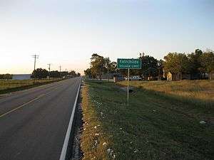
Looking northeast near Fairchilds
-

View is southeast near Long Point
History
FM 361 was originally designated on June 18, 1945, to run from SH 36 south of Rosenberg to Fairchilds. On March 18, 1947, the highway was extended from Fairchilds to Long Point. In 1947, the description of its starting point was defined as 1.5 miles (2.4 km) south of Big Creek on SH 36.[1]
Major intersections
The entire highway is in Fort Bend County.
| Location | mi | km | Destinations | Notes | |
|---|---|---|---|---|---|
| Long Point | 0.0 | 0.0 | Southern terminus of FM 361 | ||
| Fairchilds | 4.0 | 6.4 | Needville–Fairchilds Road | ||
| | 5.4 | 8.7 | Southern terminus of FM 2977 | ||
| Pleak | 7.1 | 11.4 | Northern terminus of FM 361 | ||
| 1.000 mi = 1.609 km; 1.000 km = 0.621 mi | |||||
See also
 Texas portal
 U.S. Roads portal
References
- 1 2 3 Transportation Planning and Programming Division (n.d.). "Farm to Market Road No. 361". Highway Designation Files. Texas Department of Transportation. Retrieved January 8, 2013.
- ↑ Google (January 8, 2013). "Farm to Market Road 361" (Map). Google Maps. Google. Retrieved January 8, 2013.