Fairview, South Dakota
| Fairview, South Dakota | |
|---|---|
| Town | |
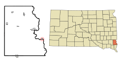 Location in Lincoln County and the state of South Dakota | |
| Coordinates: 43°13′20″N 96°29′22″W / 43.22222°N 96.48944°WCoordinates: 43°13′20″N 96°29′22″W / 43.22222°N 96.48944°W | |
| Country | United States |
| State | South Dakota |
| County | Lincoln |
| Founded | 1886[1] |
| Area[2] | |
| • Total | 0.09 sq mi (0.23 km2) |
| • Land | 0.09 sq mi (0.23 km2) |
| • Water | 0 sq mi (0 km2) |
| Elevation | 1,230 ft (375 m) |
| Population (2010)[3] | |
| • Total | 60 |
| • Estimate (2015)[4] | 65 |
| • Density | 666.7/sq mi (257.4/km2) |
| Time zone | Central (CST) (UTC-6) |
| • Summer (DST) | CDT (UTC-5) |
| ZIP code | 57027 |
| Area code(s) | 605 |
| FIPS code | 46-20780 |
| GNIS feature ID | 1254984[5] |
Fairview is a town in Lincoln County, South Dakota, United States. The population was 60 at the 2010 census.
Fairview was laid out in 1886, and named for the scenic valley setting of the site.[6]
Geography
Fairview is located at 43°13′20″N 96°29′22″W / 43.22222°N 96.48944°W (43.222124, -96.489325),[7] along the Big Sioux River.[8]
According to the United States Census Bureau, the town has a total area of 0.09 square miles (0.23 km2), all of it land.[2]
Fairview has been assigned the ZIP code 57027 and the FIPS place code 20780.
Demographics
| Historical population | |||
|---|---|---|---|
| Census | Pop. | %± | |
| 1910 | 107 | — | |
| 1920 | 174 | 62.6% | |
| 1930 | 156 | −10.3% | |
| 1940 | 150 | −3.8% | |
| 1950 | 155 | 3.3% | |
| 1960 | 101 | −34.8% | |
| 1970 | 72 | −28.7% | |
| 1980 | 90 | 25.0% | |
| 1990 | 73 | −18.9% | |
| 2000 | 94 | 28.8% | |
| 2010 | 60 | −36.2% | |
| Est. 2015 | 65 | [9] | 8.3% |
| U.S. Decennial Census[10] 2015 Estimate[4] | |||
2010 census
As of the census[3] of 2010, there were 60 people, 27 households, and 18 families residing in the town. The population density was 666.7 inhabitants per square mile (257.4/km2). There were 31 housing units at an average density of 344.4 per square mile (133.0/km2). The racial makeup of the town was 100.0% White.
There were 27 households of which 29.6% had children under the age of 18 living with them, 55.6% were married couples living together, 3.7% had a female householder with no husband present, 7.4% had a male householder with no wife present, and 33.3% were non-families. 29.6% of all households were made up of individuals and 18.5% had someone living alone who was 65 years of age or older. The average household size was 2.22 and the average family size was 2.67.
The median age in the town was 46 years. 18.3% of residents were under the age of 18; 11.8% were between the ages of 18 and 24; 16.6% were from 25 to 44; 28.3% were from 45 to 64; and 25% were 65 years of age or older. The gender makeup of the town was 55.0% male and 45.0% female.
2000 census
As of the census of 2000, there were 94 people, 31 households, and 23 families residing in the town. The population density was 886.1 people per square mile (329.9/km²). There were 34 housing units at an average density of 320.5 per square mile (119.3/km²). The racial makeup of the town was 96.81% White, 2.13% Native American, and 1.06% from two or more races.
There were 31 households out of which 41.9% had children under the age of 18 living with them, 71.0% were married couples living together, and 22.6% were non-families. 19.4% of all households were made up of individuals and 3.2% had someone living alone who was 65 years of age or older. The average household size was 3.03 and the average family size was 3.38.
In the town the population was spread out with 33.0% under the age of 18, 8.5% from 18 to 24, 28.7% from 25 to 44, 21.3% from 45 to 64, and 8.5% who were 65 years of age or older. The median age was 31 years. For every 100 females there were 88.0 males. For every 100 females age 18 and over, there were 96.9 males.
The median income for a household in the town was $29,063, and the median income for a family was $28,750. Males had a median income of $25,625 versus $21,250 for females. The per capita income for the town was $14,471. There were no families and 9.2% of the population living below the poverty line, including no under eighteens and 22.2% of those over 64.
References
- ↑ "SD Towns" (PDF). South Dakota State Historical Society. Retrieved 2010-02-12.
- 1 2 "US Gazetteer files 2010". United States Census Bureau. Retrieved 2012-06-21.
- 1 2 "American FactFinder". United States Census Bureau. Retrieved 2012-06-21.
- 1 2 "Population Estimates". United States Census Bureau. Retrieved June 23, 2016.
- ↑ "US Board on Geographic Names". United States Geological Survey. 2007-10-25. Retrieved 2008-01-31.
- ↑ Federal Writers' Project (1940). South Dakota place-names, v.1-3. University of South Dakota. p. 37.
- ↑ "US Gazetteer files: 2010, 2000, and 1990". United States Census Bureau. 2011-02-12. Retrieved 2011-04-23.
- ↑ DeLorme (2001). South Dakota Atlas & Gazetteer. Yarmouth, Maine: DeLorme. ISBN 0-89933-330-3
- ↑ "Annual Estimates of the Resident Population for Incorporated Places: April 1, 2010 to July 1, 2015". Retrieved July 2, 2016.
- ↑ United States Census Bureau. "Census of Population and Housing". Retrieved September 23, 2013.
Municipalities and communities of Lincoln County, South Dakota, United States | ||
|---|---|---|
| Cities | 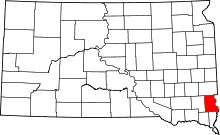 | |
| Towns | ||
| Townships |
| |
| CDP | ||
| Footnotes | ‡This populated place also has portions in an adjacent county or counties | |