Kfeir
| Kfeir كفير | |
|---|---|
| City | |
 Kfeir Location within Lebanon | |
| Coordinates: 33°25′46″N 35°44′26″E / 33.42944°N 35.74056°ECoordinates: 33°25′46″N 35°44′26″E / 33.42944°N 35.74056°E | |
| Country |
|
| Governorate | Nabatieh Governorate |
| District | Hasbaya District |
| Elevation | 900 m (3,000 ft) |
| Time zone | EET (UTC+2) |
| • Summer (DST) | EEST (UTC+3) |
| Dialing code | +961 |
Kfeir is a small village nestled 900 m above sea level along the steep slopes of the top of the air in Lebanon.
The village enjoys mild summers of an average temperature of 25 C. However, the winters are much colder and the village receives heavy snow. Kfeir's high altitude allows fog to form above the hills even in summer, giving the village a mystical and spiritual scenery.
The inhabitants of Kfeir are Christians and Druze, and they mainly cultivate olives, pines and other fruit trees. Kfeir is the hometown of renowned Lebanese novelist Emily Nasrallah.
References
External links
- http://www.kfeir.com/
- Kfayr Ez Zait, Localiban
Capital: Hasbaya | ||
| Towns and villages | 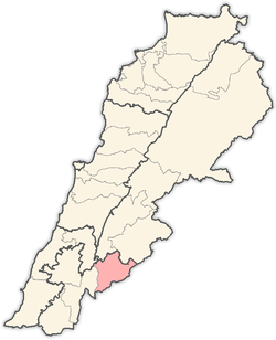 | |
| Other | ||
This article is issued from Wikipedia - version of the 9/2/2016. The text is available under the Creative Commons Attribution/Share Alike but additional terms may apply for the media files.