Halta
| Halta حلتا | |
|---|---|
| Village | |
 Halta Location within Lebanon | |
| Coordinates: 33°18′31″N 35°40′08″E / 33.30861°N 35.66889°ECoordinates: 33°18′31″N 35°40′08″E / 33.30861°N 35.66889°E | |
| Country |
|
| Governorate | Nabatieh Governorate |
| District | Hasbaya District |
| Time zone | EET (UTC+2) |
| • Summer (DST) | EEST (UTC+3) |
| Dialing code | +961 |
Halta (in Arabic حلتا ) is a small village in the far south-east of Lebanon, overlooking the territories occupied by Israel, with a population of almost 350 people. It has a mosque and an elementary school. It is divided into two parts: Upper and Lower Halta.
Halta is related to the village of Kfarchouba (in the district of Hasbaya) and is famous for agriculture and grazing. The most important crops are olive oil, olives, cactus, figs, peaches, and grapes. Halta is also known for its fragrance of pine spread vast on the side of the town and nearby villages, trees Alkinh, and the number of perennial and seasonal large trees and shrubs.
Halta is a popular destination for many of the statesmen and expatriates for the practice of hunting and during fishing seasons.
The climate is a little hot in summer and warm in winter.
Capital: Hasbaya | ||
| Towns and villages | 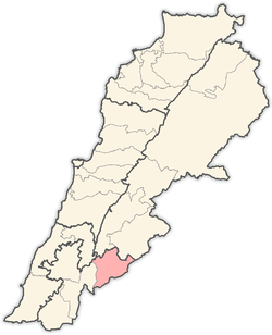 | |
| Other | ||