Effingham, Kansas
| Effingham, Kansas | |
|---|---|
| City | |
|
Effingham Water Tower (2010) | |
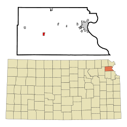 Location within Atchison County and Kansas | |
 KDOT map of Atchison County (legend) | |
| Coordinates: 39°31′22″N 95°23′55″W / 39.52278°N 95.39861°WCoordinates: 39°31′22″N 95°23′55″W / 39.52278°N 95.39861°W | |
| Country | United States |
| State | Kansas |
| County | Atchison |
| Area[1] | |
| • Total | 0.53 sq mi (1.37 km2) |
| • Land | 0.53 sq mi (1.37 km2) |
| • Water | 0 sq mi (0 km2) |
| Elevation | 1,135 ft (346 m) |
| Population (2010)[2] | |
| • Total | 546 |
| • Estimate (2012[3]) | 540 |
| • Density | 1,000/sq mi (400/km2) |
| Time zone | Central (CST) (UTC-6) |
| • Summer (DST) | CDT (UTC-5) |
| ZIP code | 66023 |
| Area code(s) | 913 |
| FIPS code | 20-20025 [4] |
| GNIS feature ID | 0473477 [5] |
| Website | City Website |

Effingham is a city in Atchison County, Kansas, United States. As of the 2010 census, the city population was 546.[6]
History
The first post office in Effingham was established in 1868.[7] Effingham experienced growth when the Central Branch Union Pacific Railroad was built through the neighborhood and by the 1880s was a thriving village.[8] Effingham was named in honor of Effingham H. Nichols, an early promoter of the Central Branch Union Pacific Railroad.[9][10]
Geography
Effingham is located at 39°31′22″N 95°23′55″W / 39.52278°N 95.39861°W (39.522774, -95.398633).[11] According to the United States Census Bureau, the city has a total area of 0.53 square miles (1.37 km2), all of it land.[1]
Demographics
| Historical population | |||
|---|---|---|---|
| Census | Pop. | %± | |
| 1880 | 187 | — | |
| 1890 | 361 | 93.0% | |
| 1900 | 634 | 75.6% | |
| 1910 | 674 | 6.3% | |
| 1920 | 616 | −8.6% | |
| 1930 | 646 | 4.9% | |
| 1940 | 676 | 4.6% | |
| 1950 | 525 | −22.3% | |
| 1960 | 564 | 7.4% | |
| 1970 | 605 | 7.3% | |
| 1980 | 634 | 4.8% | |
| 1990 | 540 | −14.8% | |
| 2000 | 588 | 8.9% | |
| 2010 | 546 | −7.1% | |
| Est. 2015 | 521 | [12] | −4.6% |
| U.S. Decennial Census | |||
2010 census
As of the census[2] of 2010, there were 546 people, 217 households, and 141 families residing in the city. The population density was 1,030.2 inhabitants per square mile (397.8/km2). There were 252 housing units at an average density of 475.5 per square mile (183.6/km2). The racial makeup of the city was 96.0% White, 1.6% African American, 0.9% Native American, 0.4% from other races, and 1.1% from two or more races. Hispanic or Latino of any race were 2.9% of the population.
There were 217 households of which 35.0% had children under the age of 18 living with them, 51.6% were married couples living together, 10.1% had a female householder with no husband present, 3.2% had a male householder with no wife present, and 35.0% were non-families. 31.3% of all households were made up of individuals and 15.7% had someone living alone who was 65 years of age or older. The average household size was 2.52 and the average family size was 3.23.
The median age in the city was 36.6 years. 30.2% of residents were under the age of 18; 5.2% were between the ages of 18 and 24; 26.4% were from 25 to 44; 19.7% were from 45 to 64; and 18.5% were 65 years of age or older. The gender makeup of the city was 49.3% male and 50.7% female.
2000 census
As of the census[4] of 2000, there were 588 people, 236 households, and 155 families residing in the city. The population density was 1,091.9 people per square mile (420.4/km²). There were 255 housing units at an average density of 473.5 per square mile (182.3/km²). The racial makeup of the city was 97.28% White, 0.34% African American, 1.36% Native American, 0.51% from other races, and 0.51% from two or more races. Hispanic or Latino of any race were 0.51% of the population.
There were 236 households out of which 31.4% had children under the age of 18 living with them, 55.5% were married couples living together, 9.3% had a female householder with no husband present, and 34.3% were non-families. 30.9% of all households were made up of individuals and 18.2% had someone living alone who was 65 years of age or older. The average household size was 2.49 and the average family size was 3.12.
In the city the population was spread out with 27.7% under the age of 18, 9.0% from 18 to 24, 21.9% from 25 to 44, 24.1% from 45 to 64, and 17.2% who were 65 years of age or older. The median age was 38 years. For every 100 females there were 90.3 males. For every 100 females age 18 and over, there were 86.4 males.
The median income for a household in the city was $37,656, and the median income for a family was $47,083. Males had a median income of $30,139 versus $20,000 for females. The per capita income for the city was $14,505. About 2.0% of families and 4.5% of the population were below the poverty line, including 4.8% of those under age 18 and 5.6% of those age 65 or over.
See also
References
- 1 2 "US Gazetteer files 2010". United States Census Bureau. Retrieved 2012-07-06.
- 1 2 "American FactFinder". United States Census Bureau. Retrieved 2012-07-06.
- ↑ "Population Estimates". United States Census Bureau. Retrieved 2013-05-29.
- 1 2 "American FactFinder". United States Census Bureau. Retrieved 2008-01-31.
- ↑ "US Board on Geographic Names". United States Geological Survey. 2007-10-25. Retrieved 2008-01-31.
- ↑ "2010 City Population and Housing Occupancy Status". U.S. Census Bureau. Retrieved April 6, 2012.
- ↑ "Kansas Post Offices, 1828-1961 (archived)". Kansas Historical Society. Archived from the original on October 9, 2013. Retrieved 4 June 2014.
- ↑ Blackmar, Frank Wilson (1912). Kansas: A Cyclopedia of State History, Embracing Events, Institutions, Industries, Counties, Cities, Towns, Prominent Persons, Etc. Standard Publishing Company. p. 568.
- ↑ Kansas Place-Names,John Rydjord, University of Oklahoma Press, 1972, p. 435 ISBN 0-8061-0994-7
- ↑ Gannett, Henry (1905). The Origin of Certain Place Names in the United States. Govt. Print. Off. p. 115.
- ↑ "US Gazetteer files: 2010, 2000, and 1990". United States Census Bureau. 2011-02-12. Retrieved 2011-04-23.
- ↑ "Annual Estimates of the Resident Population for Incorporated Places: April 1, 2010 to July 1, 2015". Retrieved July 2, 2016.
External links
| Wikimedia Commons has media related to Effingham, Kansas. |
- City
- Schools
- USD 377, local school district
- Maps
- Effingham City Map, KDOT
Municipalities and communities of Atchison County, Kansas, United States | ||
|---|---|---|
| Cities |  | |
| Unincorporated communities | ||
| Indian reservations | ||
| Townships | ||
| Ghost towns | ||
| Footnotes | ‡This populated place also has portions in an adjacent county or counties | |