Edson, Wisconsin
| Edson, Wisconsin | |
|---|---|
| Town | |
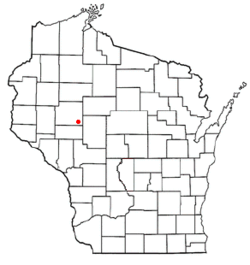 Location of Edson, Wisconsin | |
| Coordinates: 44°55′27″N 91°0′23″W / 44.92417°N 91.00639°W | |
| Country | United States |
| State | Wisconsin |
| County | Chippewa |
| Area | |
| • Total | 54.0 sq mi (139.8 km2) |
| • Land | 53.9 sq mi (139.7 km2) |
| • Water | 0.04 sq mi (0.1 km2) |
| Elevation[1] | 1,056 ft (322 m) |
| Population (2010) | |
| • Total | 1,089 |
| • Density | 20/sq mi (7.8/km2) |
| Time zone | Central (CST) (UTC-6) |
| • Summer (DST) | CDT (UTC-5) |
| Area code(s) | 715 & 534 |
| FIPS code | 55-22750[2] |
| GNIS feature ID | 1583135[1] |
| PLSS township | T28N R5W and east half of T28N R6W |
Edson is a town in Chippewa County in the U.S. state of Wisconsin. The population was 1,089 at the 2010 census,[3] up from 966 at the 2000 census. The unincorporated community of Edson is located in the town.
History
The 6-by-6-mile (10 by 10 km) squares that became Delmar were first surveyed in the fall of 1848 by crews working for the U.S. government. In September 1853 another crew marked all the section corners of the eastern six by six square, walking the woods and swamps on foot, measuring with chain and compass.[4][5] When done, the deputy surveyor filed this general description:
This Township contains but few Swamps has a Surface but slightly rolling with a good Soil & excellent timber throughout the whole Township. The Streams are Small except one in the NW of the Township which has(?) Marshy banks & sluggish current, & also a stream passing through the Eastern portions of Sections 1, 12, 25 & 36. There are no improvements in the Township except a lumberman's Cabin near the Center of Section 36.[6]
Geography
Edson is located in the southeast corner of Chippewa County and is bordered by Clark County to the east and Eau Claire County to the south. The town has the shape of a rectangle, 9 miles (14 km) east to west and 6 miles (10 km) north to south. According to the United States Census Bureau, the town has a total area of 54.0 square miles (139.8 km2), of which 53.9 square miles (139.7 km2) is land and 0.04 square miles (0.1 km2), or 0.09%, is water.[3]
Demographics
| Historical population | |||
|---|---|---|---|
| Census | Pop. | %± | |
| 1990 | 913 | — | |
| 2000 | 966 | 5.8% | |
| 2010 | 1,089 | 12.7% | |
| Est. 2014 | 1,111 | 2.0% | |
As of the census[2] of 2000, there were 966 people, 309 households, and 259 families residing in the town. The population density was 17.9 people per square mile (6.9/km²). There were 322 housing units at an average density of 6.0 per square mile (2.3/km²). The racial makeup of the town was 98.14% White, 0.10% Asian, and 1.76% from two or more races. Hispanic or Latino of any race were 0.72% of the population.
There were 309 households out of which 46.3% had children under the age of 18 living with them, 66.3% were married couples living together, 11.3% had a female householder with no husband present, and 15.9% were non-families. 13.9% of all households were made up of individuals and 5.2% had someone living alone who was 65 years of age or older. The average household size was 3.13 and the average family size was 3.38.
In the town the population was spread out with 33.6% under the age of 18, 8.1% from 18 to 24, 26.7% from 25 to 44, 21.9% from 45 to 64, and 9.6% who were 65 years of age or older. The median age was 33 years. For every 100 females there were 102.9 males. For every 100 females age 18 and over, there were 97.8 males.
The median income for a household in the town was $34,722, and the median income for a family was $36,563. Males had a median income of $22,014 versus $20,885 for females. The per capita income for the town was $12,154. About 20.1% of families and 24.1% of the population were below the poverty line, including 33.5% of those under age 18 and 12.5% of those age 65 or over.
Education
The town is served by the School District of Cadott Community and the Stanley-Boyd Area School District.
References
- 1 2 "US Board on Geographic Names". United States Geological Survey. 2007-10-25. Retrieved 2008-01-31.
- 1 2 "American FactFinder". United States Census Bureau. Retrieved 2008-01-31.
- 1 2 "Geographic Identifiers: 2010 Demographic Profile Data (G001): Edson town, Chippewa County, Wisconsin". U.S. Census Bureau, American Factfinder. Retrieved September 16, 2015.
- ↑ "Land Survey Information". Board of Commissioners of Public Lands. Retrieved 26 March 2011.
- ↑ "Field Notes for T28N R5W". Original Field Notes and Plat Maps, 1833-1866. Board of Commissioners of Public Lands. Retrieved 12 March 2013.
- ↑ Clark, J. G. "Interior Field Notes (Sept. 1853)". Land Survey Notes. Board of Commissioners of Public Lands. Retrieved 2013-03-12.
Municipalities and communities of Chippewa County, Wisconsin, United States | ||
|---|---|---|
| Cities | 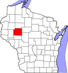 | |
| Villages | ||
| Towns | ||
| CDPs | ||
| Unincorporated communities | ||
| Footnotes | ‡This populated place also has portions in an adjacent county or counties | |