Eastwood, New South Wales
| Eastwood Sydney, New South Wales | |||||||||||||
|---|---|---|---|---|---|---|---|---|---|---|---|---|---|
 Fountain in Rowe Street mall. | |||||||||||||
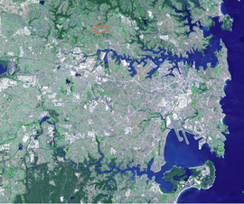 Eastwood outlined in a satellite image of Sydney | |||||||||||||
 Eastwood | |||||||||||||
| Coordinates | 33°47′25″S 151°04′54″E / 33.790362°S 151.081731°ECoordinates: 33°47′25″S 151°04′54″E / 33.790362°S 151.081731°E | ||||||||||||
| Population | 16,193 (2011 census)[1] | ||||||||||||
| Postcode(s) | 2122 | ||||||||||||
| Location | 17 km (11 mi) NW of Sydney CBD | ||||||||||||
| LGA(s) | |||||||||||||
| Region | Northern Suburbs | ||||||||||||
| State electorate(s) | |||||||||||||
| Federal Division(s) | Bennelong | ||||||||||||
| |||||||||||||

Eastwood is a suburb of Sydney, Australia. Eastwood is located 17 kilometres north-west of the Sydney central business district in the local government areas of the City of Ryde and the City of Parramatta. Eastwood is in the Northern Suburbs region.
Originally thought to have been inhabited by the Wallumedegal Aboriginal tribe, who lived in the area between the Lane Cove and Parramatta Rivers, the area was first settled by Europeans shortly after the arrival of the First Fleet in 1788, from land grants to Royal Marines and NSW Corps, and was named "Eastwood" by an early Irish free settler, William Rutledge. Today it is a large suburban centre in the north of Sydney of over 14,000 people, with a large shopping area. Eastwood has a large population of Asian descent with immigrants from China transforming the commercial precinct in the past decade.
Eastwood is famous for the Granny Smith apple, accidentally first grown in the suburb by Maria Ann Smith. Every October, the oval and cordoned-off streets become the grounds for the annual Granny Smith Festival, a celebration of the icon with fairground rides, market stalls, street theatres, parades, an apple-baking competition and a fireworks spectacular at the Upper Eastwood Oval. In recent years the festival has been influenced by the substantial Asian immigrant communities, with Chinese dragon dancers in the Grand Parade and Chinese stallholders. During the same period, Eastwood's annual Chinese New Year Celebrations have broadened their appeal by incorporating concurrent Korean New Year traditions, and have accordingly been renamed the Lunar New Year Festivities.[2]
Geography
Eastwood is located at the edge of the Hornsby Plateau with the suburbs of Dundas Valley and Denistone on its western and southern sides, respectively, as the land falls away down to the Cumberland Plain. To the north, Eastwood is bounded by the transport hub of Epping and to its east Marsfield which shares the same postcode of 2122. The suburb is predominantly residential with the main shopping area of Eastwood centred between Rowe Street and Rutledge Street around the railway line.
History
The Wallumedegal aboriginal tribe lived in the area between the Lane Cove River and Parramatta River, which was known as Walumetta.[3] The area was originally heavily timbered.[4]
The area was first settled by Europeans shortly after the arrival of the First Fleet in 1788 and was part of the Field of Mars. The area of Eastwood was originally granted between the years of 1790 and 1803 to marines and the NSW Corps. John Love, a private was granted 90 acres (36 ha) here in 1794, described as North Brush, in the Field of Mars Common. The land was then acquired by William Kent who already held land in what is now Epping. The land was purchased by William Rutledge for 288 pounds in 1835, who built 'Eastwood House' in 1840. This house is now part of Marist College Eastwood. In 1863 Edward Terry purchased the estate and upon his death in 1905, the estate was sub-divided.
In 1886, the railway line from Strathfield to Hornsby was opened, with a station here originally called Dundas. This was changed a year later to Eastwood, named after the Eastwood Estate.
The commercial centre underwent a major upgrade in the early 1980s. Rowe Street, which originally ran across the railway line through a level crossing was turned into a mall between The Avenue and West Parade, and the 1940s bridge built in First Avenue for crossing traffic was replaced with a six-lane bridge. This bridge was to service the planned County of Cumberland Scheme, Eastwood County Road (linking Eastwood with Macquarie Park), a road project in the local area which has been controversial among locals.[5]
Commercial area
The Eastwood commercial district is located around Eastwood railway station. The Eastwood Shopping Centre is a shopping mall, which includes major retailer Woolworths is located in the town centre and opens on to the Eastwood Plaza. The Plaza features a fountain and several cafes with outdoor seating. Eastwood is becoming well known as an Asian shopping precinct, with speciality stores, supermarkets and many restaurants run by Chinese and Korean retailers.[6] The ethnic background of its shoppers has created a hub of mainly Chinese, Vietnamese, Cantonese, Singaporean, Hong Kong and Korean restaurants and eateries in the area.
Transport
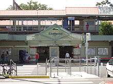
Eastwood is relatively well served by public transport. Eastwood railway station is located on the North Shore, Northern & Western Line. The station opened in 1886,[7] and it takes approximately 30–35 minutes to travel to Central. Intercity services also service Eastwood station between Central, Newcastle and the Central Coast region.
Numerous bus services also operate from the small interchange outside the station. These include the 545/550 route between Parramatta and Chatswood, the 544 route between Auburn and Macquarie University, and the 515/X15 service to the Sydney CBD. Eastwood is also served well by roads, and is located close to the trunk routes of the A6 (Marsden Road), and Victoria Road.
In spite of the range of public transport options, the 2011 census found that only 28% of employed people travelled to work on public transport and 53% by car (either as driver or as passenger).[1]
Landmarks


- Brush Farm House – former home of Gregory Blaxland, one of the explorers of the Blue Mountains. It is included on the NSW State Heritage Register and the National Trust of Australia register.[8]
- Eastwood House – the former home of Edward Terry, the original landowner of the estate on which Eastwood is now built.[9] It is Heritage Listed.[10]
- Eastwood Park Grandstand and Pavillion - these date from 1933 and 1935 respectively. The croquet pavilion is still in use for its original purpose, associated with the Eastwood Croquet Club. Both are Heritage listed.[11][12]
- Ripley (14 Auld Avenue) was built in 1907, on the 1897 Bush Farm Estate subdivision. The house, designed by architect George W Durrell, is an example of the Federation Arts and Crafts style, rare in the Eastwood area. It is Heritage listed.[13]
- Ryde Hospital on Denistone Road is a public hospital with between 100 and 199 beds and an emergency department.[14]
- Corrective Services Academy, a training centre for prison officers, is on the site of what was previously Brush Farm Public School.[15]
Eastwood once featured a lake which gave the names Lakeside Road and The Lakeside Road Uniting Church.[16] This lake was later converted to an oval which is used for soccer matches and by local schools. Unfortunately, the oval does still occasionally flood after very heavy rainfall.
Forest reserves
Darvall Park and Brush Farm Park are examples of remnant forest areas in the Eastwood district. Volunteers and professional bush regenerators have worked to preserve the blue gum high forest and rainforest in these areas. The largest tree heath known in existence occurs at Brush Farm park. Other notable plants include mative crabapple, jackwood and red olive berry. Despite being within a large city, Brush Farm has remarkable fauna, including the powerful owl, emerald dove, eastern whipbird, satin bowerbird and the green tree snake.
Housing
At the 2011 census, more than half (61.2%) of occupied private dwellings in Eastwood were separate houses, 23.5% were flats, units or apartments, and 15.3% were semi-detached or townhouses. Three-quarters (74.4%) were family households, 20.3% were single person households and 5.3% were group households. The average household size was 2.8 people.[1]
Housing consists of many Californian Bungalow and Federation homes, especially in streets located closer to the station. More post World War II homes can be seen further from the station, especially to the north of Terry Road. While most of Eastwood is residential, with one or two-storey detached houses and villas, the area surrounding the town centre boasts buildings up to seven storeys high. In 2006 the City of Ryde developed a Control Plan for the Eastwood Town Centre, which includes the provision of buildings of up to ten storeys high in the shopping and railway areas.[17] Former industrial parts of the suburb are also undergoing redevelopment. The former brickworks site was converted into a housing estate.[18][19]
Churches
- Christ Evangelical Center of Australia (CECA)
- Eastwood Baptist Church
- Exclusive Brethren Church
- Lakeside Road Uniting Church (former Methodist Church)
- Macquarie Chapel – Pastor Richard Quadrio started the church in 2001. It is combined with Macquarie Presbyterian Church.[20]
- St Andrew's Uniting Church – (former Presbyterian Church)
- St Kevin's Catholic Church – this church was completed in 1994 to replace the original church, which is now the library of the local Catholic school (St Kevins.)[21]
- St Philip's Anglican Church was founded over 100 years ago, and has met in the current church building since 1907.[22]
- Cornerstone Presbyterian Community Church Eastwood (meets at Eastwood Heights Public School)
- St Georges Anglican Church, Balaclava Road, Eastwood Heights
- St Dunstan's Anglican Church, Lovell Road, Denistone East
- The Church of Jesus Christ of Latter-day Saints, Blaxland Road, Denistone East
- The Crusader Union of Australia, known as Crusaders, is based in Eastwood.[23]
Schools
Primary Schools
- Eastwood Heights Public School[24]
- Eastwood Public School[25]
- St Kevins Eastwood (Catholic primary school)[26]
- Denistone East Public School (Although it is named Denistone East Public School, it is located in Eastwood.)
High Schools
Culture and events

Eastwood is well known as the place where the Granny Smith apple was first grown. This is celebrated each October with the Granny Smith Festival which attracts over 60,000 people each year.
Population
Today it is a large suburban centre in the north of Sydney with over 16,000 residents. Over the past few decades Eastwood has become increasingly multicultural.[27] Migrants from southern Europe countries such as Italy and Greece began settling here and at Carlingford from the 1960s. From the early eighties to the late nineties, many Chinese and Koreans settled in the area.
Demographics
At the 2011 census, the suburb of Eastwood recorded a population of 16,193 people. Of these:[1]
- Age distribution
- The distribution of ages in Eastwood was similar to the country as a whole. Eastwood residents' median age was 37 years, the same as the national median. Children aged under 15 years made up 15.9% of the population (national average is 19.3%) and people aged 65 years and over made up 13.8% of the population (national average is 14.0%).
- Ethnic diversity
- Just under half (43.3%) of Eastwood residents were born in Australia; the next most common countries of birth were China 18.6%, South Korea 6.8%, Hong Kong 5.3%, India 2.3% and Sri Lanka 1.9%. However, only 13.7% identify their ancestry as Australian; the other common self-identified ancestries were Chinese 30.5%, English 13.4%, Korean 7.0% and Irish 5.2%. Less than half (40.1%) of the residents spoke English at home; other languages spoken at home included Mandarin 16.1%, Cantonese 15.0%, Korean 8.0%, Italian 1.5% and Tamil 1.4%.
- Religion
- This question is optional in the Census. Of the people who answered it, the most common response was "No Religion" (28.8%); the next most common responses were Catholic 21.6%, Anglican 9.8%, Buddhism 6.8% and Presbyterian and Reformed 5.4%
- Income
- The median weekly household income was $1,327, somewhat higher than the national median of $1,234.
Residents
- The band All Mankind, best known for the song "Break the Spell" are residents of Eastwood
Former residents
- Natalie Bennett, leader of the Green Party of England and Wales
- Reg Campbell – portrait painter and self-taught artist
- Geoffrey Robertson – human rights lawyer, academic, author and broadcaster
- Aziz Shavershian - bodybuilder and internet personality
- Maria Ann Smith - orchardist, who is known for growing the first Granny Smith apples
References
- 1 2 3 4 Australian Bureau of Statistics (31 October 2012). "Eastwood (State Suburb)". 2011 Census QuickStats. Retrieved 2 May 2013.
- ↑ "Mixing it up in Bennelong" Accessed 11 August 2011.
- ↑ Smith, Keith Vincent (2005). Wallumedegal : an Aboriginal history of Ryde. North Ryde, N.S.W.: Community Services Unit, City of Ryde. ISBN 9780959941999.
- ↑ The Book of Sydney Suburbs, Compiled by Frances Pollon, Angus & Robertson Publishers, 1990, Published in Australia ISBN 0-207-14495-8, page 92
- ↑ "Ozroads: Eastwood County Road", 2004–2007. Accessed 6 July 2007.
- ↑ Maher, Stephen, "Goodbye to the Eastwood of old", Northern District Times, 11 April 2007, page 14. Accessed via Factiva on 10 July 2007.
- ↑ Bozier, Rolfe, "New South Wales Railways: Eastwood Railway Station". Accessed 4 July 2006.
- ↑ "Brush Farm". www.environment.nsw.gov.au. NSW Department of Environment and Heritage. Retrieved 23 April 2014.
- ↑ City of Ryde, "A Brief History of Ryde", 2007. Accessed 6 July 2007.
- ↑ "Eastwood House (former house)". www.environment.nsw.gov.au. NSW Office of Environment & Heritage. Retrieved 18 November 2016.
- ↑ "Eastwood Park - Grandstand". www.environment.nsw.gov.au. NSW Department of Environment and Heritage. Retrieved 24 November 2016.
- ↑ "Eastwood Park - Pavilion". www.environment.nsw.gov.au. NSW Department of Environment and Heritage. Retrieved 24 November 2016.
- ↑ "Ripley - Federation Arts & Crafts style dwelling". www.environment.nsw.gov.au. NSW Department of Environment and Heritage. Retrieved 24 November 2016.
- ↑ "Ryde Hospital". www.myhospitals.gov.au. Australian Government - Institute of Health and Welfare. Retrieved 18 November 2016.
- ↑ "Brush Farm Corrective Services Academy". www.bfcsa.nsw.gov.au. NSW Corrective Services. Retrieved 18 November 2016.
- ↑ Giuliani, Bernard, (1988) Eastwood Scrapbook, p.1? Marist Publishers: Drummoyne, NSW. ISBN 0-949807-64-8.
- ↑ City of Ryde, "Development Control Plan – Part 4.1 Eastwood Town Centre", 2006, pp. 11–12. Accessed 4 July 2007.
- ↑ Rumble, Chantal, "Brick pit fill bakes anger", Northern District Times, 21 May 2003, p. 2.
- ↑ "Life at Newthorpe". Accessed 4 July 2007.
- ↑ "Presbyterian Churches of New South Wales: Macquarie Chapel Presbyterian". Accessed 6 July 2007.
- ↑ "St Kevins Primary School: History". Accessed 6 July 2007.
- ↑ "St Philips Anglican Church Eastwood" Accessed 20 October 2010.
- ↑ Pro-bono Australia Retrieved 22 June 2013
- ↑ Eastwood Heights Public School
- ↑ Eastwood Public School
- ↑ St Kevins School
- ↑ Megalogenis, George, "Asian influence spices up contest", The Australian, 27 February 2007, p. 11. Accessed via Factiva on 10 July 2007.
External links
| Wikimedia Commons has media related to Eastwood, New South Wales. |
- A Brief History of Ryde (Including Eastwood)
- Beverley McClymont (2010). "Eastwood". Dictionary of Sydney. Retrieved 27 September 2015. [CC-By-SA]