Dvor, Croatia
| Dvor Двор (Serbian)[1] | ||
|---|---|---|
| Municipality | ||
| Municipality of Dvor Općina Dvor | ||
| ||
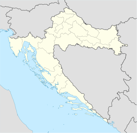 Dvor Location of Dvor within Croatia | ||
| Coordinates: 45°04′00″N 16°22′00″E / 45.06667°N 16.36667°E | ||
| Country |
| |
| County | Sisak-Moslavina County | |
| Area | ||
| • Total | 504.9 km2 (194.9 sq mi) | |
| Population (2011) | ||
| • Total | 6,233 | |
| Time zone | CET (UTC+1) | |
| • Summer (DST) | CEST (UTC+2) | |
| Postal code | 44440 Dvor | |

Dvor (Serbian Cyrillic: Двор)[2] is a town and a municipality in the Banovina region in central Croatia. Administratively it belongs to the Sisak-Moslavina County and is located across the Una River from Novi Grad (also known as Bosanski Novi) in Bosnia and Herzegovina.
Languages and names
The town of Dvor was named Dvor na Uni in the Kingdom of Yugoslavia.[3] A majority of the present-day inhabitants self-identify as Serb and the Serbian language was added as a second official language, alongside Croatian, which is the official first language.
History
Dvor used to be a district capital in the historic Zagreb County, an administrative unit within the Kingdom of Croatia-Slavonia, which ceased to exist in 1918. In 1929 Dvor was placed in Vrbas Banovina within Kingdom of Yugoslavia. It was not incorporated into Croatia when the Banovina of Croatia province was formed in 1939. In 1941, the town became a part of the Independent State of Croatia. After the end of World War II the town officially became part of SR Croatia within SFR Yugoslavia, which largely followed the historic border of the Kingdom of Croatia-Slavonia in this area.
During the Croatian War of Independence (1991–1995), Dvor was within the breakaway Republic of Serbian Krajina, but following Operation Storm in 1995 the municipality returned to Croatian control. Most of Serbian population was evacuated from Dvor during the Operation Storm of which some had returned.
Demographics

According to Population Censuses, the majority of the population are ethnic Serbs. Between 1991 and 2011 the number of Serb residents fell from 14,555 to 4,005, a drop from 86.5% of the population to 71.9%. The number of Croat residents remained essentially the same, 1,395 and 1,440, respectively, but given the population decline, its size, as a percentage of the population, rose from 9.58% to 25.85% of the population of Dvor.
| Ethnic Composition | |||||||||||||
| Year | Serbs | % | Croats | % | Total | Notes | |||||||
|---|---|---|---|---|---|---|---|---|---|---|---|---|---|
| 1931 | 23,452 | 88.24% | 3,073 | 11.56% | 26,579 | ||||||||
| 1948 | 21,736 | 89.44% | 2,248 | 10.34% | 21,736 | ||||||||
| 1953 | 22,658 | 89.6% | 2,290 | 10.11% | 22,658 | ||||||||
| 1961 | 21,354 | 89.84% | 2,060 | 9.95% | 21,354 | ||||||||
| 1971 | 18,359 | 88.38% | 1,876 | 10.22% | 18,359 | ||||||||
| 1981 | 16,507 | 80.93% | 1,525 | 9.35% | 16,507 | ||||||||
| 1991 | 14,555 | 86,50% | 1,395 | 9,58% | 14,555 | ||||||||
| 2001 | 3,495 | 60.87% | 1,943 | 33.84% | 5,742 | ||||||||
| 2011 | 4,005 | 71.90% | 1,440 | 25.85% | 5,570 | [4] | |||||||
Settlements
Bansko Vrpolje, Buinja, Buinjski Riječani, Čavlovica, Ćore, Divuša, Donja Oraovica, Donja Stupnica, Donji Dobretin, Donji Javoranj, Donji Žirovac, Draškovac, Dvor, Gage, Glavičani, Golubovac Divuški, Gorička, Gornja Oraovica, Gornja Stupnica, Gornji Dobretin, Gornji Javoranj, Gornji Žirovac, Grabovica, Grmušani, Gvozdansko, Hrtić, Javnica, Javornik, Jovac, Kepčije, Kobiljak, Komora, Kosna, Kotarani, Kozibrod, Kuljani, Lotine, Ljeskovac, Ljubina, Majdan, Matijevići, Ostojići, Paukovac, Pedalj, Rogulje, Rudeži, Rujevac, Sočanica, Stanić Polje, Struga Banska, Šakanlije, Šegestin, Švrakarica, Trgovi, Udetin, Unčani, Vanići, Volinja, Zakopa, Zamlača, Zrin, Zrinska Draga, Zrinski Brđani, Zut.
See also
References
- ↑ Government of Croatia (October 2013). "Peto izvješće Republike Hrvatske o primjeni Europske povelje o regionalnim ili manjinskim jezicima" (PDF) (in Croatian). Council of Europe. p. 36. Retrieved 30 November 2016.
- ↑ "Minority names in Croatia:Registar Geografskih Imena Nacionalnih Manjina Republike Hrvatske" (PDF). Retrieved 2013-03-08.
- ↑ "History" [Povijest]. Official website. Municipality of Dvor. Retrieved 8 April 2015.
U vrijeme Kraljevine Jugoslavije mjesto dobiva ime Dvor na Uni.
- ↑ "Population by Ethnicity, by Towns/Municipalities, 2011 Census: County of Sisak-Moslavina". Census of Population, Households and Dwellings 2011. Zagreb: Croatian Bureau of Statistics. December 2012.
External links
- Official website (Croatian)
Subdivisions of Sisak-Moslavina County | ||
|---|---|---|
| Cities and towns | ||
| Municipalities | ||
Coordinates: 45°04′N 16°22′E / 45.067°N 16.367°E