Dunai, Nepal
| Dunai दुनै | |
|---|---|
| Village development committee | |
|
Dunai, Dolpa, Nepal | |
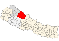
 Dunai Location in Nepal | |
| Coordinates: 28°56′N 82°54′E / 28.933°N 82.900°ECoordinates: 28°56′N 82°54′E / 28.933°N 82.900°E | |
| Country |
|
| Zone | Karnali Zone |
| District | Dolpa District |
| Elevation | 2,000 m (7,000 ft) |
| Population (1991) | |
| • Total | 1,773 |
| Time zone | NST (UTC+5:45) |
| Climate | Cwb |

Dunai is the district headquarters of Dolpa District in Nepal. The town is on the banks of the Thuli Bheri River at about 2,000 metres (6,562 ft) elevation.
The 1991 Nepal census counted 1,773 persons in 334 households.[1]
Dunai has one FM radio station: Radio Dolpa 101.4 MHz which is a community radio station. There is one hospital: the 15-bed Dolpa District Hospital.
In education, there is the Dolpa Campus affiliated with Tribhuvan University, one high school: Sarswoti Higher Secondary School affiliated with HSEB, and the Dunai Community Library which is a community learning center.
Dolpa Airport is 10 kilometres (6 mi) WNW of the town with flights to Nepalgunj, Birendranagar and Pokhara.
References
- ↑ "Nepal Census 2001". Nepal's Village Development Committees. Digital Himalaya. Retrieved 3 September 2008.
Capital: Dunai | ||
 | ||
This article is issued from Wikipedia - version of the 8/28/2016. The text is available under the Creative Commons Attribution/Share Alike but additional terms may apply for the media files.