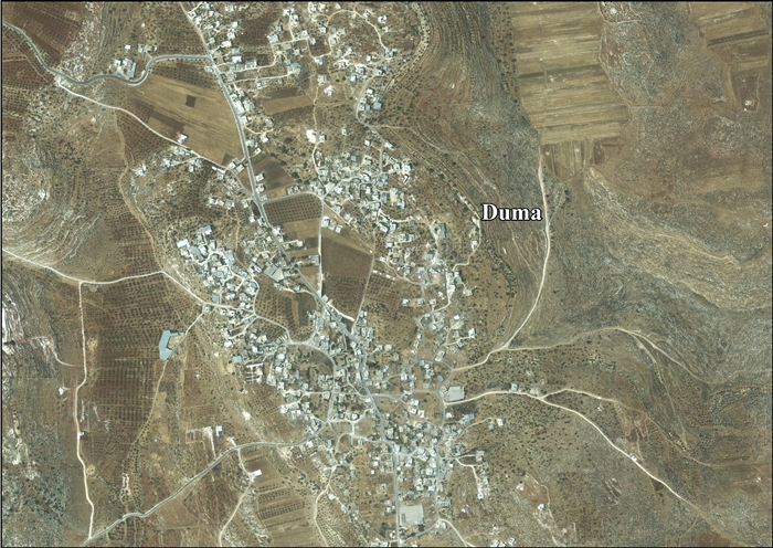
Duma, Nablus
| Duma | |
|---|---|
| Other transcription(s) | |
| • Arabic | دوما |
| • Also spelled | Doma (official) |
|
View of Duma, January 2014 | |
 Duma Location of Duma within the Palestinian territories | |
| Coordinates: 32°03′27″N 35°22′02″E / 32.05750°N 35.36722°ECoordinates: 32°03′27″N 35°22′02″E / 32.05750°N 35.36722°E | |
| Palestine grid | 184/162 |
| Governorate | Nablus |
| Government | |
| • Type | Village council |
| • Head of Municipality | Abd al-Salaam Dawabsha |
| Area | |
| • Jurisdiction | 17,351 dunams (17.4 km2 or 6.7 sq mi) |
| Population (2006) | |
| • Jurisdiction | 2,220 |
| Name meaning | The lotus[1] |

Duma (Arabic: دوما, also spelled as Douma)[2] is Palestinian town in the Nablus Governorate in the northern West Bank, located 25 kilometers southeast of Nablus. According to the Palestinian Central Bureau of Statistics, the town had a population of 2,220 inhabitants in mid-year 2006.[3] Duma's total land area consists of 17,351 dunams, about 200 of which are designated as built-up area.[4]
On 31 July 2015, suspected Israeli settlers firebombed two homes in Duma, killing 18-month-old Ali Saad Dawabsha and critically injuring his parents and 4-year-old brother. The boy, Ali, died in the attack; his father, 32, died later of second-degree burns over most of his body, followed by the death of his wife, from her injuries, about 5 weeks later.[5][6] The attack is believed to be a price tag attack by Israeli settlers, who were seen fleeing towards Ma'ale Efrayim.[7][8]
History
Pottery sherds from the Hellenistic, Hellenistic/Roman and Roman era have been found.[9] South–southwest of the village is a spring called Ayn Duma, where water has been collected in ancient small pools, some hollowed out of rock.[10]
Ottoman era
Duma, like the rest of Palestine, was incorporated into the Ottoman Empire in 1517, and in the census of 1596 the village appeared under the name Duma as being in the Nahiya (Subdistrict) of Jabal Qubal of the Liwa (District) of Nablus. It had a population of 23 households, all Muslim. They paid a fixed tax-rate of 33.3% on agricultural products, including wheat, barley, summer crops, olive trees, goats and bee-hives; in addition to occasional revenues; a total of 1,300 akçe.[11]
In 1870, Victor Guérin visited and noted: "The village was formerly defended by two towers, one on the east and the other on the west. One of them was 18 paces long by 13 broad, and the other was 17 paces long by 8 in breadth. Some of the lower courses are still in place, and show that the towers were built of stones of large dimensions, some cut smooth and others in boss. These remains, separated by a space of about 750 yards, prove ancient work. The antiquity of the site is also proved by the numerous excavations in the rock, such as cisterns and subterranean magazines, found everywhere."[12]
In 1882, the Palestine Exploration Fund's Survey of Western Palestine (SWP) described it as "A small village on the top of a ridge. It has cisterns and ancient rock-cut tombs. There is a spring, 'Ain Umm 'Omeir, 3/4 mile southeast of the houses. On the north is the ruin of a place sacred to el Khudr, St. George. There are olives to the north."[13] The SWP also thought that the mosque of the village, with drafted stones, was a former church of St. George.[14]
British Mandate era
In the 1922 census of Palestine conducted by the British Mandate authorities, Duma had a population of 155 inhabitants, all Muslims,[15] increasing in the 1931 census to 218, still all Muslims, in a total of 43 houses.[16]
In 1945 Duma had a population of 310, all Muslims,[17] with 17,351 dunams of land, according to an official land and population survey.[18] Of this, 580 dunams were plantations and irrigable land, 4,076 used for cereals,[19] while 33 dunams were built-up land.[20]
1948-1967
In the wake of the 1948 Arab–Israeli War, and after the 1949 Armistice Agreements, Duma came under Jordanian occupation.
1967-present
After the Six-Day War in 1967, Duma has been under Israeli occupation. Prior to 1967, nearly all of Duma's working male residents were farmers. Since then the number of farmers has been reduced since many residents have found work in construction in Israel or work in small businesses in the town.[21] However, Duma's residents still mostly rely on irrigated crops, fruit orchards, olive groves and livestock for food.[4][21] Water is provided to Duma by four springs: Fasayel to the west, Ein Duma and Rashash to the south and Umm Amir to the east. Fasayel, the largest spring is also used by Israeli authorities to distribute water to nearby Israeli settlements.[4]
Duma has three schools for girls and boys and the town established a Mayo Clinic in 2002 with the help of the Palestinian Ministry of Health.
On 31 July 2015, suspected Israeli settlers firebombed two homes in Duma, killing 18-month-old Ali Saad Dawabsha, and critically injuring his parents—both his parents later died of their burns—and his 4-year-old brother. The attack is believed to have been a price tag attack by Israeli settlers, who were seen fleeing towards Ma'ale Efrayim.[8] The attack was condemned as an act of terrorism by the Palestinian government and Israel.[7][8][22]
References
- ↑ Palmer, 1881, p. 253
- ↑ "Life in the West Bank: What is the Palestinian Authority for?". The Economist. 5 August 2015. Retrieved 9 August 2015.
- ↑ Projected Mid -Year Population for Nablus Governorate by Locality 2004- 2006 Palestinian Central Bureau of Statistics.
- 1 2 3 New Israeli Demolition Warnings to Palestinian Houses in Doma Village Land Research Center. 10 May 2008.
- ↑ West Bank arson attack father dies, MSN
- ↑ Death of Palestinian woman from fire 'started by settlers' sparks grief and anger, 07 Sep 2015, The Telegraph
- 1 2 "Palestinian fury as 'Jewish settler' arson attack kills child". BBC News. 2015-07-31.
- 1 2 3 Palestinian infant burned to death in West Bank arson attack; IDF blames 'Jewish terror', Jul. 31, 2015, Haaretz
- ↑ Finkelstein and Lederman, eds., 1997, pp. 784-786
- ↑ Dauphin, 1998, p. 851
- ↑ Hütteroth and Abdulfattah, 1977, p. 133
- ↑ Guérin, 1875, pp. 14-15; as translated in Conder and Kitchener, 1882, SWP II, p. 390
- ↑ Conder and Kitchener, 1882, SWP II, p. 386
- ↑ Conder and Kitchener, 1882, SWP II, p. 390
- ↑ Barron, 1923, Table IX, Sub-district of Nablus, p. 25
- ↑ Mills, 1932, p. 61
- ↑ Department of Statistics, 1945, p. 18
- ↑ Government of Palestine, Department of Statistics. Village Statistics, April, 1945. Quoted in Hadawi, 1970, p. 59
- ↑ Government of Palestine, Department of Statistics. Village Statistics, April, 1945. Quoted in Hadawi, 1970, p. 106
- ↑ Government of Palestine, Department of Statistics. Village Statistics, April, 1945. Quoted in Hadawi, 1970, p. 156
- 1 2 Olive Harvest: Duma TriptoPalestine. 30 November 2004.
- ↑ Vigilante Effort After a Child’s Death Underlines Stark Change in West Bank, Diaa Hadid, 3. Aug., 2015, NY times
Bibliography
| Wikimedia Commons has media related to Duma, Nablus. |
- Barron, J. B., ed. (1923). Palestine: Report and General Abstracts of the Census of 1922. Government of Palestine.
- Conder, Claude Reignier; Kitchener, H. H. (1882). The Survey of Western Palestine: Memoirs of the Topography, Orography, Hydrography, and Archaeology. 2. London: Committee of the Palestine Exploration Fund.
- Dauphin, Claudine (1998). La Palestine byzantine, Peuplement et Populations. BAR International Series 726 (in French). III : Catalogue. Oxford: Archeopress. ISBN 0-860549-05-4.
- Department of Statistics (1945). Village Statistics, April, 1945. Government of Palestine.
- Finkelstein, Israel; Lederman, Zvi, eds. (1997). Highlands of many cultures. Tel Aviv: Institute of Archaeology of Tel Aviv University Publications Section. ISBN 965-440-007-3.
- Guérin, Victor (1875). Description Géographique Historique et Archéologique de la Palestine (in French). 2: Samarie, pt. 2. Paris: L'Imprimerie Nationale.
- Hadawi, Sami (1970). Village Statistics of 1945: A Classification of Land and Area ownership in Palestine. Palestine Liberation Organization Research Center.
- Hütteroth, Wolf-Dieter; Abdulfattah, Kamal (1977). Historical Geography of Palestine, Transjordan and Southern Syria in the Late 16th Century. Erlanger Geographische Arbeiten, Sonderband 5. Erlangen, Germany: Vorstand der Fränkischen Geographischen Gesellschaft. ISBN 3-920405-41-2.
- Mills, E., ed. (1932). Census of Palestine 1931. Population of Villages, Towns and Administrative Areas. Jerusalem: Government of Palestine.
- Palmer, E. H. (1881). The Survey of Western Palestine: Arabic and English Name Lists Collected During the Survey by Lieutenants Conder and Kitchener, R. E. Transliterated and Explained by E.H. Palmer. Committee of the Palestine Exploration Fund.
External links
- Welcome To Duma
- Map of the town, Google Maps
- mapcarta
- Survey of Western Palestine, Map 15: IAA, Wikimedia commons
- Duma Village Profile, ARIJ
- Duma, aerial photo, ARIJ
| Cities |
|  |
|---|---|---|
| Municipalities | ||
| Villages |
| |
| Refugee camps | ||