Dodds Bridge, Indiana
| Dodds Bridge | |
|---|---|
| Unincorporated community | |
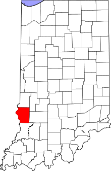 Sullivan County's location in Indiana | |
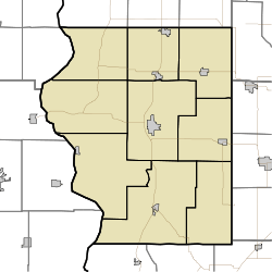 Dodds Bridge Location in Sullivan County, Indiana | |
| Coordinates: 39°09′26″N 87°31′26″W / 39.15722°N 87.52389°WCoordinates: 39°09′26″N 87°31′26″W / 39.15722°N 87.52389°W | |
| Country | United States |
| State | Indiana |
| County | Sullivan |
| Township | Turman |
| Elevation[1] | 463 ft (141 m) |
| ZIP code | 47879 |
| Area code(s) | 812 |
| GNIS feature ID | 433595 |
Dodds Bridge is an unincorporated community in Turman Township, Sullivan County, in the U.S. state of Indiana.[2]
The community is part of the Terre Haute Metropolitan Statistical Area.
Geography
Dodds Bridge is located at 39°09′26″N 87°31′26″W / 39.15722°N 87.52389°W.
References
- ↑ "US Board on Geographic Names". United States Geological Survey. October 25, 2007. Retrieved 2016-08-30.
- ↑ "Dodds Bridge, Indiana". Geographic Names Information System. United States Geological Survey. Retrieved 2010-08-18.
Municipalities and communities of Sullivan County, Indiana, United States | ||
|---|---|---|
| Cities | ||
| Towns | ||
| Townships | ||
| Unincorporated communities |
| |
| Ghost towns | ||
| Footnotes | ‡This populated place also has portions in an adjacent county or counties | |
This article is issued from Wikipedia - version of the 8/30/2016. The text is available under the Creative Commons Attribution/Share Alike but additional terms may apply for the media files.