Dlebta
| Dlebta دلبتا | |
|---|---|
| Municipality | |
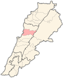
 Dlebta Location in Lebanon | |
| Coordinates: 34°0′31″N 35°41′27″E / 34.00861°N 35.69083°E | |
| Country |
|
| Governorate | Mount Lebanon |
| District | Keserwan |
| Area | |
| • Total | 8.4 km2 (3.23 sq mi) |
| Elevation | 670 m (2,200 ft) |
| Time zone | EET (UTC+2) |
| • Summer (DST) | EEST (UTC+3) |
Dlebta (Arabic: دلبتا; also spelled Delebteh) is a village and municipality located in the Keserwan District of the Mount Lebanon Governorate in Lebanon. The village is 26 kilometres (16 mi) north of Beirut.[1] It has an average elevation of 670 meters above sea level and a total land area of 323 hectares.[1] Dlebta's inhabitants are Maronite Catholics and other Christians.[2]
References
- 1 2 "Dlebta". Localiban. Localiban. 2008-01-19. Retrieved 2016-03-29.
- ↑ "Elections municipales et ikhtiariah au Mont-Liban" (pdf). Localiban. Localiban. 2010. p. 19. Retrieved 2016-02-12.
Capital: Jounieh | ||
| Towns and villages |
|  |
| Notable landmarks | ||
This article is issued from Wikipedia - version of the 3/30/2016. The text is available under the Creative Commons Attribution/Share Alike but additional terms may apply for the media files.