Adma wa Dafneh
| Adma wa Dafneh أدما والدفنه | |
|---|---|
| Municipality | |
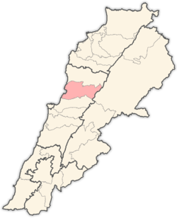
 Adma wa Dafneh Location in Lebanon | |
| Coordinates: 34°1′21″N 35°38′50″E / 34.02250°N 35.64722°ECoordinates: 34°1′21″N 35°38′50″E / 34.02250°N 35.64722°E | |
| Country |
|
| Governorate | Mount Lebanon |
| District | Keserwan |
| Area | |
| • Total | 4.56 km2 (1.76 sq mi) |
| Elevation | 10 m (30 ft) |
| Time zone | EET (UTC+2) |
| • Summer (DST) | EEST (UTC+3) |
| Dialing code | +961 |
ِAdma wa Dafneh is a town in the Keserwan District of the Mount Lebanon Governorate in Lebanon. The town consists of the villages of Adma and Dafneh, and is part of the larger municipality of Tabraja-Adma wa Dafneh-Kfar Yassine. The municipality is located 27 kilometers north of Beirut. Its average elevation is 10 meters above sea level and the municipality's total land area consists of 456 hectares.[1] Adma wa Dafneh's inhabitants are predominantly Maronite Christians.[2]
Adma wa Dafneh is largely made up of sparse structures situated between thick brush and forestation on the limestone hillsides and cliffs. The town is home to an assortment of traditional structures and post-modern and contemporary structures, including the Regency Hotel. It also houses the Lebanese Broadcasting Corporation and the Lebanese Army's tank training grounds. The town was the site of a major battle between the Lebanese Army and Lebanese Forces during the Lebanese Civil War, of which shells and ruins can still be found to this day. The town also features a ruined Civil War-era structure with a hidden arms depository, now empty, that survived the war.
Adma is markedly more vacant and vast than most Lebanese settlements, and is strongly connected to Jounieh and Tabarja to the south and north of it respectively. Adma is also home to the local hunting grounds, to which people from the neighboring towns come to line up and fire upon the returning migratory birds every year. This has come under criticism from locals who have noticed a marked decrease in the once populous birds of the area.
References
- ↑ "Faraya". Localiban. Localiban. 2008-01-19. Retrieved 2016-02-12.
- ↑ "Elections municipales et ikhtiariah au Mont-Liban" (pdf). Localiban. Localiban. 2010. p. 19. Retrieved 2016-02-12.
Capital: Jounieh | ||
| Towns and villages |
|  |
| Notable landmarks | ||