Safra, Lebanon
| Safra صفرا | |
|---|---|
| Municipality | |
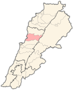
 Safra Location in Lebanon | |
| Coordinates: 34°2′15″N 35°38′16″E / 34.03750°N 35.63778°E | |
| Country |
|
| Governorate | Mount Lebanon |
| District | Keserwan |
| Area | |
| • Total | 3.06 km2 (1.18 sq mi) |
| Elevation | 150 m (490 ft) |
| Time zone | EET (UTC+2) |
| • Summer (DST) | EEST (UTC+3) |
Safra (Arabic: صفرا) is a village and municipality in the Keserwan District of the Mount Lebanon Governorate in Lebanon. It is located 29 kilometers north of Beirut. The village has a total land area of 306 hectares.[1] Safra is perched on a curve on a rocky butte overlooking the Nahr Ibrahim river and the Mediterranean Sea, standing at an average elevation of 150 meters above sea level,[1]
The inhabitants are predominantly Maronite Catholics.[2] The main families of Safra are the Saleh El Nar, Rudy Tarabay, Abi Sejaan, Khoury, Azzi, Hawa and Zgheib. Hawa Chicken, Lebanon's largest poultry producer and distributor, is located in Safra.
References
- 1 2 "Safra". Localiban. Localiban. 2008-01-22. Retrieved 2009-07-24.
- ↑ "Elections municipales et ikhtiariah au Mont-Liban" (pdf). Localiban. Localiban. 2010. p. 19. Retrieved 2016-02-12.
Capital: Jounieh | ||
| Towns and villages |
|  |
| Notable landmarks | ||
This article is issued from Wikipedia - version of the 11/19/2016. The text is available under the Creative Commons Attribution/Share Alike but additional terms may apply for the media files.