Derbyshire Dales
| Derbyshire Dales District | |
|---|---|
| District | |
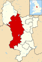 Shown within Derbyshire | |
| Sovereign state | United Kingdom |
| Constituent country | England |
| Region | East Midlands |
| Administrative county | Derbyshire |
| Admin. HQ | Matlock |
| Government | |
| • Type | Derbyshire Dales District Council |
| • Leadership: | Alternative - Sec.31 |
| • Executive: | Conservative |
| • MP: | Patrick McLoughlin |
| Area | |
| • Total | 305.9 sq mi (792.4 km2) |
| Area rank | 45th |
| Population (mid-2014 est.) | |
| • Total | 71,281 |
| • Rank | Ranked 299th |
| • Density | 230/sq mi (90/km2) |
| Time zone | Greenwich Mean Time (UTC+0) |
| • Summer (DST) | British Summer Time (UTC+1) |
| ONS code |
17UF (ONS) E07000035 (GSS) |
| Ethnicity |
97.8% White 0.8% .Asian[1] |
| Website | derbyshiredales.gov.uk |
Derbyshire Dales /ˈdɑːrbᵻʃə deɪlz/ or /ˈdɑːrbiʃɪər deɪlz/ is a local government district in Derbyshire, England. The population of the district as taken at the 2011 Census was 71,116.[2] Much of the district is situated in the Peak District, although most of its population lies along the River Derwent.
The borough borders the districts of High Peak, Amber Valley, North East Derbyshire and South Derbyshire in Derbyshire and also Sheffield in South Yorkshire. The district also lies within the Sheffield City Region, and the district council is a non-constituent partner member of the Sheffield City Region Combined Authority. A significant amount of the working population is employed in Sheffield and Chesterfield.
The district offices are in Matlock. It was formed on 1 April 1974, originally under the name of West Derbyshire. The district adopted its current name in 1988. The district was a merger of Ashbourne, Bakewell, Matlock and Wirksworth urban districts along with Ashbourne Rural District and Bakewell Rural District.
Following their review of parliamentary representation in Derbyshire, the Boundary Commission for England has formed a new constituency called Derbyshire Dales.
Governance
Derbyshire Dales District Council is elected every four years, with currently 39 councillors being elected at each election. The Conservative party has had a majority on the council since 1976, apart from a four-year period between 1995 and the 1999 election when no party had a majority. As of July 2011 and after the 2011 election the council is composed of the following councillors:-[3]
| Party | Councillors | |
| Conservative Party | 29 | |
| Labour Party | 5 | |
| Liberal Democrats | 4 | |
| Independent | 1 | |
Places
- Alsop-en-le-Dale, Ashford-in-the-Water, Ashbourne
- Bakewell, Baslow, Beeley, Biggin, Birchover, Bonsall, Bradbourne, Bradwell, Brailsford, Brassington, Bretton
- Calver, Carsington, Chatsworth, Chelmorton, Cromford, Curbar
- Darley Dale
- Earl Sterndale, Edensor, Elton, Eyam
- Fenny Bentley, Foolow, Froggatt
- Great Hucklow, Great Longstone, Grindleford
- Hassop, Hathersage, Hognaston, Hartington
- Kirk Ireton, Kniveton
- Little Hucklow, Litton
- Matlock, Matlock Bath, Middleton-by-Wirksworth, Middleton-by-Youlgreave, Monyash
- Over Haddon
- Parwich
- Rowsley
- Stanton-in-Peak, Stoney Middleton, Sudbury
- Taddington, Tansley, Thorpe, Tideswell, Tissington
- Wardlow, Wensley, Winster, Wirksworth
- Youlgreave
References
| Wikimedia Commons has media related to Derbyshire Dales District. |
- ↑ "Resident Population Estimates by Ethnic Group (Percentages) Area: Derbyshire Dales (Local Authority)". Neighbourhood Statistics. National Office for Statistics. Retrieved 2 August 2015.
- ↑ "Local Authority population 2011". Neighbourhood Statistics. Office for National Statistics. Retrieved 23 March 2016.
- ↑ "District Council Elections 2011". Derbyshire Dales District Council. Retrieved 13 December 2011.
| Unitary authorities | |
|---|---|
| Boroughs or districts | |
| Major settlements |
|
| Rivers | |
| Topics | |
Districts of the East Midlands | ||
|---|---|---|
| Derbyshire |  | |
| Leicestershire | ||
| Lincolnshire | ||
| Nottinghamshire | ||
| Northamptonshire | ||
| Rutland | ||
Coordinates: 53°03′N 1°42′W / 53.05°N 1.70°W