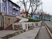
Daşkəsən
- For the administrative district, see Dashkasan Rayon; for the settlement and municipality also called Daşkəsən, see Daşkəsən (settlement); for the village in Jabrayil Rayon, see Daşgəsən; for the place in Zanjan Province of Iran , see Dashkasan.
Coordinates: 40°29′41″N 46°04′38″E / 40.49472°N 46.07722°E
| Daşkəsən | ||
|---|---|---|
| City & Municipality | ||
_2.jpg) | ||
| ||
 Daşkəsən | ||
| Coordinates: 40°29′41″N 46°04′38″E / 40.49472°N 46.07722°E | ||
| Country |
| |
| Rayon | Dashkasan | |
| Elevation | 1,630 m (5,350 ft) | |
| Population (2010)[1] | ||
| • Total | 11,262 | |
| Time zone | AZT (UTC+4) | |
| • Summer (DST) | AZT (UTC+5) | |
| Area code(s) | +994 216 | |

Daşkəsən, also known as Dashkasan, is a city and municipality in and the capital of the Dashkasan Rayon of modern Azerbaijan. It has a population of 10 801. The municipality consists of the city of Daşkəsən and the village of Alunitdağ.[2]
Etymology
The city's name means Rock Cutter in Azerbaijani, in which Azerbaijani daş means stone and kəsən is rooted in the verb kəsmək, "to cut", thus referring to a place where rocks have been hacked.[3] [4]
History
The settlement existed from the early Middle Ages as an Armenian town known as Karhat. [5] The mountains of Daşkəsən were used as pastures for a long time. The most beautiful pastures of the South Caucasus are located here and in Khoshbulag. Khoshbulag was inhabited by the primitive people in the Stone Age whose main engagement was hunting. In the 3rd century B.C. people engaged in animal breeding rose to Khoshbulag pastures. The tradition is followed up today. Daşkəsən summer pastures are 2000 m high from sea level. Different animal-breeding tribes settled here and built Cyclops-like small towers to protect themselves from attacks. Since that period Daşkəsən turned to the place of settlement.
Tumuli type burying monuments found in the archaeological digs carried out in 1959-1960 in the places of ancient settlement in Daşkəsən show that people used this area as summer pastures and there was only one way to those pastures in summer- north-east, the valley of the river Kur.
The 4th-century Targmanchats Monastery is also just north of Daşkəsən.
The Middle Ages in Daşkəsən are characterized with the development of cultural work.
According to the Russian Empire Census in 1897 Daşkəsən (Karhat) was an Armenian village with a population of 544.[6]
The region Daşkəsən is very rich in natural resources. In the period of the Soviet Union the so-called strategic products of the region, i.e., ironstone, aluminum, cobalt, marble and others were actively exploited.
Many of the buildings in present-day Daşkəsən were constructed by German POWs during the aftermath of World War II. Workers that died during the city's construction are buried in a German cemetery alongside the road between Daşkəsən and Gəncə.
See also
Gallery
.jpg)
References
- ↑ The state statistical committee of the Azerbaijan Republic
- ↑ "Belediyye Informasiya Sistemi" (in Azerbaijani). Archived from the original on September 24, 2008.
- ↑ Ministry of Culture and Tourism of Azerbaijan:Dashkesen city
- ↑ Maria Adelaide Lala Comneno, Pablo Cuneo, Setrag Manoukian. Gharabagh. OEMME Edizioni, 1988, p. 56.
- ↑ Maria Adelaide Lala Comneno, Pablo Cuneo, Setrag Manoukian. Gharabagh. OEMME Edizioni, 1988, p. 56.
- ↑ Первая всеобщая перепись населения Российской империи 1897 г. "Населенные места Российской империи в 500 и более жителей с указанием всего наличного в них населения и числа жителей преобладающих вероисповеданий, по данным первой всеобщей переписи населения 1897 г.", Санкт-Петербург, 1905, стр. 30
.svg.png)