Sharur District
| Sharur | |
|---|---|
| Rayon | |
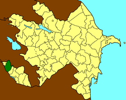 Map of Azerbaijan showing Sharur Rayon | |
| Country |
|
| Autonomous republic | Nakhchivan |
| City | 1 |
| Villages | 65 |
| Capital | Şərur |
| Area | |
| • Total | 872,26 km2 (33,678 sq mi) |
| Population | |
| • Total | 96,000 |
| • Density | 1.1/km2 (2.9/sq mi) |
| Time zone | AZT (UTC+4) |
| Postal code | AZ 6800 |
| Telephone code | (+994) 36 |
Şərur (also, Sharur and Sherur; formerly Norashen (1930-1964), Iliich (Ильич) and Il'ichëvsk (Ильичёвск) (1964–1991) after Vladimir Ilyich Lenin) is an rayon of Azerbaijan in the Nakhchivan Autonomous Republic. The district was established in August 8, 1930. In the north and north-east it is bordered by the Armenia, and in the south and south-west by the Iran. The area of district is 872.26 km2. There are 1 city and 65 villages within the district. The administrative center of the district is the Sharur town. It has a population of 96,000.[1]
History
In the first centuries of the 1st millennium BC, Sharur was a part of the state of Manna (IX - late VI centuries ВС). The Manna state succeeded in maintaining its independence, fighting against the neighboring states of Assyria and Urartu. Following the collapse of the Manna state, Sharur was first annexed to Medea (late VII century BC-550 BC), and then to the Achaemenid Empire (550 BC - 330 ВС). After the death of Alexander the Great (336-323 BC), the territory of Sharur was included in the state of Atropatena.
During ancient times, Sharur was a district in the Ayrarat province of the Kingdom of Armenia.[2] The lands in the district belonged to the Armenian kings until the fifth century AD. In the 6th century it was annexed to the Caucasian Albania.[1] When King Smbat I Bagratuni wrested control of the region from the Arabs, he awarded the lands to the Armenian princes of Syunik'.[2] It was conquered by Turkic tribes and later the Mongols in later centuries.
Sharur formed part of the territory of the Nakhichevan Khanate until its abolition in 1828. In the Russian Empire it was made a part of the Armenian Oblast. After the oblast was abolished, it became a part of Sharur-Daralagez uyezd of the Erivan Governorate.
Annexation
After the signing of the Treaty of Kars, in spite of the announcement of Nakhchivan region the Soviet Socialist Republic, the Armenia tried to refuse from the this article of the Treaty of Kars with certain excuses and began to make territorial claims against Nakhchivan. With the decisions of the Transcaucasian Central Executive Committee in 1929-1931, part of the territory of Nakhchivan ASSR has illegally been given to Armenia. Thus, Qurdqulaq (Gurdgulag), Xaçik (Khachik), Horadiz (Horadis) villages of the Sharur District, Ağbinə (Aghbina), Ağxaç (Aghkhaj), Almalı (Almaly), İtqıran (Itkyran), Sultanbəy (Sultanbek) villages of the Shahbuz District, Mehri (Meghri), Buğakər (Bughakar), Aldərə (Aldara), Lehvaz, Astazur, Nüvədi (Nyuvadi) settlements which includes to the Qərcıvan (Gorchivan) administrative unit of Ordubad District, a part of the Kilit village, altogether, 657 square kilometers area were given to Armenia. In 1930, moreover, the Mehri district was established on the basis of separated land. In subsequent years, a number of areas also annexed to Armenia. In the 1990s, the Armenian armed forces have occupied the village of Karki. Thus, about 15 per cent of the determined territory of Nakhchivan Autonomous Republic by the Treaty of Kars, has illegally been occupied by Armenia in 20-90-es of the last century.[1]
Historical and Archaeological monuments
Sharur is one of the most ancient and the largest settlements of the Autonomous Republic of Nakhchivan. The favorable geographical position of Sharur created conditions for the settlement of people in the ancient times. The researches showed that the people settled in the area in the late glacial period. The territory of Sharur with its full water rivers, fertile soils were favorable for the development of plant-growing. The historical researches defined the settlement of the people in Sharur before Christ. The archaeological excavations on the territory of Sharur which is mentioned as Sharuk in the epos of "The Book of Dede Korkut" dating back to the period 1300 ago revealed the settlement and burial places of the Neolithic, Bronze Age as well as Antique period. The settlement Oghlangaya covering an area of 40 hectares of the Garatepe Mountain of the region dates back to the 2-1st millenniums B.C. The region accounts for a number of archeological monuments and settlements rich in the patterns of material culture reflecting the activity and lifestyle of ancient people. These are the ancient, settlement, towers, cemeteries, Kurgans and architectural monuments. The researches of 1980-1990 revealed the cultural remnants of the dug cave of the Stone Age including a great many of instruments made of stone and wine-tree. The monuments of the mid Bronze Age was revealed in the Araz River, Arpachay and its branches (Shortepe, Kheledj mountain, Kultepe, Djennettepe and others).[1]
Twin cities
References
- 1 2 3 4 ANAS, Azerbaijan National Academy of Sciences (2005). Nakhchivan Encyclopedia. volume II. Baku: ANAS. p. 313. ISBN 5-8066-1468-9.
- 1 2 (Armenian) Anon. «Շարուր» (Sharur). Soviet Armenian Encyclopedia. vol. viii. Yerevan: Armenian Academy of Sciences, 1982, p. 469.
.svg.png)
Coordinates: 39°33′N 45°04′E / 39.550°N 45.067°E