Cullman, Alabama
| Cullman, Alabama | |
|---|---|
|
Buildings on 1st Avenue SE | |
| Motto: "A City of Character" | |
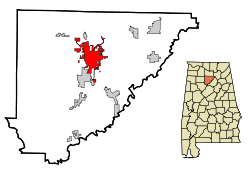 Location in Cullman County and the state of Alabama | |
 Location in the United States | |
| Coordinates: 34°10′39″N 86°50′41″W / 34.17750°N 86.84472°W | |
| Country | United States |
| State | Alabama |
| County | Cullman |
| Settled | 1873 |
| Incorporated | 1878 |
| Founded by | Colonel Johann Gottfried Cullmann |
| Named for | Colonel Johann Gottfried Cullmann |
| Government | |
| • Type | Mayor-Council |
| Area | |
| • Total | 20.6 sq mi (53.3 km2) |
| • Land | 19.4 sq mi (50.2 km2) |
| • Water | 1.2 sq mi (3.1 km2) |
| Elevation | 898 ft (251 m) |
| Population (2015 est.)[1] | |
| • Total | 15,350 |
| • Density | 776/sq mi (299.5/km2) |
| Time zone | Central Standard Time (UTC-6) |
| • Summer (DST) | CDT (UTC-5) |
| ZIP code | 35055-35058 |
| Area code(s) | 256 |
| Mayor | Woody Jacobs |
| FIPS code | 01-18976 |
| GNIS feature ID | 0116948 |
| Website |
www |

Cullman is a city in Cullman County, Alabama, United States. Cullman is located along Interstate 65, about 50 miles (80 km) north of Birmingham and about 55 miles (89 km) south of Huntsville. As of the 2010 census it had a population of 14,775,[2] with an estimated population of 15,350 in 2015.[1] Cullman is the seat of Cullman County.
History
In the time before European settlement, the area that today includes Cullman was originally in the territory of the Cherokee Nation. The region was traversed by a trail known as the Black Warrior's Path, which led from the Tennessee River near the present location of Florence, Alabama, to a point on the Black Warrior River south of Cullman. This trail figured significantly in Cherokee history, and it featured prominently in the American Indian Wars prior to the establishment of the state of Alabama and the relocation of several American Indian tribes, including the Creek people westward along the Trail of Tears. During the Creek War in 1813, General Andrew Jackson of the U.S. Army dispatched a contingent of troops down the trail, one of which included the frontiersman Davy Crockett.[3]
During the Civil War, the future location of Cullman was the site of the minor Battle of Day's Gap. On April 30, 1863, Union forces under the command of Colonel Abel Streight won a victory over forces under Confederate General Nathan Bedford Forrest. This battle was part of a campaign and chase known collectively as Streight's Raid. Although Streight got the upper hand in this battle, Forrest would have the last laugh. In one of the more humorous moments of the war, Streight sought a truce and negotiations with Forrest in present-day Cherokee County near present-day Gaylesville. Although Streight's force was larger than Forrest's, while the two were negotiating, Forrest had his troops march repeatedly in a circuitous route past the site of the talks. Thinking himself to be badly outnumbered, Streight surrendered to Forrest on the spot.[4]

Cullman itself was founded in 1873 by Colonel John G. Cullmann, a German refugee who had arrived in America in 1865. (The city's name was Americanized to "Cullman", although some sources state that Cullmann had earlier Americanized his name from "Kullmann". Stanley Johnson, his only surviving American descendant, told The Cullman Times in 1998 that there are no German records indicating the name "Kullmann", and that "Cullmann" had always been the correct spelling.)[5] Cullmann had been an advocate of democratic reforms in his native Bavaria, and he fled when the autocratic Prussian-dominated regime emerged ascendant after the Revolutions of 1848. In 1873, Cullmann negotiated an agreement to act as agent for a tract of land 349,000 acres (1,410 km2) in size, owned by the Louisville and Nashville Railroad Company, on which he established a colony for German immigrants.[6][7]
Five German families moved to the area in March 1873; in 1874, the town was incorporated and named after Colonel Cullmann. Over the next twenty years, Cullmann encouraged around 100,000 Germans to immigrate to the United States, with many settling in the Cullman area. Cullmann drew on his military engineering training in laying out and planning the town. During this period, Cullman underwent considerable growth. German continued to be widely spoken, and Cullmann himself was the publisher of a German-language newspaper. When Cullmann died in 1895, at the age of 72, his funeral was marked by the attendance of Governor William C. Oates.[6] The site Cullmann selected for his headquarters is now his gravesite.
German immigrants also founded St Bernard's Monastery, on the grounds of which is the Ave Maria Grotto, containing 125 miniature reproductions of some of the most famous religious structures of the world. It's Cullman's principal tourist attraction.[8]
For many years Cullman was a college town, with Saint Bernard College serving as the home of several hundred students. In the mid-1970s, St. Bernard briefly merged with Sacred Heart College (a two-year Benedictine women’s college), to become Southern Benedictine College. That college closed in 1979, and it now operates as St. Bernard Preparatory School. The former site of Sacred Heart College is now the Sacred Heart Monastery, which serves as a retreat center operated by the Benedictine Sisters of Sacred Heart Monastery.[9]
During the twentieth century, Cullman developed a more diverse economy, including several manufacturing and distribution facilities. However, its economy remains primarily based on agriculture and providing services to the agricultural workforce. Cullman County has the highest agricultural production in the state, and is one of the sixty largest agricultural-production counties in dollar terms in the United States.[10]
Cullman gained national attention in early 2008, when a special election was held to fill a vacancy in the Alabama House of Representatives.The district that included Cullman elected James C. Fields, an African-American, in that special election.[11]
Cullman's German heritage was repressed during World War I and World War II, while the United States was fighting Germany. This was reversed in the 1970s, with renewed interest in the city's history and heritage. Today, Cullman holds an annual Oktoberfest.[12] An honorary "Bürgermeister" is elected for each Oktoberfest. For many years the Oktoberfest did not include alcohol because Cullman was dry, but starting in 2011 the Oktoberfest was able to offer beer.[13]

Downtown was significantly damaged by an EF4 tornado during the April 2011 tornado outbreak. Hitting on April 27, it destroyed many buildings in downtown and in an east-side residential area, but causing no fatalities. The twister moved northeast towards Arab and Guntersville, killing two Cullman County residents and four or more others.[14]
Geography
Cullman is located on top of the Brindley Mountain plateau at 34°10′39″N 86°50′42″W / 34.17750°N 86.84500°W (34.177508, −86.844996).[15] This is a close offshoot of the long geographic ridge called Sand Mountain, a southmost extension of the Appalachian Mountains. The elevation is 826 feet (252 m), close to the watershed between the Tennessee River and the Black Warrior River. Cullman provides its own town water supply from a city-owned lake within the city limits, Lake Catoma.
According to the U.S. Census Bureau, the city has a total area of 20.6 square miles (53.3 km2), of which 19.4 square miles (50.2 km2) is land and 1.2 square miles (3.1 km2), or 5.81%, is water.[2]
Education
The Cullman City School System operates five schools:
Cullman Primary School (Pre-K – First Grade),
East Elementary (Second Grade – Sixth Grade)
West Elementary (Second Grade – Sixth Grade),
John G. Cullman Middle School (Seventh and Eighth Grades),
and Cullman High School (Ninth Grade – Twelfth Grade).[16]
Other schools in Cullman include:
Saint Bernard Preparatory School, Benedictine boarding and day school (Ninth grade – Twelfth grade),
Saint Bernard Middle School (Seventh and Eighth Grade),
Sacred Heart Elementary School (Pre-K – Sixth Grade),
Saint Paul's Lutheran School (Pre-K – Sixth Grade),
Cullman Christian School (Pre-K – Twelfth Grade).
Cullman is also the home of Wallace State Community College in Hanceville. It was named for the former Governor of Alabama, George C. Wallace. The public, non-profit college opened its doors in 1966 and has grown to become the third largest community college in the state of Alabama, with an enrollment of around 6,000 students. The college is accredited by the Southern Association of Colleges and Schools Commission on Colleges to award degrees. Many programs have additional accreditation from organizations appropriate to the particular disciplines. Wallace State offers hundreds of degree and certificate options in dozens of programs in its Academic, Health and Technical Divisions. The college offers more Health programs than any other community college in the state. The college offers early enrollment through its Dual Enrollment, Fast Track Academy and Fast Track for Industry programs, the latter of which is funded through grants that allow free tuition for qualified students entering the technical, academic and health programs included in the program. The college's current president is Dr. Vicki P. Karolewics, who is the institution's third president in 50 years. She was preceded by Dr. James C. Bailey from 1971 to 2003 and Dr. Ben Johnson from 1965 to 1971. The college is located in the southern portion of Cullman County on a verdant 300-acre campus that includes state-of-the-art facilities, men's and women's dormitories and multiple recreational opportunities. The college boasts several national championship athletic teams and competes in Division I of the National Junior College Athletic Association. Athletic programs at Wallace State include men's and women's basketball, baseball, softball, men's and women's golf, men's and women's tennis, volleyball and cheerleading.
Demographics
| Historical population | |||
|---|---|---|---|
| Census | Pop. | %± | |
| 1880 | 426 | — | |
| 1890 | 1,017 | 138.7% | |
| 1900 | 1,255 | 23.4% | |
| 1910 | 2,130 | 69.7% | |
| 1920 | 2,467 | 15.8% | |
| 1930 | 2,786 | 12.9% | |
| 1940 | 5,074 | 82.1% | |
| 1950 | 7,523 | 48.3% | |
| 1960 | 10,883 | 44.7% | |
| 1970 | 12,601 | 15.8% | |
| 1980 | 13,084 | 3.8% | |
| 1990 | 13,367 | 2.2% | |
| 2000 | 13,995 | 4.7% | |
| 2010 | 14,775 | 5.6% | |
| Est. 2015 | 15,350 | [17] | 3.9% |
| U.S. Decennial Census[18] 2013 Estimate[19] | |||
The population density was 765.0 inhabitants per square mile (295.4/km2). There were 6,957 housing units at an average density of 365.1 per square mile (141.0/km2). The racial makeup of the city was 93.4% White, 0.01% Black or African American, 0.3% Native American, 0.9% Asian, 0.05% Pacific Islander, and 1.1% from two or more races. 8.2% of the population were Hispanic or Latino of any race.
As of the census of 2010, there were 14,775 people and 6,957 households, out of which 22.5% had children under the age of 18 living with them, 48.3% were married couples living together, 10.7% had a female householder with no husband present, and 37.9% were non-families. 35.2% of all households were made up of individuals and 18.0% had someone living alone who was 65 years of age or older. The average household size was 2.22 and the average family size was 2.85.
In the city the population was spread out with 21.8% under the age of 18, 8.2% from 18 to 24, 25.3% from 25 to 44, 22.6% from 45 to 64, and 22.1% who were 65 years of age or older. The median age was 41 years. For every 100 females there were 87.5 males. For every 100 females age 18 and over, there were 81.4 males.
The median income for a household in the city was $29,164, and the median income for a family was $41,313. Males had a median income of $32,863 versus $21,647 for females. The per capita income for the city was $18,484. About 9.4% of families and 13.2% of the population were below the poverty line, including 12.3% of those under age 18 and 18.5% of those age 65 or over.
Cullman was ranked among Bloomberg Businessweek's 50 Best Places to Raise Your Kids in 2012[20] based on the city's educational and economic factors, crime level, air quality, amenities, and ethnic diversity.
Media
Radio stations
- WFMH 1340 AM (Sports/Talk)
- WKUL 92.1 FM (Country/Talk)
- WRJM-LP 95.5 FM (CHR/AAA/Variety)
- WMCJ 1460 AM (Southern Gospel)
- WYDE-FM 101.1 FM (Talk Radio)
Newspapers
- The Cullman Times (daily)
- The Cullman Tribune (weekly)
- Cullman Sense (weekly)
- Community Shoppers Guide (weekly)
- Cullman Today (online)
Television
Cullman is in the TV broadcasting areas of Birmingham and Huntsville, Alabama.
There are two low-power broadcasting stations in Cullman: WCQT-LP TV-27 and CATV-2. Cullman also has a PEG station, CCTV55, which is run by students at Cullman High School. CCTV55 was known as CATS-55 at one time.
Health care
- Cullman Regional Medical Center – a 115-bed hospital
Transportation
 Interstate 65
 U.S. Highway 31
 U.S. Highway 278
 State Route 69
 State Route 157
- CSX Transportation (railroad)
- Folsom Field municipal airport
Sister city
-
 Frankweiler (Germany)
Notable persons from Cullman
- JoJo Billingsley, singer/songwriter
- Wesley Britt, National Football League player
- Paul Burnum, former basketball and baseball coach at the University of Alabama
- Paul Bussman, member of the Alabama Senate
- Caleb Clay, former pitcher for the Los Angeles Angels of Anaheim
- Jamelle Folsom, First Lady of Alabama 1948 – 1951 and 1955 – 1959[21]
- James E. "Big Jim" Folsom, Governor of Alabama 1947 – 1951 and 1955 – 1959
- James E. "Little Jim" Folsom, Jr., Governor of Alabama 1993 – 1995, Lieutenant Governor of Alabama 1987-1993 and 2007-2011
- Morgan Smith Goodwin, actress, 2012 - 2013 Wendy's spokesperson
- Roger Hallmark, country musician
- Kurt Heinecke, composer and voice actor
- Charles Kleibacker, fashion designer
- Zeb Little, member of the Alabama Senate from 1998 to 2010
- Harold E. Martin, journalist and 1970 Pulitzer Prize winner
- William C. Martin, physicist
- Julian L. McPhillips, candidate for Attorney General of Alabama in 1978
- David Miller, American football defensive end
- Kassie Miller, singer/songwriter
- Talmadge Prince, stock car racing driver who was killed in a crash in a qualifying race for the 1970 Daytona 500
- Josh Rutledge, Major League Baseball player
- Frank Stitt, nationally acclaimed and James Beard Award-winning chef
- Channing Tatum, actor/model
- Wayne Trimble, American football player
- Zac Tubbs, American football offensive lineman
- Holly Williams, country music singer, daughter of Hank Williams, Jr.
- Larry Willingham, professional football player
Climate
The climate in this area is characterized by hot, humid summers and generally mild to cool winters. According to the Köppen Climate Classification system, Cullman has a humid subtropical climate, abbreviated "Cfa" on climate maps.[22]
References
- 1 2 "Population Estimates". United States Census Bureau. Retrieved 2014-06-07.
- 1 2 "Geographic Identifiers: 2010 Demographic Profile Data (G001): Cullman city, Alabama". U.S. Census Bureau, American Factfinder. Retrieved June 11, 2014.
- ↑ Fulenwider, Dan. "Cullman County, Alabama History: The Black Warrior's Path". Cullman County, Alabama. Retrieved January 28, 2010.
- ↑ Partain, Rich. "Streight's Raid". co.cullman.al.us. Retrieved January 28, 2010.
- ↑ "Cullman: Moving Forward while Treasuring the Past". the Cullman Times. 1998.
- 1 2 Johnson, Stanley. "Founding of Cullman". co.cullman.al.us. Retrieved January 28, 2010.
- ↑ Northern Alabama: Historical and Biographical. Birmingham: Smith & Deland. 1888.
- ↑ "The Ave Maria Grotto". www.minorsights.com. Retrieved March 22, 2015.
- ↑ "History of St Bernard Prep". stbernardprep.com. Retrieved January 28, 2010.
- ↑ "The Cullman Area Chamber of Commerce- Business Climate". cullmanchamber.org. Retrieved January 28, 2010.
- ↑ Nossiter, Adam (February 21, 2008). "Race Matters Less in Politics of South". The New York Times. p. A1. Retrieved January 28, 2010.
- ↑ "Oktoberfest history Oktoberfest". Cullman, Alabama Oktoberfest. Retrieved November 29, 2010.
- ↑ "Cheers: Home of dry Oktoberfest goes wet". Montgomery Advertiser. Associated Press. November 4, 2010. Retrieved November 29, 2010.
- ↑ "National Weather Service Huntsville, AL - Cullman County Survey Information". Srh.noaa.gov. 2012-03-17. Retrieved 2013-07-10.
- ↑ "US Gazetteer files: 2010, 2000, and 1990". United States Census Bureau. 2011-02-12. Retrieved 2011-04-23.
- ↑ "Cullman City Schools". cullmancats.net. Retrieved January 28, 2010.
- ↑ "Annual Estimates of the Resident Population for Incorporated Places: April 1, 2010 to July 1, 2015". Retrieved July 2, 2016.
- ↑ United States Census Bureau. "Census of Population and Housing". Archived from the original on May 11, 2015. Retrieved June 7, 2014.
- ↑ "Annual Estimates of the Resident Population: April 1, 2010 to July 1, 2013". Retrieved June 7, 2014.
- ↑ "The Best Places to Raise Your Kids 2012".
- ↑ "Former Ala. first lady Jamelle Folsom dies at 85". Montgomery Advertiser. Associated Press. December 2, 2012. Retrieved 2012-12-30.
- ↑ Climate Summary for Cullman, Alabama
External links
| Wikimedia Commons has media related to Cullman, Alabama. |
- City of Cullman official website
- History of Cullman, on the Cullman High School web site
- Cullman Schools
Municipalities and communities of Cullman County, Alabama, United States | ||
|---|---|---|
| Cities | 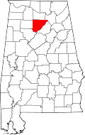 | |
| Towns | ||
| CDPs | ||
| Unincorporated communities | ||
| Footnotes | ‡This populated place also has portions in an adjacent county or counties | |