Colony, Alabama
| Colony, Alabama | |
|---|---|
| Town | |
 Location in Cullman County and the state of Alabama | |
| Coordinates: 33°56′42″N 86°53′58″W / 33.94500°N 86.89944°W | |
| Country | United States |
| State | Alabama |
| County | Cullman |
| Area | |
| • Total | 2.26 sq mi (5.85 km2) |
| • Land | 2.25 sq mi (5.83 km2) |
| • Water | 0.008 sq mi (0.02 km2) |
| Elevation | 456 ft (139 m) |
| Population (2010) | |
| • Total | 268 |
| • Density | 119/sq mi (46.0/km2) |
| Time zone | Central (CST) (UTC-6) |
| • Summer (DST) | CDT (UTC-5) |
| FIPS code | 01-16684 |
| GNIS feature ID | 1669444 |
Colony is a town in Cullman County, Alabama, United States. At the 2010 census the population was 268,[1] down from 385 in 2000. Colony is a historically African-American town. In its early days it was a haven for African Americans in the Deep South. It incorporated in 1981.
Geography
Colony is located in southern Cullman County at 33°56′42″N 86°53′58″W / 33.94500°N 86.89944°W (33.945011, -86.899465),[2] about 1 mile (1.6 km) north of the Mulberry Fork of the Black Warrior River. The town is located along Alabama State Route 91, approximately one mile west of Interstate 65.
According to the U.S. Census Bureau, the town has a total area of 2.3 square miles (5.9 km2), of which 0.008 square miles (0.02 km2), or 0.40%, is water.[1]
Demographics
| Historical population | |||
|---|---|---|---|
| Census | Pop. | %± | |
| 1990 | 298 | — | |
| 2000 | 385 | 29.2% | |
| 2010 | 268 | −30.4% | |
| Est. 2015 | 273 | [3] | 1.9% |
| U.S. Decennial Census[4] 2013 Estimate[5] | |||
As of the census[6] of 2000, there were 385 people, 130 households, and 99 families residing in the town. The population density was 171.6 people per square mile (66.4/km2). There were 154 housing units at an average density of 68.6 per square mile (26.5/km2). The racial makeup of the town was 5.71% White, 93.51% Black or African American, 0.26% Native American, 0.26% from other races, and 0.26% from two or more races. 0.78% of the population were Hispanic or Latino of any race.
There were 130 households out of which 27.7% had children under the age of 18 living with them, 46.9% were married couples living together, 23.1% had a female householder with no husband present, and 23.8% were non-families. 20.8% of all households were made up of individuals and 6.2% had someone living alone who was 65 years of age or older. The average household size was 2.92 and the average family size was 3.41.
In the town the population was spread out with 26.0% under the age of 18, 10.6% from 18 to 24, 27.3% from 25 to 44, 24.7% from 45 to 64, and 11.4% who were 65 years of age or older. The median age was 35 years. For every 100 females there were 103.7 males. For every 100 females age 18 and over, there were 100.7 males.
The median income for a household in the town was $32,708, and the median income for a family was $35,417. Males had a median income of $24,821 versus $19,125 for females. The per capita income for the town was $12,415. About 12.0% of families and 12.7% of the population were below the poverty line, including 8.5% of those under age 18 and 41.3% of those age 65 or over.
Notable person
- James C. Fields, member of the Alabama House of Representatives from 2008 to 2010
References
- 1 2 "Geographic Identifiers: 2010 Demographic Profile Data (G001): Colony town, Alabama". U.S. Census Bureau, American Factfinder. Retrieved June 11, 2014.
- ↑ "US Gazetteer files: 2010, 2000, and 1990". United States Census Bureau. 2011-02-12. Retrieved 2011-04-23.
- ↑ "Annual Estimates of the Resident Population for Incorporated Places: April 1, 2010 to July 1, 2015". Retrieved July 2, 2016.
- ↑ "U.S. Decennial Census". Census.gov. Archived from the original on May 11, 2015. Retrieved June 6, 2013.
- ↑ "Annual Estimates of the Resident Population: April 1, 2010 to July 1, 2013". Retrieved June 3, 2014.
- ↑ "American FactFinder". United States Census Bureau. Archived from the original on 2013-09-11. Retrieved 2008-01-31.
Coordinates: 33°56′42″N 86°53′58″W / 33.945011°N 86.899465°W
Municipalities and communities of Cullman County, Alabama, United States | ||
|---|---|---|
| Cities | 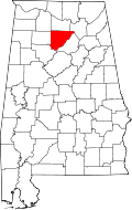 | |
| Towns | ||
| CDPs | ||
| Unincorporated communities | ||
| Footnotes | ‡This populated place also has portions in an adjacent county or counties | |