Tecate Peak
| Tecate Peak | |
|---|---|
 | |
| Highest point | |
| Elevation | 3,883 ft (1,184 m) NAVD 88[1] |
| Prominence | 1,885 ft (575 m) [2] |
| Coordinates | 32°34′46″N 116°41′20″W / 32.579569°N 116.688767°WCoordinates: 32°34′46″N 116°41′20″W / 32.579569°N 116.688767°W [1] |
| Geography | |
 California, U.S. | |
| Location | San Diego County, California, U.S. |
| Topo map | USGS Tecate |
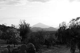
Tecate Peak is a mountain in San Diego County in the U.S. state of California. Tecate Peak is four miles west of Tecate, Baja California, and is about 1/2 mile north of the United States-Mexico border.[1]
Tecate Peak is also known as Kuuchamaa (also spelled Kuchamaa, Cuchuma, and Cuchama) Mountain, and is a sacred mountain for the indigenous Kumeyaay people.[3]
Tecate Peak is the 54th highest peak[4] in San Diego County.
References
- 1 2 3 "TECATE 2 RESET". NGS data sheet. U.S. National Geodetic Survey. Retrieved 2015-07-07.
- ↑ "Tecate Peak, California". Peakbagger.com. Retrieved 2015-07-07.
- ↑ Shipek, Florence C. (1985). "Kuuchamaa: The Kumeyaay Sacred Mountain". Journal of California and Great Basin Anthropology. 7 (1). JSTOR 27825214.
- ↑ "100 Highest Peaks in San Diego County".
External links
This article is issued from Wikipedia - version of the 11/14/2016. The text is available under the Creative Commons Attribution/Share Alike but additional terms may apply for the media files.