Cuautitlán
| Cuautitlán | |
|---|---|
| Town & Municipality | |
|
Cuautitlán | |
| Coordinates: 19°40′20″N 99°10′50″W / 19.67222°N 99.18056°W | |
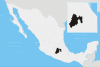
| Country |
|
| State | State of Mexico |
| Municipal Status | 1861 |
| Government | |
| • Municipal President | Francisco Javier Fernandez Clamont (2009-2012) |
| Elevation (of seat) | 2,250 m (7,380 ft) |
| Population (2005) Municipality | |
| • Municipality | 110,385 |
| • Seat | 97,686 |
| Time zone | CST (UTC-6) |
| Website | http://www.cuautitlan.gob.mx |
Cuautitlán (Spanish pronunciation: [kwautiˈtɬan]) is a city and municipality in the State of Mexico, just north of the northern tip of the Federal District (Distrito Federal) within the Greater Mexico City urban area. The city has engulfed most of the municipality, making the two synonymous. The name comes from Náhuatl and means 'between the trees.'[1]
City and municipal seat
In the Mexican national intermediary census (conteo) of 2005, the municipality recorded an overall population of census population of 110,345. The great majority of these inhabitants—some 97,686 people—resided in the urban confines of the city of Cuautitlán itself.[2]
Cuautitlán began as a Chichimeca village around the 14th century. It was dominated by Tlacopan before being conquered by the Mexica and made part of the Aztec empire. After the Conquest, Cuautitlán was evangelized by the Franciscans. They constructed San Buenaventura monastery and established the brotherhood of the Purísima Concepción de Nuestra Señora de Cuautitlán. Saint Juan Diego (1474–1548) reputedly lived there with his wife Maria Lucia up to the time of her death in 1529. They lived there in a one-roomed mud house thatched with corn stalks. The house still survives in a good state of preservation. Cuautitlán gained city status in 1968.[1]
It is the birthplace of painter and sculptor Luis Nishizawa (1918-2014).[1]
The municipality
As municipal seat, Cuautitlán has governing jurisdiction over the following communities: Colonia Venecia, Ejido de Santa Bárbara, Ex-hacienda la Corregidora (La Corregidora), Fracción San Roque (El Prieto), Granja San Isidro, Hacienda San Mateo, La Chinampa, La Laguna, La Trinidad, Machero, Rancho Puente la Cruz, San Mateo Ixtacalco, Santa María Huecatitla, and Xaltipa (Jaltipa)
The municipality has an area of 37.30 km² (14.4 sq mi).[1]
References
- 1 2 3 4 "Enciclopedia de los Municipios de Mexico Estado de Mexico Cuautitlán". Archived from the original on 2007-09-27. Retrieved 2008-03-07.
- ↑ "Link to tables of population data from Census of 2005". INEGI: Instituto Nacional de Estadística, Geografía e Informática. Archived from the original on 2013-02-27.
- México Enciclopedia de los Municipios de México
External links
- Sitio Oficial de Cuautitlán Official website
Coordinates: 19°41′N 99°11′W / 19.683°N 99.183°W