Aculco
| Aculco (de Espinoza) | |
|---|---|
| Town and municipality | |
|
Aculco (de Espinoza) | |
| Coordinates: 20°05′54″N 99°49′37″W / 20.09833°N 99.82694°WCoordinates: 20°05′54″N 99°49′37″W / 20.09833°N 99.82694°W | |
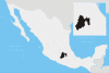
| Country | Mexico |
| State | State of Mexico |
| Municipal status | 1825 |
| Government | |
| • Municipal President | Francisco Javier Venancio Ramírez (2006–2009) |
| Area | |
| • Municipality | 492.13 km2 (190.01 sq mi) |
| Elevation (of seat) | 2,450 m (8,040 ft) |
| Population (2005) Municipality | |
| • Municipality | 40,492 |
| • Seat | 1,624 |
| Time zone | CST (UTC-6) |
| Postal code (of seat) | 50360 |
| Official name | Town of Aculco, Camino Real de Tierra Adentro |
| Type | Cultural |
| Criteria | II, IV |
| Designated | 2010 (34th session) |
| Reference no. | 1351 |
| State Party | Mexico |
| Region | Latin America and the Caribbean |
Aculco de Espinoza is a town and the seat of the municipality called Aculco in Mexico State.
Aculco de Espinoza
History
Aculco was founded approximately in 1110 AD by the Otomies, despite the fact that its name comes from Nahuatl. After being a village inhabited by Otomies for long time, it became a region dominated by the Mexicas, who lived there many years before the founding of Tenochtitlan.[1]
With the arrival of the Spanish in 1540, construction on the church and the convent of San Jeronimo began. In November 1810, Miguel Hidalgo and his contingent, who began the Mexican War of Independence, arrived in the region. Aculco was also where insurgents, led by Don Miguel Hidalgo, lost a battle against the troops of Felix Ma. Calleja.[1]
During the nineteenth century, the town hall and the first primary school in the region were constructed. Public baths and a municipal pool were also built.
Notable residents
- Lucas Magos Bárcenas y Cornejo
- Alfonso Díaz de la Vega
- Pablo de San Antonio Indio
- Juan García, Juan Nicolás
- Sotero González Mena
- Juan Maldonado Chemiso
- José Rafael Polo
- José Trinidad Polo
- Manuel Polo
- Ignacio Espinoza Martínez[1]
Aculco currently has a population of over 40,000 people.[1] On February 19, 1825, it became a municipality. In 1914 and 1915, Aculco was the scene of clashes led by the revolutionaries’ carrancistas, villistas and Zapatistas.[1]
Geography
The municipality of Aculco has a geographical extent of 484.7 square kilometres (187.1 sq mi). That represents 2.18% of the state. It is located in Mexico State.[1]
Aculco borders Polotitlán in the north, Querétaro in the south, and Acambay and Timilpan in the south.[2] It is approximately 100 kilometers away from or over 1 hour from Toluca, Toluca.
Climate
Aculco has a relatively cool, humid climate, with rain in the summer. The annual average temperature is of 13.2 °C (55.8 °F), with the lowest temperature occurring in the winter. The rain season starts at the end of March or beginning of April and lasts until October or November.[1]
Demographics
According to INEGI, in 2005, Aculco has a population of over 40,000. The ethnic composition is mainly Otomi.[1]
Over 16,000 people in the region are illiterate.[3]
Economy
The main economic activity of Aculco is the ranching of animals like pigs and sheep. The municipality's principal products include milk, fur, wool and egg. Aculco's inner commerce principally occurs at the municipal market, while its outer commerce is with Toluca, Mexico City and Querétaro.
Another major economic activity of Aculco is the exploitation of natural resources like sand, with quarries present in the region.[4]
Aculco is famous for the dairy products it produces. The municipality is also home to a metal structure manufacturing company.[1]
Tourism
Aculco contains numerous geographic features suitable for tourism. Two cascades are located in the area: "Tixhiñu" and "la Concepción". Many rivers, including the Río Ñadó and Río Prieto also flow through the municipality.
In addition, Aculco is home to numerous historic sites, including the San Jerónimo and the "Garrido Varela" (a bullring),[2] as well as the former residence of Miguel Hidalgo y Costilla. Two busts are located in Aculco in the memory of Benito Juarez and Miguel Hidalgo.[1]
Communities belonging to the municipality
Arroyo Zarco, Arroyo Zarco Ejido, Ñado Buenavista, Bañe, Bimbo, Decandeje, Ejido de Santa María Nativitas, Ejido de Totolopan, Ejido Decandeje (Chapala Ejido Decandeje), Ejido las Ánimas, Ejido San Joaquín Coscomatepec, El Azafrán (Santa Rosa el Azafrán), El Bonxhi, El Bosque, El Colorado, El Mogote, El Rincón, El Tixhiñu, El Zethe (Jazmín), Encinillas Ejido, Fondo, Gunyo Oriente, Gunyo Poniente (San José Gunyo), Higuerillas, Huizachal, Jurica, La Cofradía Grande, La Concepción Ejido, La Concepción Pueblo, La Cuesta, La Esperanza, La Estancia, La Pera, La Presita Segundo Cuartel, La Soledad Barrio, La Soledad Ejido, Las Lajas, Loma Alta Cabresteros, Loma Alta Ejido Bañe (Bañe Barrio CONASUPO), Los Ailes, Los Gavilanes, Presa del Tepozán, Rancho Chapala, San Antonio Arroyo Zarco, San Antonio el Zethe, San Antonio Pueblo, San Francisquito, San Jerónimo Barrio, San Jerónimo Ejido, San Joaquín Coscomatepec, San Lucas Totolmaloya, San Martín Ejido, San Pedro Denxhi, Santa Ana Matlavat, Santa Ana Oxtoc-toxhie, Santa María Nativitas, Santiago Oxtoc-Toxhie, Taxtho
References
- 1 2 3 4 5 6 7 8 9 10 "Enciclopedia de los Municipios de México". Archived from the original on 2007-09-30. Retrieved 2008-01-26.
- 1 2 "Aculco". Archived from the original on 2007-09-07. Retrieved 2008-01-30.
- ↑ "Sitios de México". Retrieved 2008-01-31.
- ↑ Gaspar Sampayo, Domingo. Monografía Municipal - Aculco. Mexico: Gobierno del Estado de Mexico. ISBN 968-841-079-9.