Crown Heights–Utica Avenue (IRT Eastern Parkway Line)
| Crown Heights–Utica Avenue | |||||||||||||||
|---|---|---|---|---|---|---|---|---|---|---|---|---|---|---|---|
| New York City Subway rapid transit station | |||||||||||||||
|
Southbound platform | |||||||||||||||
| Station statistics | |||||||||||||||
| Address |
Utica Avenue & Eastern Parkway Brooklyn, NY 11213 | ||||||||||||||
| Borough | Brooklyn | ||||||||||||||
| Locale | Crown Heights | ||||||||||||||
| Coordinates | 40°40′08″N 73°55′52″W / 40.668758°N 73.931208°WCoordinates: 40°40′08″N 73°55′52″W / 40.668758°N 73.931208°W | ||||||||||||||
| Division | A (IRT) | ||||||||||||||
| Line | IRT Eastern Parkway Line | ||||||||||||||
| Services |
2 3 4 5 | ||||||||||||||
| Transit connections |
| ||||||||||||||
| Structure | Underground | ||||||||||||||
| Levels | 2 | ||||||||||||||
| Platforms |
2 island platforms (1 on each level) cross-platform interchange | ||||||||||||||
| Tracks | 4 (2 on each level) | ||||||||||||||
| Other information | |||||||||||||||
| Opened | August 23, 1920 | ||||||||||||||
| Accessible |
| ||||||||||||||
| Traffic | |||||||||||||||
| Passengers (2015) |
8,965,908[1] | ||||||||||||||
| Rank | 37 out of 422 | ||||||||||||||
| Station succession | |||||||||||||||
| Next north |
Kingston Avenue (local): 2 Franklin Avenue (express): 4 | ||||||||||||||
| Next south |
Sutter Avenue–Rutland Road: 2 (Terminal): 4 | ||||||||||||||
|
| |||||||||||||||
| Next |
Atlantic Avenue–Barclays Center: 2 | ||||||||||||||
| Next |
none: 2 | ||||||||||||||
| |||||||||||||||
| |||||||||||||||


Crown Heights–Utica Avenue is an express station on the IRT Eastern Parkway Line of the New York City Subway. Located under Eastern Parkway near Utica Avenue in Crown Heights, Brooklyn, it is served by the 4 train at all times and the 3 train at all times except late nights. There is also sporadic 2 and 5 service during rush hours.
Despite its name, this station has no exit to the corner of Utica Avenue and Eastern Parkway. It is actually located between Schenectady and Utica Avenues and the two exits lead to the middle of the blocks, some number of feet from the actual cross street.
Station layout
| G | Street Level | Exit/ Entrance |
| B1 | Mezzanine | Fare control |
| B2 | Southbound express | → |
| Island platform, doors will open on the left, right | ||
| Southbound local | → | |
| B3 | Northbound express | ← |
| Island platform, doors will open on the left, right | ||
| Northbound local | ← | |
The station's two exits are located at either end. The one on the west (railroad north) is staffed weekdays only and accessed via a wide staircase in place of the end wall of the New Lots Avenue-bound platform. This staircase leads up to a small mezzanine where there is a token booth and turnstiles. When the booth and turnstile bank are closed, three HEET turnstiles and one exit-only turnstile provide access to/from the entrance. The two street staircases lead out to the two malls on either side of the main road of Eastern Parkway on the west side of Schenectady Avenue.
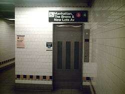
The station's full-time exit is at the east end (railroad south) of the platforms. Two narrow staircases and one elevator connect both platforms to a small upper level mezzanine that has two public restrooms (one for men and the other for women) and leads to a bank of turnstiles. The two street stairs here lead to either mall of Eastern Parkway west of Utica Avenue. Another elevator from the south mall leads to fare control.
The station serves local and express trains in a two-level layout with two island platforms. The upper platform serves southbound trains, with local tracks to the west and express tracks to the east, and the lower platform serves northbound trains with a similar configuration.[2] This is the easternmost underground and four-track subway station on the Eastern Parkway Line; to the east (railroad south) of here, the local tracks rises and become the IRT New Lots Line, while the express tracks end at bumper blocks just under Ralph Avenue. Diamond crossover tracks exist west (railroad north) of the station for northbound trains and east for southbound trains. Another diamond crossover, east of here, connects the southbound express track to a ramp down to the lower level. Trains descending the ramp can access either the local or express track.[2]
There is an active tower at the south end of the platform while a closed one exists on the east of the lower level.
In 1981, the MTA listed the station among the 69 most deteriorated stations in the subway system.[3]
Design
On the New Lots Avenue-bound platform, the track walls have a section of yellow-orange tiles beneath the trim-line and another line of yellow tiles on the bottom of the tiled portions. The I-beams and other steel work along the track walls are painted in dark blue. The Manhattan-bound platform has its metalwork painted in golden yellow and the tiles beneath the trim line in dark blue. In the station, there are ornate doors in the tile walls which serve as vent chambers.
The 2004 artwork here is called Good Morning and Good Night by Hugo Consuegra. It contains ceramic tiles of the sun and moon on the platform walls.
Provisions for expansion
Extensions of the IRT subway past the station have been proposed going back to the line's planning in the 1910s, which included terminating the line at Buffalo Avenue just east of the station, or extending the line down Utica Avenue towards Flatbush Avenue and Avenue U near Kings Plaza. The Utica Avenue extension in particular has been proposed several times as part of the New York City Transit Authority's 1968 expansion proposals, in older pre-unification plans, and in the competing pre-unification expansion plans of the Independent Subway System (IND).[4][5][6][7][8] Just east of this station, a bellmouth splits away from the local track on both levels, and curves south. This was built into the station as a provision for the proposed Utica Avenue Line, which is why the station itself has no exits to Utica Avenue.[9] In 2015, New York City Mayor Bill de Blasio announced his proposal for an extension of the 3 and 4 trains down Utica Avenue.[10]
References
- ↑ "Facts and Figures: Annual Subway Ridership". Metropolitan Transportation Authority. Retrieved 2016-04-19.
- 1 2 "www.nycsubway.org: New York City Subway Track Maps". www.nycsubway.org. 2015-10-09. Retrieved 2015-10-09.
- ↑ Gargan, Edward A. (June 11, 1981). "AGENCY LISTS ITS 69 MOST DETERIORATED SUBWAY STATIONS". The New York Times. Retrieved 13 August 2016.
- ↑ Joseph B. Raskin (1 November 2013). The Routes Not Taken: A Trip Through New York City's Unbuilt Subway System. Fordham University Press. ISBN 978-0-8232-5369-2. Retrieved 12 August 2015.
- ↑ "1968 NYCTA Expansion Plans (Picture)". Second Avenue Sagas. Retrieved December 2013. Check date values in:
|access-date=(help) - ↑ Program for Action maps from thejoekorner.com
- ↑ "Transit Outlook Bright in Brooklyn: First Branch Lines on Assessment Plan Likely to be Built in That Borough". The New York Times. March 6, 1910. Retrieved 16 September 2015.
- ↑ Prial, Frank J. (October 31, 1971). "Brooklyn Bemoans Its Ancient Subways". The New York Times. Retrieved 16 September 2015.
- ↑ Taft, Lyman W. (October 13, 1954). "Finds Many Unused Subway Tunnels Under City Streets". Brooklyn Daily Eagle. p. 24. Retrieved 16 September 2015 – via Newspapers.com.
- ↑ Fitzsimmons, Emma G. (April 22, 2015). "Mayor de Blasio Revives Plan for a Utica Avenue Subway Line". The New York Times. Retrieved 16 September 2015.
External links
| Wikimedia Commons has media related to Crown Heights – Utica Avenue (IRT Eastern Parkway Line). |
- nycsubway.org – Brooklyn IRT: Utica Avenue
- nycsubway.org — Good Morning, Good Night Artwork by Hugo Consuegra (2005)
- Station Reporter — 3 Train
- Station Reporter — 4 Train
- The Subway Nut — Crown Heights–Utica Avenue Pictures
- MTA's Arts For Transit — Crown Heights–Utica Avenue (IRT Eastern Parkway Line)
- Utica Avenue entrance from Google Maps Street View
- Schenectady Avenue entrance from Google Maps Street View
- Platform from Google Maps Street View