Croswell, Michigan
| Croswell, Michigan | |
|---|---|
| City | |
 Location of Croswell, Michigan | |
| Coordinates: 43°16′15″N 82°37′23″W / 43.27083°N 82.62306°W | |
| Country | United States |
| State | Michigan |
| County | Sanilac |
| Area[1] | |
| • Total | 2.41 sq mi (6.24 km2) |
| • Land | 2.29 sq mi (5.93 km2) |
| • Water | 0.12 sq mi (0.31 km2) |
| Elevation | 732 ft (223 m) |
| Population (2010)[2] | |
| • Total | 2,447 |
| • Estimate (2012[3]) | 2,394 |
| • Density | 1,068.6/sq mi (412.6/km2) |
| Time zone | Eastern (EST) (UTC-5) |
| • Summer (DST) | EDT (UTC-4) |
| ZIP code | 48422 |
| Area code(s) | 810 |
| FIPS code | 26-18920[4] |
| GNIS feature ID | 0624126[5] |
Croswell is a city in Sanilac County in the U.S. state of Michigan. The population was 2,447 at the 2010 census.
History
The settlement, originally known as Black River, was established in 1845. Later it was known as Davisville, after the town's first postmaster. In 1877 it was renamed Croswell, in honor of Governor Charles Croswell. The city was incorporated in 1881.[6]
Geography
According to the United States Census Bureau, the city has a total area of 2.41 square miles (6.24 km2), of which 2.29 square miles (5.93 km2) is land and 0.12 square miles (0.31 km2) is water.[1] It is considered to be part of the Thumb of Michigan, which in turn is a subregion of the Flint/Tri-Cities. Croswell can also be considered as in the Blue Water Area, a subregion of the Thumb.
Demographics
| Historical population | |||
|---|---|---|---|
| Census | Pop. | %± | |
| 1880 | 447 | — | |
| 1890 | 504 | 12.8% | |
| 1900 | 606 | 20.2% | |
| 1910 | 1,380 | 127.7% | |
| 1920 | 1,678 | 21.6% | |
| 1930 | 1,470 | −12.4% | |
| 1940 | 1,381 | −6.1% | |
| 1950 | 1,775 | 28.5% | |
| 1960 | 1,817 | 2.4% | |
| 1970 | 1,954 | 7.5% | |
| 1980 | 2,073 | 6.1% | |
| 1990 | 2,174 | 4.9% | |
| 2000 | 2,467 | 13.5% | |
| 2010 | 2,447 | −0.8% | |
| Est. 2015 | 2,338 | [7] | −4.5% |
2010 census
As of the census[2] of 2010, there were 2,447 people, 971 households, and 649 families residing in the city. The population density was 1,068.6 inhabitants per square mile (412.6/km2). There were 1,120 housing units at an average density of 489.1 per square mile (188.8/km2). The racial makeup of the city was 91.7% White, 0.5% African American, 0.7% Native American, 0.2% Asian, 5.1% from other races, and 1.8% from two or more races. Hispanic or Latino of any race were 12.8% of the population.
There were 971 households of which 35.2% had children under the age of 18 living with them, 45.8% were married couples living together, 14.8% had a female householder with no husband present, 6.2% had a male householder with no wife present, and 33.2% were non-families. 27.9% of all households were made up of individuals and 11.6% had someone living alone who was 65 years of age or older. The average household size was 2.51 and the average family size was 3.00.
The median age in the city was 38.8 years. 26.8% of residents were under the age of 18; 7.5% were between the ages of 18 and 24; 24.5% were from 25 to 44; 26.9% were from 45 to 64; and 14.2% were 65 years of age or older. The gender makeup of the city was 47.8% male and 52.2% female.
2000 census
As of the census[4] of 2000, there were 2,467 people, 914 households, and 633 families residing in the city. The population density was 1,080.1 per square mile (417.8/km²). There were 973 housing units at an average density of 426.0 per square mile (164.8/km²). The racial makeup of the city was 90.80% White, 0.16% African American, 0.45% Native American, 6.61% from other races, and 1.99% from two or more races. Hispanic or Latino of any race were 12.61% of the population.
There were 914 households out of which 38.3% had children under the age of 18 living with them, 49.0% were married couples living together, 16.1% had a female householder with no husband present, and 30.7% were non-families. 27.7% of all households were made up of individuals and 13.3% had someone living alone who was 65 years of age or older. The average household size was 2.68 and the average family size was 3.24.
In the city the population was spread out with 30.5% under the age of 18, 9.5% from 18 to 24, 28.6% from 25 to 44, 19.4% from 45 to 64, and 12.0% who were 65 years of age or older. The median age was 33 years. For every 100 females there were 91.8 males. For every 100 females age 18 and over, there were 83.3 males.
The median income for a household in the city was $30,379, and the median income for a family was $37,593. Males had a median income of $30,375 versus $20,231 for females. The per capita income for the city was $12,686. About 10.4% of families and 12.6% of the population were below the poverty line, including 11.3% of those under age 18 and 12.2% of those age 65 or over.
Industry
The surrounding areas are mostly engaged in farming. Crops include corn, wheat, oats, soy beans, sugar beets, peas, and alfalfa (hay).
Landmarks
The most notable landmark in Croswell is the "Be Good to Your Mother-In-Law" footbridge, which runs across the Black River. The cable and wood plank suspension bridge is known locally as the "Swinging Bridge" and is the setting of the annual Swinging Bridge Festival.
Events
One of the oldest fairs in Michigan, the Croswell Agricultural Society Fair (est. 1884), is held each summer at the Croswell Fairgrounds located at Harrington and Croswell Roads.
Transportation
Arnold Field is a public-use airport located two nautical miles (2.3 mi, 3.7 km) northeast of Croswell's central business district.[9]
Croswell Lexington Little League
In 2011, Croswell Lexington Little League won the Junior League Softball World Series. The team is the first Junior League Softball World Series champion from Michigan.[10]
References
- 1 2 "US Gazetteer files 2010". United States Census Bureau. Archived from the original on January 24, 2012. Retrieved 2012-11-25.
- 1 2 "American FactFinder". United States Census Bureau. Retrieved 2012-11-25.
- ↑ "Population Estimates". United States Census Bureau. Archived from the original on June 17, 2013. Retrieved 2013-06-03.
- 1 2 "American FactFinder". United States Census Bureau. Archived from the original on September 11, 2013. Retrieved 2008-01-31.
- ↑ "US Board on Geographic Names". United States Geological Survey. 2007-10-25. Retrieved 2008-01-31.
- ↑ Daly, Matthew L., et al. (eds.) (1999). Michigan Encyclopedia 2008-2009 Edition, Vol. 1, p. 229. Somerset Publishers, Inc.
- ↑ "Annual Estimates of the Resident Population for Incorporated Places: April 1, 2010 to July 1, 2015". Retrieved July 2, 2016.
- ↑ "Census of Population and Housing". Census.gov. Archived from the original on May 11, 2015. Retrieved June 4, 2015.
- ↑ FAA Airport Master Record for 55G (Form 5010 PDF). Federal Aviation Administration. Effective 30 June 2011.
- ↑ "Michigan State Champion Wins Junior League Softball World Series Championship". Little League Online. Little League. Retrieved 29 March 2012.
External links
Municipalities and communities of Sanilac County, Michigan, United States | ||
|---|---|---|
| Cities | 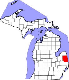 | |
| Villages | ||
| Townships | ||
| CDP | ||
| Other unincorporated communities | ||
| Footnotes | ‡This populated place also has portions in an adjacent county or counties | |
Coordinates: 43°16′32″N 82°37′16″W / 43.27556°N 82.62111°W