Crescent Junction, Utah
| Crescent Junction | |
|---|---|
| Unincorporated community | |
 Crescent Junction Location within the state of Utah | |
| Coordinates: 38°56′40″N 109°48′45″W / 38.94444°N 109.81250°WCoordinates: 38°56′40″N 109°48′45″W / 38.94444°N 109.81250°W | |
| Country | United States |
| State | Utah |
| County | Grand |
| Named for | Crescent-shaped formation of the Book Cliffs |
| Elevation[1] | 4,882 ft (1,488 m) |
| Time zone | Mountain (MST) (UTC-7) |
| • Summer (DST) | MDT (UTC-6) |
| ZIP codes | 84540 |
| Area code(s) | 435 |
| GNIS feature ID | 1437536[1] |
Crescent Junction (or Brendel) is a small unincorporated community within Grand County in the eastern part of the U.S. state of Utah. The community is located at 4,882 feet (1,488 m) above sea level.[1] Most highway maps use the name Crescent Junction, as the name given to the junction of Interstate 70 and U.S. Route 191. Most railroad maps use the name Brendel, the name of the rail siding and junction at the same location.[2]
History
The origin of the town is the Denver and Rio Grande Western Railroad which constructed its main line through Eastern Utah in 1883. However the only thing that existed at this location was the rail siding, called Crescent[3] for the crescent-shaped formation of the Book Cliffs in the area.[4] A town formed approximately 5 miles (8.0 km) east at the next rail siding, Thompson Springs. Thompson became a transfer point to unload goods from the train for shipment to other cities in the region without rail access.
U.S. Route 50 was commissioned in Eastern Utah in 1926, loosely following the route of the railroad. However, the junction point for the highway south to Moab was moved from Thompson Springs southwest to what was called Valley City.[5] This arrangement existed until approximately 1930, when US-50 was straightened. At that time the junction was moved again to the present site and named Crescent Junction,[5] next to the rail siding, now called Brendel.[2] The junction has not moved since. Over time two buildings were constructed, a gas station and restaurant.
Highways
Though the junction has stayed essentially the same since the 1930s; both highways that meet at Crescent Junction have been renumbered numerous times. The east-west highway was originally US-50. Later US-6 was overlapped with US-50. In the 1970s Interstate 70 was built and the two US highways overlapped with the freeway. The north-south highway has changed number several times, from US-450 to US-160 to US-163, to the present number US-191.[5]
Railroad
Originally the only rail line in the area was the D&RGW main line which rain east-west. In 1962, a line - the Cane Creek Subdivision - was built south through the area. The line branched from the main line at Brendel towards the Cane Creek potash mine and processing plant along the Colorado River, near the terminus of State Route 279.[6] Since this time Brendel has served as both the name of the rail siding and the junction of the potash or Cane Creek branch line [7] with the main line.
Transportation
As Crescent Junction is along a major Interstate and main railroad line, many vehicles pass through the community every day. Greyhound Bus Lines and Amtrak's California Zephyr pass through Crescent Junction en route between Green River and Grand Junction. However, neither service stops here, and the area is currently only accessible via charter or private transportation.
References
- 1 2 3 U.S. Geological Survey Geographic Names Information System: Crescent Junction, Utah. Retrieved on May 18, 2011.
- 1 2 Utah Road & Recreation Atlas (Map) (2002 ed.). 1:250000. Benchmark Maps. 2002. p. 70. § C4. ISBN 0-929591-74-7.
- ↑ Map of the Denver and Rio Grande, Western Pacific and connections (Map). Poole Brothers. 1930.
- ↑ Van Cott, John W. (1990). Utah Place Names. Salt Lake City, Utah: University of Utah Press. p. 96. ISBN 0-87480-345-4.
- 1 2 3 Dale Sanderson (mapguy). "Historic U.S. Highway Ends in and near Crescent Jct. Utah". Archived from the original on October 26, 2009. Retrieved 2007-12-18.
- ↑ Don Strack. "Rio Grande in Utah 1908 to 1988". Utah Rails. Retrieved 2007-12-18.
- ↑ Robert Pisani. "photo of the Potash Local train". Railphotos.net. Retrieved 2007-12-18.
Municipalities and communities of Grand County, Utah, United States | ||
|---|---|---|
| City | 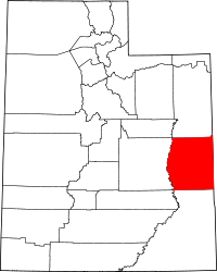 | |
| Town | ||
| CDP | ||
| Unincorporated community | ||
| Indian reservation | ||
| Ghost towns | ||
| Footnotes | ‡This populated place also has portions in an adjacent county or counties | |