Cranesville, Pennsylvania
| Cranesville, Pennsylvania | |
|---|---|
| Borough | |
 Location in Erie County and the state of Pennsylvania | |
| Coordinates: 41°54′12″N 80°20′50″W / 41.90333°N 80.34722°WCoordinates: 41°54′12″N 80°20′50″W / 41.90333°N 80.34722°W | |
| Country | United States |
| State | Pennsylvania |
| County | Erie |
| Government | |
| • Mayor | David Maynard |
| Area | |
| • Total | 0.94 sq mi (2.43 km2) |
| • Land | 0.93 sq mi (2.42 km2) |
| • Water | 0.004 sq mi (0.01 km2) |
| Population (2010) | |
| • Total | 638 |
| • Density | 682/sq mi (263.4/km2) |
| Time zone | EST (UTC-4) |
| • Summer (DST) | EDT (UTC-5) |
| ZIP code | 16410 |
| Area code(s) | 814 |
Cranesville is a borough in Erie County, Pennsylvania, United States. The population was 638 at the 2010 census.[1] It is part of the Erie Metropolitan Statistical Area.
Cranesville is the birthplace of Olympic gold medalist John Williams.
History
Cranesville was named after its founder, Fowler Crane.[2] On May 31, 1985 the borough was devastated by an F4 tornado which killed three people in Cranesville and another nine in nearby Albion.[3]
Geography
Cranesville is located in southwestern Erie County at 41°54′12″N 80°20′50″W / 41.90333°N 80.34722°W (41.903313, -80.347089).[4] It is bordered to the west by Conneaut Township and to the north, east, and south by Elk Creek Township. The borough of Albion is 2 miles (3 km) southwest of Cranesville.
According to the United States Census Bureau, the borough has a total area of 0.93 square miles (2.4 km2), of which 0.004 square miles (0.01 km2), or 0.51%, is water.[1]
Pennsylvania Route 18 (Meadville Street) passes through the center of the borough, leading north 7 miles (11 km) to Girard and south 12 miles (19 km) to Conneautville. The city of Erie is 25 miles (40 km) northeast via PA 18, Interstate 90, and Interstate 79.
Demographics
| Historical population | |||
|---|---|---|---|
| Census | Pop. | %± | |
| 1920 | 548 | — | |
| 1930 | 554 | 1.1% | |
| 1940 | 548 | −1.1% | |
| 1950 | 602 | 9.9% | |
| 1960 | 575 | −4.5% | |
| 1970 | 705 | 22.6% | |
| 1980 | 703 | −0.3% | |
| 1990 | 598 | −14.9% | |
| 2000 | 600 | 0.3% | |
| 2010 | 638 | 6.3% | |
| Est. 2015 | 614 | [5] | −3.8% |
| Sources:[6][7][8] | |||
As of the census[7] of 2000, there were 600 people, 216 households, and 166 families residing in the borough. The population density was 648.7 people per square mile (251.8/km²). There were 221 housing units at an average density of 238.9 per square mile (92.7/km²). The racial makeup of the borough was 99.17% White, 0.33% Asian, and 0.50% from two or more races.
There were 216 households, out of which 40.7% had children under the age of 18 living with them, 64.8% were married couples living together, 7.9% had a female householder with no husband present, and 22.7% were non-families. 18.5% of all households were made up of individuals, and 8.3% had someone living alone who was 65 years of age or older. The average household size was 2.78 and the average family size was 3.18.
In the borough the population was spread out, with 29.3% under the age of 18, 6.8% from 18 to 24, 32.3% from 25 to 44, 19.8% from 45 to 64, and 11.7% who were 65 years of age or older. The median age was 33 years. For every 100 females there were 103.4 males. For every 100 females age 18 and over, there were 99.1 males.
The median income for a household in the borough was $35,000, and the median income for a family was $37,500. Males had a median income of $28,068 versus $23,214 for females. The per capita income for the borough was $14,403. About 5.4% of families and 7.8% of the population were below the poverty line, including 8.8% of those under age 18 and none of those age 65 or over.
Education
Cranesville is part of the Northwestern School District.
References
- 1 2 "Geographic Identifiers: 2010 Demographic Profile Data (G001): Cranesville borough, Pennsylvania". American Factfinder. U.S. Census Bureau. Retrieved March 15, 2016.
- ↑ Gannett, Henry (1905). The Origin of Certain Place Names in the United States. Govt. Print. Off. p. 94.
- ↑ Grazulis, Thomas P. (1993). Significant tornadoes, 1680-1991. St. Johnsbury, Vt.: Environmental Films. ISBN 1-879362-03-1.
- ↑ "US Gazetteer files: 2010, 2000, and 1990". United States Census Bureau. 2011-02-12. Retrieved 2011-04-23.
- ↑ "Annual Estimates of the Resident Population for Incorporated Places: April 1, 2010 to July 1, 2015". Retrieved July 2, 2016.
- ↑ "Census of Population and Housing". U.S. Census Bureau. Archived from the original on 11 May 2015. Retrieved 11 December 2013.
- 1 2 "American FactFinder". United States Census Bureau. Archived from the original on 2013-09-11. Retrieved 2008-01-31.
- ↑ "Incorporated Places and Minor Civil Divisions Datasets: Subcounty Resident Population Estimates: April 1, 2010 to July 1, 2012". Population Estimates. U.S. Census Bureau. Archived from the original on 17 June 2013. Retrieved 11 December 2013.
Municipalities and communities of Erie County, Pennsylvania, United States | ||
|---|---|---|
| Cities | 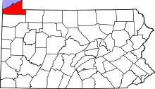 | |
| Boroughs | ||
| Townships | ||
| CDPs | ||
| Unincorporated communities | ||