1985 United States–Canada tornado outbreak
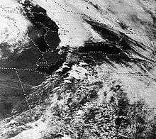
 Tracks of all tornadoes that touched down during the outbreak | |
| Type | Tornado outbreak |
|---|---|
| Duration | May 31, 1985 |
| Tornadoes confirmed | 44 confirmed |
| Max rating1 | F5 tornado |
| Duration of tornado outbreak2 | ~8 hours |
| Damage | $980 million (2005 USD) |
| Casualties | 90 fatalities, hundreds of injuries |
| Areas affected | New York, Ohio, Pennsylvania, Ontario |
|
1Most severe tornado damage; see Fujita scale 2Time from first tornado to last tornado | |
The 1985 United States – Canada tornado outbreak, referred to as the Barrie tornado outbreak in Canada, was a major tornado outbreak that occurred in Ohio, Pennsylvania, New York, and Ontario, on May 31, 1985. Forty-four tornadoes were counted including 14[1] in Ontario, Canada. It is the largest and most intense tornado outbreak ever to hit this region, and the worst tornado outbreak in Pennsylvania history in terms of deaths and destruction.[2]
Meteorological synopsis
| F0 | F1 | F2 | F3 | F4 | F5 | Total |
|---|---|---|---|---|---|---|
| 4 | 12 | 7 | 12 | 8 | 1 | 44 |

The upper air pattern was conducive for a major severe weather event in the Great Lakes that Friday, May 31. An unseasonably deep low pressure system at 984 hPa crossed out of the Midwestern U.S. through the day, and then into the Upper Peninsula of Michigan. Very warm air surged in ahead of this system. Temperatures reached the upper twenties in Celsius (approximately 80-85 Fahrenheit) across much of southern Ontario, in addition to high dew point levels. An unstable atmosphere (surface based lifted indices around minus 6) was the byproduct of this.[3] Directional wind shear was also present in the warm sector of the storm, in addition to high helicity values and a vorticity maximum approaching the lower lakes.
The situation was worsened by the presence of copious amounts of moisture, which would allow any storms that could form to become severe rather quickly. Also, this was supportive of the HP (high-precipitation) counterpart of the supercell thunderstorm (Verkaik, 1997). All of this added up to the distinct possibility of severe rotating storms that were messy, hard to see, and extremely dangerous. What was needed now was a trigger, and that came in the form of a trailing cold front behind the low. Severe thunderstorms and isolated tornadoes had already raked parts of the Midwest U.S. (particularly in Iowa and Wisconsin) the day before on May 30, associated with this same cold front (Grazulis, 1990).
The day started off on an active note with the warm front moving northwards. A possible tornado was reported near Leamington, accompanied by golfball size hail from widespread severe thunderstorm activity in southwestern Ontario. Following the warm frontal passage, skies cleared rapidly and temperatures quickly began to rise. The cold front began crossing Lake Huron towards the noon hour, and with it several thunderstorms developed shortly after 1:30pm EDT, with the northernmost cell soon becoming most dominant. Environment Canada issued a severe thunderstorm warning at 2:25pm for Bruce County (complementing the special weather statement issued early that morning). At around 2:50pm, an F2 tornado touched down briefly in the Lion's Head area (north of Wiarton) before moving out over Georgian Bay and dissipating.[3]

At daybreak on May 31, 1985, a strong area of low pressure was centered near Duluth, Minnesota. A cold front extended south from the low across the western Great Lakes and then through Illinois and Missouri. The low tracked across the northern Great Lakes during the afternoon, while the cold front progressed eastward across Indiana and western Ohio. By late afternoon, temperatures had reached 87 degrees at Cleveland, 82 degrees at Youngstown, and 85 degrees at Erie, Pennsylvania. At the same time, conditions in the upper atmosphere continued to become more favorable for an outbreak of severe weather. By early afternoon, thunderstorms developed in Ontario, Canada just ahead of the cold front.
Despite a forecast for severe thunderstorms, though, the sun shone relentlessly for most of that Friday because of a fourth element: a stable air mass at about 2,000 feet, which served as a "lid" on the brew beneath. Then, at 2:50 p.m., the "lid" moved, and huge cumulonimbus clouds—anvil-topped thunderheads—seemingly appeared out of nowhere all along the Ohio-Pennsylvania border. The storms quickly grew into powerful tornadic supercells.
Storm timeline and aftermath
The outbreak lasted roughly from just before 3 p.m. EDT, when the first tornado touched down in Wiarton, Ontario, until around 12 a.m. EDT when the last reported tornado struck Tobyhanna, Pennsylvania. The peak of the outbreak took place during the early evening hours where the strongest and deadliest tornadoes formed across western Pennsylvania and eastern Ohio.
The first of two F4 tornadoes to affect Erie County touched down just west of the Pennsylvania state line around 5 p.m. The tornado moved across the northwestern tip of Crawford County and then entered Erie County near Pennside. After causing considerable damage there, the tornado slammed into Albion leveling the town. A ten-block area was completely destroyed, with nine people being killed. The tornado killed three more people in Cranesville before lifting. There were also 82 injuries, and a total of 309 destroyed buildings. The second F4 to affect Erie County touched down between Wattsburg and Corry in eastern Erie County. This tornado stayed on the ground for 45 miles (72 km) but resulted in no fatalities.
The most famous tornado of this outbreak touched down in Portage County, Ohio near the Ravenna National Guard Armory at about 6:30 p.m. and cut a 47-mile (76 km) path through Newton Falls, Niles, and Hubbard, Ohio before entering Pennsylvania. This was the only F5 in the United States in 1985, and the deadliest Ohio tornado since the Xenia F5 during the 1974 Super Outbreak.
90 people were killed in the United States and Canada in the outbreak; the most for an outbreak since the 1974 Super Outbreak, and a mark that stood until the April 25–28, 2011 tornado outbreak. It was the third costliest tornado outbreak in the history of the U.S., where it caused $600 million (2010 U.S. dollars) damage in Ohio, Pennsylvania, and New York. It was also one of the costliest in Canada: damage in Ontario totaled an estimated $400 million USD. The damage would total nearly $1 billion in 2010 U.S. dollars.
United States
The Niles, OH/Wheatland, PA Tornado
This extremely violent tornado began in eastern Ohio, and tore directly through the towns of Niles, Ohio and Wheatland, Pennsylvania, producing F5 damage at both locations. The tornado killed 18 people and injured 310, and was the most violent and deadly of the 43 recorded that day. Registering F5 on the Fujita scale, it remains the only F5 in Pennsylvania history,[4] and was also the most violent tornado reported in the United States in 1985.[5]

It first touched down in Ohio near the Ravenna Arsenal in Portage County around 6:30 PM EDT. Gathering strength, it moved quickly into Newton Falls in Trumbull County causing F3 to F4 damage through much of the town. While nearly 400 homes were heavily damaged or destroyed, no fatalities were recorded in Newton Falls, due to storm preparedness of local authorities and its tornado siren.[6][7] Additional homes were completely destroyed as the tornado struck the north side of Lordstown.[8] Continuing east, the tornado reached F5 intensity as it tore through the north side of Niles. Hundreds of well-built homes in the Niles area were completely destroyed, some of which were swept from their foundations and scattered. The well-built Niles Park Plaza shopping center was completely leveled and partially swept away at F5 intensity, with several of the fatalities occurring at that location. Steel girders were buckled at the shopping center. A nearby retirement home and a skating rink were leveled as well. As the tornado struck an industrial area in Niles, large 30 foot tall metal petroleum storage tanks (each weighing 75,000 pounds) were torn from where they were anchored and thrown, some of which were tossed or bounced considerable distances. One of the tanks was found in the middle of a road, 60 yards from where it originated. The tornado weakened slightly as it tore through the north side of Hubbard and through the center of Coalburg, though many additional homes were still leveled in those areas.[8][9][10]

As the tornado crossed the state line and reached Wheatland, Pennsylvania, it was a half-mile (0.8 km) wide and had regained F5 strength. A steel-frame trucking plant in Wheatland was completely obliterated and partially swept away at F5 intensity, as the building's steel girder frame was mangled into a pile and pushed off of the foundation. At nearby Wheatland Sheet and Tube, sections of pavement were scoured from the parking lot, and shards of sheet metal and routing slips were left wedged beneath the remaining asphalt. Ninety-five percent of Wheatland's business and residential area were destroyed. According to Storm Data from the National Weather Service, the destruction of the town "resembled that of a bombed-out battle field." Continuing east, the tornado weakened slightly but remained violent as it struck Hermitage, damaging or destroying 71 homes along with the town's airport, destroying several hangars and planes. A wing from one of the planes was found 10 miles away in Mercer. Another trucking steel processing plant were heavily damaged in Hermitage as well. The tornado then destroyed 15 homes and damaged 30 others in the Greenfield area before finally dissipating.[8][9][10]
In Ohio, it was the deadliest tornado since the Xenia F5 during the Super Outbreak of April 3, 1974. The tornado was also captured on camera by several residents.
Other U.S. tornadoes
What may have been what was described as "one of the most impressive tornadic events of the 20th century" by meteorologist and researcher Thomas Grazulis also occurred during this outbreak.[11] Later rated at F4, this massive tornado tracked over 69 miles (110 kilometers) of mainly dense forest and wilderness in central Pennsylvania (some outbuildings were either damaged or destroyed early in its life). The maximum width of the damage path from this storm was estimated to be at least 2.5 miles;[11] and it was also estimated that at least 90,000 trees were obliterated in the Moshannon/Sproul State Forest. This storm generated tremors, subsequently picked up by seismometers in the area, and a reflectivity spike (known as a debris ball, when the storm tracked through dense, old-growth forests in a rugged part of Pennsylvania) later became visible in the hook-echo on the more primitive weather radar of the time (a WSR-57 unit located in State College, Pennsylvania). The radar was picking up the hundreds of trees flying through the air at any given moment.[12]
The second-deadliest tornado (also rated at F4) in Pennsylvania's history tracked through southern Crawford and northern Venango Counties where 16 were killed.[12] In total, 65 people were killed in Pennsylvania alone, by far the highest death toll in a tornado outbreak, and in a single day for that state.[12] Later in the evening, some of these tornadoes crossed into New York affecting southern Chautauqua County, New York and Cattaraugus County, New York. One was an F4 and the other was an F3; nobody was killed but over 20 were injured in New York state.[12]
Canada
Most of the tornadic activity at this point moved into southeastern Ontario producing more tornadoes (some of which were significant). These tornadoes formed around the Highway 7 corridor between Lindsay to Madoc (Joe and Leduc, 1993) near the towns of Wagner Lake (F1 at 5:40pm), Reaboro (F1 at 6:05pm), Ida (F2 at 6:20pm), Rice Lake (F3 at 6:25pm), and Minto (F1 at 6:35pm). Most of these tornadoes had conversely shorter paths than the earlier tornadoes, likely as a result of the parent thunderstorms beginning to weaken. In addition, they did not receive as much media attention as the previous tornadoes (those earlier storms were grouped collectively by the media as comprising “The Barrie Tornado”), probably a result of the fact that they didn’t have the opportunity to cause as much damage.[3]
Even so, at the time these more eastern tornadoes were touching down, a final, more isolated supercell developed near Milverton in eastern Perth County which spawned a tornado at 6:15pm. On the ground for approximately fifteen minutes, this tornado tracked a 33-kilometre (21 mi) path of sporadic F3 damage (mainly to outbuildings) from Alma east-northeast towards the Hillsburgh area. Its path was almost parallel to the Grand Valley/Tottenham tornado only a couple of hours earlier.[13]
The Hopeville to Barrie supercell
At about the same time the Lion's Head tornado dissipated, two very severe thunderstorms had developed (that probably owe their inception, at least partially, to lake breeze convergence): one to the east of Clinton and another further to the north, in the Walkerton area. These two developing supercells would grow into a pair of incredibly devastating, monster storms within the next hour - likely the most prolific tornado producers in Canadian history to date.
The second tornado of the day touched down south of Hopeville around 3:45pm, causing some localized F3 damage along its track. This tornado lifted after a 17-kilometre (11 mi) path, but another tornado quickly formed just north of Corbetton, in northern Dufferin County at about 4:15pm.[13] It stayed over rural areas for most of its 40-kilometre (25 mi) path, however a few homes (especially in the Terra Nova and Mansfield area) sustained F3 damage (it has been somewhat disputed whether this path was of two separate tornadoes, rather than just one). In any case, shortly after this tornado had clearly dissipated, there were hints of another brief touchdown near Angus in the Blackdown Park training area of Canadian Forces Base Borden (north of Alliston). This northern storm, clearly a cyclic supercell, was far from finished. The next tornado was the last of this storm, but was the most infamous one. It formed in southern Simcoe County (Essa Township), less than 10 kilometres (6.2 mi) southwest of Highway 400 and the Barrie city limits.
At approximately 4:00pm, all electrical power in Barrie went out, as the Grand Valley/Tottenham tornado took out the main hydro transformers, southwest of the city (LeGrand, 1990). Few residents had any idea of what was looming over the horizon, but many people were let off work 30–45 minutes before the storm hit due to these power outages. Had this not happened, the death toll would have undoubtedly been much higher.[14] The intensifying tornado first obliterated a pine tree forest plantation. Some 10-metre (33 ft) high trees were snapped at the 2-metre (6 ft 7 in) level. At this point the damage path was about 600 metres (2,000 ft) wide, moving steadily towards the east-northeast. It then entered the southern part of Barrie shortly before 5:00pm. Visibility was very low as the tornado was cloaked in heavy rain and dust, thus making it very difficult to see. Extensive F3 (although some localized F4) damage occurred to an entire square block of homes in the Crawford Street and Patterson Road subdivision. Five people were killed in the area as some homes there were not well-built, and thus collapsed after being pushed off their foundations.[14] Two of these five deaths included a mother and son, killed when their Crawford Street home was completely levelled (Bruineman, 2010). Most of the fatalities occurred in homes with no basements, where head and chest trauma resulted from an increased exposure to flying debris.
Next, the tornado hit an industrial complex (known then as Molson Park). One person died at a tire retreading facility while at least fifteen other businesses were damaged or destroyed (Bruineman, 2010). Steel I-beams were twisted horribly out of shape, and splinters of wood were found embedded into nearby concrete walls. The tornado then proceeded to cross Highway 400 at Essa Road (former Highway 27) interchange, just missing the Barrie Racetrack to the south. The grandstand was heavily damaged and several barns nearby were destroyed. A man was killed after he was sucked out of his parked car in an adjacent lot (Bruineman, 2010). Several vehicles traveling on Highway 400 were tossed into the ditch, their drivers escaping with only minor injuries. Highway guard rails were found wrapped around telephone poles nearby. Many cars were also found with puncture holes in their frames, owing to the flying debris. As it crossed the highway, it moved into the Allandale subdivision.
Many homes sustained severe damage there, with much of their upper floors missing. By this time the tornado’s path had narrowed to about 300 metres (980 ft). The track moved from Debra Crescent to Joanne Court with more extensive damage. Near Tower Crescent, the path narrowed to a comparatively small fifty metres.[14] On Briar Road, homes sustained only minor damage, indicating that the tornado had weakened somewhat. But the next road east, Trillium Crescent had sustained heavy damage indicating that it had strengthened once again. Four warehouses near Highway 11 were ripped apart. It then hit the Tollendal Woods and Minets Point area, taking out the Brentwood Marina and a nearby subdivision. A boy was killed in this area while trying to bicycle home (Bruineman, 2010). Over thirty boats, accompanied by their concrete moorings, were tossed into Lake Simcoe and never to be recovered.[14] The tornado then moved out over Kempenfelt Bay where it became a waterspout for a brief time before weakening out completely. It came very close to the opposite shore, but no damage was reported there. Large quantities of debris from the city were later found floating in the bay, however. Despite the tornado's relatively short path length (under 10 kilometres (6.2 mi)), eight died in Barrie with 155 injured, and as many as 300 homes were damaged or destroyed.[15]
The Grand Valley to Tottenham supercell

The storm which had initially developed east of Clinton produced a new tornado a couple kilometres north of Arthur by 4:15pm. Many power lines and hydro towers were destroyed early in its lifetime (including those used to deliver electricity from the Bruce Nuclear Generating Station to northern and western parts of the Greater Toronto Area). The tornado quickly widened, intensified and reached violent proportions by the time it reached the small crossroads community of Grand Valley just before 4:30pm.[3] At that point the tornado's damage path was approximately 200 metres (660 ft) wide.
The tornado caused major damage in the small town, where two people were killed. An elderly woman visiting from Scotland died as the home was destroyed, and a man was killed in his pickup truck on a nearby farm (Bruineman, 2010). The worst damage was found along Amaranth Street (running west to east, parallel to the tornado's path) where the local library, three churches, and many other homes were severely damaged or destroyed. Approximately sixty structures in total sustained damage. The most severe was on the north side of the street, where some homes exhibited classic F4 damage. The library roof was found some 200 metres away on a nearby house (Bruineman, 2010).
Continuing eastward through more open country, it brushed the northern outskirts of Orangeville about fifteen minutes later (Grazulis, 2001) where the southern portion of the Mono Shopping Plaza completely collapsed (injuring 67 people, one of them seriously). It then caused extensive damage to approximately fifty buildings (many of which were only recently built) about 2 kilometres (1.2 mi) south of the town of Tottenham at around 5:00pm. Two more people died here, as an elderly man was crushed under an equipment shed on his farm and a woman was killed in her home (Bruineman, 2010). The tornado continued moving to the east-northeast, crossing Highway 400 into York region. It just missed the cities of Newmarket and Bradford before lifting west of Mount Albert at 5:25pm, with a path length in excess of 100 kilometres (62 mi), thus becoming a Canadian record that still stands today. When the earliest tornado track maps were published within the next year, they showed this particular tornado to have tracked almost twice as far towards the Peterborough area before dissipating.[16] In more recent years this theory has proved to be incorrect; it is likely that this supercell was also a cyclic one.
Aftermath
Following the event, twelve people were dead and 281 were injured, as close to a thousand businesses and homes were wiped out (Grazulis, 2001). Still, hundreds more were left out of work largely as a result of the massive damage sustained to the industrial complex in Barrie. Of the 605 homes in the path of these tornadoes, approximately one-third were rendered uninhabitable.[17] One of the more sobering instances was that of a blind Orangeville-area man whose home suffered a similar fate, following a painstaking 20 years of construction (LeGrand, 1990). Nevertheless, in the hours following the event, soldiers from "B" and "F" Companies, The Grey and Simcoe Foresters and from Canadian Forces Base in Borden assembled in Barrie to assist in the canvassing of the worst affected areas of the city. Coincidentally, the latter had barely escaped a tornado itself that day, it having momentarily touched down in the Blackdown Park Training Area before lifting again and passing over hundreds of married quarters. In addition, the Grand Valley library (levelled by an F4 tornado) donated books, and wooden pallets were donated by a local trucking company in Barrie so survivors could salvage their possessions.
Most of Grand Valley was completely rebuilt by August 1986, a little over a year later. The textile plant, Albarrie (one of twelve factories completely destroyed by the Barrie tornado) opened its doors once again within the next year.[18][19] Even so, to this day there are still hints from the past of the tornadoes that day. Some of the wooded areas that were affected are still a twisted mess, and some random debris still remains scattered in the bush to the east of Highway 400 in Barrie. In the end, the price tag from the severe weather in Ontario alone reached an estimated $200 million (in unadjusted Canadian dollars, 1985). Correlating to nearly $390 million in Canadian dollars by today’s standard, it was a very expensive disaster indeed (LeGrand, 1990). This tornado outbreak ranks among the Southern Ontario tornado outbreak of 2005 and the 1998 Ice Storm as one of the most costly weather disasters to strike Ontario. Climatologists have estimated that the probability of a severe weather outbreak as widespread and catastrophic as this one, occurring this far north and east in North America once again is one in 75,000 (Grazulis, 2001).
On the evening of May 31, 1985, an F1 tornado touched down far to the east of the other twisters from that day at around 8:10 p.m., near Grippen Lake, about 35 kilometres northeast of Kingston, Ontario. This makes it a "14th lost and found tornado".[1]
See also
References
- 1 2 "May 31, 1985 outbreak: How a 'lost' 14th tornado was found". theweathernetwork.com. Retrieved 2016-05-31.
- ↑ "May 31 - Pennsylvania's Deadliest Day". Weather.com. Retrieved 2013-07-28.
- 1 2 3 4 Environment Canada - Report on the 1985 Barrie Tornado
- ↑ "weather.com - Storms of the Century: 1985 Ohio/Pennsylvania Tornado Outbreak". Web.archive.org. Archived from the original on 2008-07-25. Retrieved 2013-07-28.
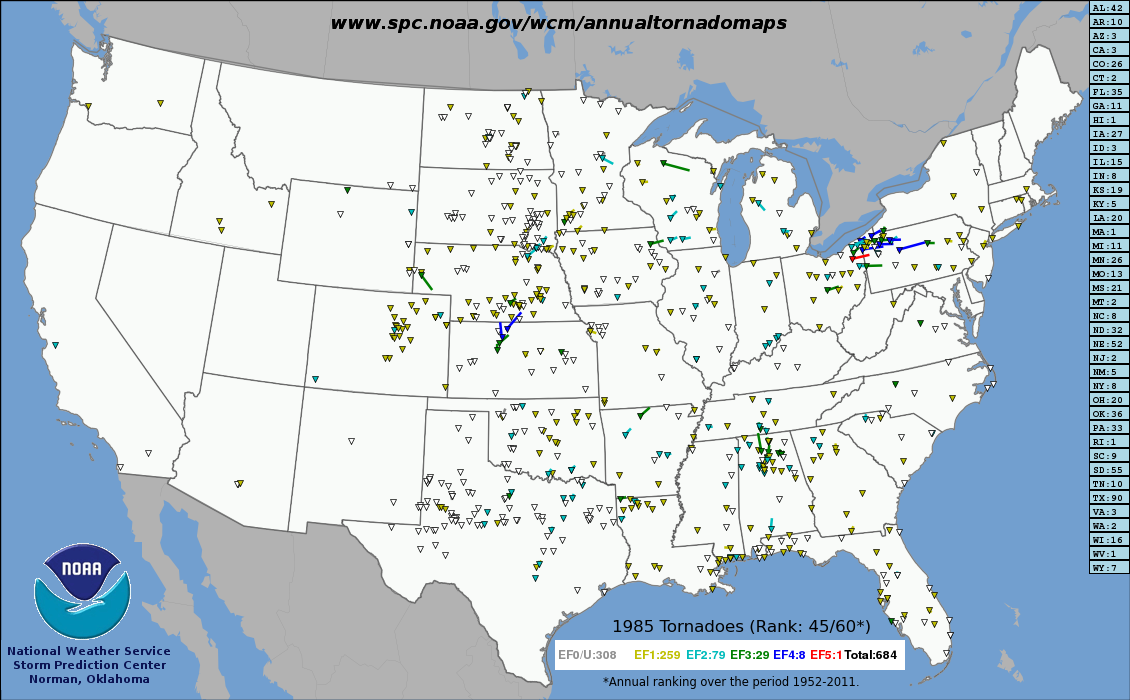
- ↑ http://www.spc.noaa.gov/wcm/annualtornadomaps/1985.png
- ↑ "07 Clayton Reakes". May311985tornadoes.com. 1985-05-31. Retrieved 2013-07-28.
- ↑ "1985: Northeastern Tornadoes". Ohiohistory.org. Retrieved 2013-07-28.
- 1 2 3 Grazulis, Thomas P (July 1993). Significant Tornadoes 1680-1991. St. Johnsbury, VT: The Tornado Project of Environmental Films. ISBN 1-879362-03-1.
- 1 2 http://extremeplanet.me/tag/niles-ohio-1985-tornado/
- 1 2 Stiegler, Duane (1985). "Tornado Outbreak in the United States and Canada on May 31, 1985" (PDF). NWS Cleveland, OH. NOAA. Retrieved July 8, 2014.
- 1 2 Grazulis, Thomas P. 2001. The Tornado. Norman; University of Oklahoma Press; p. 203
- 1 2 3 4 Carpenter, Mackenzie (2005-05-29). "The day the twisters came". Pittsburgh Post Gazette. Retrieved 2010-06-07.
- 1 2 Project Atmosphere - Tracking the Grand Valley Tornado
- 1 2 3 4 Institute for Catastrophic Loss Reduction - A Tornado Scenario for Barrie, Ontario
- ↑ CBC Archives - Deadly Skies, Canada's Most Destructive Tornadoes
- ↑ National Research Council of Canada - Tornado Damage in the Barrie/Orangeville Area, May 1985
- ↑ Human Health in a Changing Climate - Vulnerabilities to Natural Hazards and Extreme Weather
- ↑ Albarrie Canada Limited - About Us
- ↑ The 1985 Barrie Tornado Revisited
- Fuller, John G. (1987). "Tornado Watch #211"
- Witten, Donald E. (1985). "May 31, 1985 - A Deadly Tornado Outbreak". Weatherwise magazine, 38 (4).
- Bruineman, M. (2010, May 30). Touchdown - 25 years after the Barrie Tornado. The Barrie Examiner, pp. A8-A9.
- Grazulis, T. (1990). Significant Tornadoes: 1880-1989, Vol. 2. St. Johnsbury, VT: Environmental Films.
- Grazulis, T. (2001). The Tornado: Nature’s Ultimate Windstorm. Norman, OK: University of Oklahoma Press.
- Grenci, L. and Nese, J. (1998). A World of Weather (2nd Ed). Dubuque, IA: Kendall-Hunt Publishing.
- Joe, P. and Leduc, M. (1993). Radar Signatures and Severe Weather Forecasting. In D. Burgess, C. Church, R. Davies-Jones, and C. Doswell (Eds.), The Tornado: Its Structure, Dynamics, Prediction, and Hazards (pp. 233–240). Washington, DC: American Geophysical Union.
- LeGrand, J. (1990). Chronicle of Canada. Montreal, QC: Chronicle Publications.
- Verkaik, A. and J. (1997). Under the Whirlwind. Elmwood, ON: Whirlwind Books.
- years later: What we’ve learned since the Barrie tornado., Global Toronto, May 31, 1985
- 'The sky was green': Barrie looks back on fatal tornado 30 years later, CTV Toronto, May 22, 2015
- It’s been 31 years since deadly tornadoes hit central Ontario, CTV Barrie, May 31, 2016
- Barrie tornado DVD brings tragic day to life, Barrie Examiner, May 31, 2016
External links
| Wikimedia Commons has media related to 1985 United States – Canadian tornado outbreak. |
- NWS Storm Data
- Website on the May 31, 1985 tornado outbreak
- NWS Cleveland outbreak page
- Map of the 1985 United States - Canadian outbreak (U.S. tornadoes only) Tornado History Project
- NOAA tornado event map including Ontario tornadoes
- Analysis of the Moshannon State Park tornado
- PAHighways.com May 31, 1985 Tornado Outbreak
- May 31, 1985: Northeastern Tornadoes
- Barrie Tornado CBC News Coverage (1985) - YouTube
- Timeline of the devestating [sic] tornadoes that hit 30 years ago - CTV Barrie - 2015
| 10 deadliest Canadian tornadoes | ||||
|---|---|---|---|---|
| Rank | Name (location) | Date | Deaths | |
| 1 | Regina Cyclone | June 30, 1912 | ≥28 | |
| 2 | Edmonton tornado | July 31, 1987 | 27 | |
| 3 | Windsor–Tecumseh, Ontario tornado | June 17, 1946 | 17 | |
| 4 | Pine Lake, Alberta tornado | July 14, 2000 | 12 | |
| =5 | Salaberry-de-Valleyfield, Quebec Windsor, Ontario tornado |
August 16, 1888 April 3, 1974 |
9 9 | |
| 7 | Barrie, Ontario tornado | May 31, 1985 | 8 | |
| =8 | Sudbury, Ontario tornado Sainte-Rose, Quebec tornado |
August 20, 1970 June 8, 1953 |
6 6 | |
| =10 | Bouctouche, New Brunswick tornado Portage la Prairie, Manitoba tornado |
August 6, 1879 June 22, 1922 |
5 5 | |
| Sources: Environment Canada (PDF) | ||||