Condon, Montana
| Condon, Montana | |
|---|---|
| Census-designated place & Unincorporated community | |
 Condon, Montana  Condon, Montana | |
| Coordinates: 47°31′40″N 113°42′38″W / 47.52778°N 113.71056°WCoordinates: 47°31′40″N 113°42′38″W / 47.52778°N 113.71056°W | |
| Country | United States |
| State | Montana |
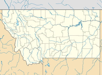
| County | Missoula |
| Area[1] | |
| • Total | 21.587 sq mi (55.91 km2) |
| • Land | 21.401 sq mi (55.43 km2) |
| • Water | 0.186 sq mi (0.48 km2) |
| Elevation | 3,711 ft (1,131 m) |
| Population (2010)[2] | |
| • Total | 343 |
| • Density | 16/sq mi (6.1/km2) |
| Time zone | Mountain (MST) (UTC-7) |
| • Summer (DST) | MDT (UTC-6) |
| ZIP code | 59826 |
| Area code(s) | 406 |
| GNIS feature ID | 781557[3] |
Condon is an unincorporated community and census-designated place in Missoula County, Montana, United States.[3] Its population was 343 as of the 2010 census.[2]
Condon is the site of a U.S. post office, using ZIP Code 59826, which opened on July 1, 1952.[4][5] Mission Mountain School is located in the community and the U.S. Forest Service operates an airport in Condon.
Climate
This climatic region is typified by large seasonal temperature differences, with warm to hot (and often humid) summers and cold (sometimes severely cold) winters. According to the Köppen Climate Classification system, Condon has a humid continental climate, abbreviated "Dfb" on climate maps.[6]
References
- ↑ "US Gazetteer files: 2010, 2000, and 1990". United States Census Bureau. 2011-02-12. Retrieved 2011-04-23.
- 1 2 "American FactFinder". United States Census Bureau. Archived from the original on 2013-09-11. Retrieved 2011-05-14.
- 1 2 "Condon". Geographic Names Information System. United States Geological Survey.
- ↑ United States Postal Service (2012). "USPS - Look Up a ZIP Code". Retrieved 2012-02-15.
- ↑ "Postmaster Finder - Post Offices by ZIP Code". United States Postal Service. Retrieved February 10, 2013.
- ↑ Climate Summary for Condon, Montana
Municipalities and communities of Missoula County, Montana, United States | ||
|---|---|---|
| City | 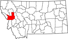 | |
| CDPs | ||
| Unincorporated communities | ||
| Ghost towns | ||
| Indian reservation | ||
| Footnotes | ‡This populated place also has portions in an adjacent county or counties | |
This article is issued from Wikipedia - version of the 11/29/2016. The text is available under the Creative Commons Attribution/Share Alike but additional terms may apply for the media files.