Columbia Township, Whitley County, Indiana
| Columbia Township | |
|---|---|
| Township | |
|
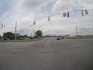
Intersection of U.S. 30 and State Highway 9 in Columbia Township | |
 Location in Whitley County | |
| Coordinates: 41°08′05″N 85°30′45″W / 41.13472°N 85.51250°WCoordinates: 41°08′05″N 85°30′45″W / 41.13472°N 85.51250°W | |
| Country | United States |
| State | Indiana |
| County | Whitley |
| Government | |
| • Type | Indiana township |
| Area | |
| • Total | 36.73 sq mi (95.1 km2) |
| • Land | 36.71 sq mi (95.1 km2) |
| • Water | 0.02 sq mi (0.05 km2) 0.05% |
| Elevation | 820 ft (250 m) |
| Population (2010) | |
| • Total | 11,047 |
| • Density | 301/sq mi (116/km2) |
| GNIS feature ID | 453242 |
Columbia Township is one of nine townships in Whitley County, Indiana, United States. As of the 2010 census, its population was 11,047 and it contained 4,799 housing units.[1]
Geography
According to the 2010 census, the township has a total area of 36.73 square miles (95.1 km2), of which 36.71 square miles (95.1 km2) (or 99.95%) is land and 0.02 square miles (0.052 km2) (or 0.05%) is water.[1] The streams of Blue Babe Branch, Blue River and Stony Creek run through this township.
Cities and towns
- Columbia City (vast majority)
Unincorporated towns
(This list is based on USGS data and may include former settlements.)
Adjacent townships
- Thorncreek Township (north)
- Union Township (east)
- Jefferson Township (southeast)
- Washington Township (south)
- Cleveland Township (southwest)
- Richland Township (west)
Cemeteries
The township contains five cemeteries: Bethel, Nolt, Oak Grove, Saint Peters and South Park.
Major highways
References
- "Columbia Township, Whitley County, Indiana". Geographic Names Information System. United States Geological Survey. Retrieved 2009-09-24.
- United States Census Bureau cartographic boundary files
- 1 2 "Population, Housing Units, Area, and Density: 2010 - County -- County Subdivision and Place -- 2010 Census Summary File 1". United States Census. Retrieved 2013-05-10.
External links
Municipalities and communities of Whitley County, Indiana, United States | ||
|---|---|---|
| City | ||
| Towns | ||
| Townships | ||
| CDP | ||
| Other unincorporated communities | ||
| Footnotes | ‡This populated place also has portions in an adjacent county or counties | |
This article is issued from Wikipedia - version of the 11/28/2016. The text is available under the Creative Commons Attribution/Share Alike but additional terms may apply for the media files.