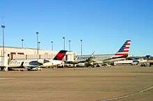
Colorado Springs Airport
| City of Colorado Springs Municipal Airport | |||||||||||||||||||
|---|---|---|---|---|---|---|---|---|---|---|---|---|---|---|---|---|---|---|---|
|
| |||||||||||||||||||
 | |||||||||||||||||||
|
IATA: COS – ICAO: KCOS – FAA LID: COS – WMO: 72466 | |||||||||||||||||||
| Summary | |||||||||||||||||||
| Airport type | Public | ||||||||||||||||||
| Owner/Operator | City of Colorado Springs | ||||||||||||||||||
| Serves | Colorado Springs, Colorado | ||||||||||||||||||
| Elevation AMSL | 6,187 ft / 1,886 m | ||||||||||||||||||
| Coordinates | 38°48′21″N 104°42′03″W / 38.80583°N 104.70083°WCoordinates: 38°48′21″N 104°42′03″W / 38.80583°N 104.70083°W | ||||||||||||||||||
| Website | Colorado Springs Airport | ||||||||||||||||||
| Maps | |||||||||||||||||||
 FAA airport diagram | |||||||||||||||||||
 COS  COS Location of airport in Colorado/United States | |||||||||||||||||||
| Runways | |||||||||||||||||||
| |||||||||||||||||||
| Statistics (2013) | |||||||||||||||||||
| |||||||||||||||||||
City of Colorado Springs Municipal Airport[2] (IATA: COS, ICAO: KCOS, FAA LID: COS) (also known as Colorado Springs Airport[1]) is a city-owned public civil-military airport 6 miles (10 km) southeast of Colorado Springs, in El Paso County, Colorado.[2] It is the second busiest airport in the state. Peterson Air Force Base, which is located on the north side of runway 13/31, is a tenant of the airport.
History
|
Colorado Springs Airport | |
|
Former terminal, now Peterson Air & Space Museum | |
 | |
| Nearest city | Colorado Springs, Colorado |
|---|---|
| Area | 8.3 acres (3.4 ha) |
| Built | 1942 |
| Architectural style | Art Deco, Moderne |
| NRHP Reference # | 90001296[3] |
| Added to NRHP | November 15, 1996 |


In 1927 the airport opened on 640 acres (260 ha) 7 miles (11 km) east of the city, with two gravel runways. In the late 1930s the first scheduled airline flight went from El Paso, Texas, through Pueblo, Colorado Springs, to Denver and back. The first municipal terminal was built in 1942 in an art deco style. Soon after the terminal was built the field was taken over by the military in the months preceding World War II. After the war, the city regained control.
In 1966 a new terminal was built on the west side of the runways, just east of Powers Boulevard. This terminal expanded by the 1980s, with a six gate addition. By 1991 the airport had three 150-foot (46 m) wide runways, one 13,501 feet (4,115 m) long, making it the longest runway in Colorado until 16R/34L, a 16,000-foot (4,900 m) runway, opened at Denver International Airport in September 2003. In 1991 the city approved a new terminal, two miles east of the former terminal, in the south-center part of the airport. The 280,000-square-foot (26,000 m2) terminal opened on October 22, 1994 with 12 gates; it was designed by the Van Sant Group and cost $140 million.[4] In the 1990s a second, 5-gate concourse was added on the east side of the main terminal.
Operations
Through the 1970s, 1980s and 1990s, the airport tried to expand service. The largest number of passengers was nearly 5 million in 1996 when now-defunct Western Pacific Airlines had a hub at COS (they moved it to Denver International Airport in late 1996). Their timetable for 15 June shows 33 daily departures to 20 airports between the west coast and Newark and Washington Dulles. (All their flights left from or landed at COS.)
Colorado Springs has non-stop flights to 10 U.S. cities.
Facilities and aircraft
The airport covers 7,200 acres (2,900 ha) and has three paved runways: 17L/35R, 13,501 x 150 ft (4,115 x 46 m) long, 17R/35L, 11,022 x 150 ft (3,360 x 46 m) and 13/31, 8,269 x 150 ft (2,520 x 46 m).[2]
Reached via Milton Proby Parkway, the terminal consists of two concourses. However, only one, the larger concourse housing gates 1–12, has ever been put to commercial use; the second concourse (called the Western Pacific Airlines concourse) contains gates 14–18 (there is no gate 13.), and is now mainly used for meetings. Access between the concourses requires leaving the secure area, walking through the main terminal and down a long hallway.
Since September 2011 the airport terminal has been under renovation, that includes reconstruction of the TSA checkpoint to support full body scanners, expansion of office space behind the ticket counters, and new facilities for automated baggage screening.
Repairs to runway 17L/35R, first scheduled for 2011, but got delayed to spring 2012 by the FAA shutdown.
In the year ending September 30, 2013 the airport had 138,326 aircraft operations, an average of 378 per day: 58% general aviation, 18% air taxi, 14% scheduled commercial and 11% military. 292 aircraft were then based at the airport: 50% single-engine, 22% multi-engine, 12% jet, 1% helicopter and 16% military.[2]
Airlines and destinations
Passenger
Statistics
Top destinations
| Rank | City | Passengers | Carriers |
|---|---|---|---|
| 1 | Dallas/Fort Worth, Texas | 170,000 | American |
| 2 | Denver, Colorado | 143,000 | United |
| 3 | Houston–Intercontinental, Texas | 57,000 | United |
| 4 | Chicago–O'Hare, Illinois | 56,000 | United |
| 5 | Atlanta, Georgia | 47,000 | Delta |
| 6 | Los Angeles, California | 32,000 | United |
| 7 | Salt Lake City, Utah | 30,000 | Delta |
| 8 | Las Vegas, Nevada | 28,000 | Allegiant, Frontier |
| 9 | Seattle/Tacoma, Washington | 21,000 | Alaska |
| 10 | Phoenix/Mesa, Arizona | 13,000 | Allegiant |
Accidents and incidents
- On March 3, 1991, United Airlines Flight 585, a Boeing 737-291 flying from Peoria, Illinois, to Colorado Springs via Moline, Illinois, and Denver, Colorado, crashed on final approach to Colorado Springs Runway 35 after a rudder malfunction caused the aircraft to roll over and dive, killing all 25 on board. The incident was officially closed as undetermined but after investigating a nearly identical crash involving USAir Flight 427 in Aliquippa, Pennsylvania, as well as another nearly identical incident involving Eastwind Airlines Flight 517 in 1996 in Richmond, Virginia, the cause of the accident was finally determined. The reason was the effect of thermal shock on the rudder which blocked it entirely. The pilot tried to change the direction of the rudder but another effect of thermal shock was the reverse action of the pedals. The pilot flying pushed on the pedals but this contributed to the out-of-control diving of the aircraft since he was not aware of the reverse action of the pedals.
- On January 8, 2010, a 47-year-old man from Virginia by the name of Muhammad Abu Tahir became intoxicated on AirTran Airways flight 39 bound for San Francisco after it left Atlanta, forcing the plane to make an emergency landing in Colorado Springs. The plane landed with no issues and Tahir was arrested and taken to an El Paso County jail and later charged. The plane took off again from Colorado Springs for San Francisco several hours later.[6]
- On December 30, 2010, a Delta Air Lines Boeing 757-300 operating as Flight 1921 from Detroit Metropolitan Wayne County Airport to Phoenix Sky Harbor International Airport with 225 passengers and crew had to make an emergency landing at the airport due to engine problems. Two people were injured during evacuation.
See also
- National Register of Historic Places listings in El Paso County, Colorado
- List of airports in the Denver area
References
- 1 2 Colorado Springs Airport, official web site
- 1 2 3 4 5 FAA Airport Master Record for COS (Form 5010 PDF), effective 2014-03-20
- ↑ National Park Service (2010-07-09). "National Register Information System". National Register of Historic Places. National Park Service.
- ↑ "Colorado Springs Airport -". Springs Gov.
- ↑ | BTS | Transtats. transtats.bts.gov. Retrieved in September 2015.
- ↑ "Unruly passenger charged in AirTran incident". CNN. January 12, 2010.
External links
- Colorado Springs Municipal Airport at Colorado DOT website
- FAA Airport Diagram (PDF), effective November 10, 2016
- Resources for this airport:
- AirNav airport information for KCOS
- ASN accident history for COS
- FlightAware airport information and live flight tracker
- NOAA/NWS latest weather observations
- SkyVector aeronautical chart for KCOS
- FAA current COS delay information
| Topics | |
|---|---|
| Lists by states |
|
| Lists by insular areas | |
| Lists by associated states | |
| Other areas | |
| |