Colebee, New South Wales
This article is about the suburb of Sydney. For the department store, see Schofields (department store).
| Colebee Sydney, New South Wales | |||||||||||||
|---|---|---|---|---|---|---|---|---|---|---|---|---|---|
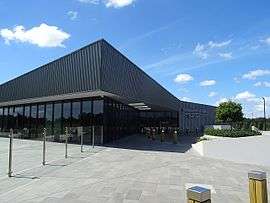 Stonecutters Ridge Golf Club | |||||||||||||
| Coordinates | 33°43′16″S 150°51′18″E / 33.721°S 150.855°ECoordinates: 33°43′16″S 150°51′18″E / 33.721°S 150.855°E | ||||||||||||
| Postcode(s) | 2761 | ||||||||||||
| Location | 47 km (29 mi) west of Sydney CBD | ||||||||||||
| LGA(s) | City of Blacktown | ||||||||||||
| State electorate(s) | Mount Druitt | ||||||||||||
| Federal Division(s) | Chifley | ||||||||||||
| |||||||||||||
Colebee is a suburb of Sydney, in the state of New South Wales, Australia. Colebee is located 47 kilometres west of the Sydney central business district, in the local government area of the City of Blacktown and is part of the Western Sydney region.[1]
History
Colebee was named after C. Colobee who is believed to have been the first indigenous Australian to have been granted land in the Blacktown area, at Plumpton Ridge.[2] He was the son of Yarramundi.
References
- ↑ WESTIR Ltd (2003). "The 2001 City of Blacktown Social Plan" (PDF). City of Blacktown. Retrieved 26 August 2006.
- ↑ "Colebee". Geographical Names Register (GNR) of NSW. Geographical Names Board of New South Wales. Retrieved 14 May 2007.
This article is issued from Wikipedia - version of the 1/2/2016. The text is available under the Creative Commons Attribution/Share Alike but additional terms may apply for the media files.