Christchurch Southern Motorway
| |
|---|---|
| Route information | |
| Maintained by New Zealand Transport Agency | |
| Length: | 7.5 km (4.7 mi) |
| Existed: | 4 May 1981 – present |
| Major junctions | |
| East end: |
Brougham Street |
| To: |
Halswell Junction Road |
| Location | |
| Major cities: | Addington, Wigram, Hornby |
| Highway system | |

The Christchurch Southern Motorway is a motorway to the south-west of Christchurch, New Zealand linking the inner-city suburb of Addington, New Zealand to the southern Christchurch suburb of Hornby, New Zealand. The motorway is approximately 7.5 km long and is four-lane divided. The motorway forms part of State Highway 76.
Route
The Christchurch Southern Motorway begins in the suburb of Addington at the western end of Brougham Street (at the Collins Street intersection), just south of the Christchurch CBD. It heads south-west, crossing Barrington Street (where there is an interchange) and Lincoln Road and passing to the south of Middleton. There is an interchange at Curletts Road, then the motorway heads through Wigram, passing under Aidanfield Drive and Awatea Road. The motorway ends at Halswell Junction Road to the south of Hornby.
History
Plans for a motorway network in Christchurch were first revealed in 1962, with the release of the Christchurch Master Transportation Plan. The Christchurch Southern Motorway, which formed a critical component of this plan, was proposed to run from Templeton to an interchange with the Christchurch Northern Motorway at Waltham, just south of the CBD. These plans were scaled back in 1975 so that the Southern Motorway would terminate into the western end of Brougham Street. The first section of the motorway, a short two-lane arterial, opened in 1981, linking Brougham Street with Curletts Road.[1] Further motorway work was subsequently deferred due to slowing population and economic growth and a lack of funding.[2]
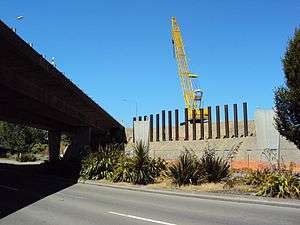
Beginning in March 2010, the section between the Lincoln Road overbridge and Curletts Road was duplicated, and a new flyover was built linking the motorway directly to Brougham Street, creating a grade-separated junction with Barrington Street.[3] The motorway was also extended from Curletts Road, where a new full interchange was built, to a new terminating roundabout at Halswell Junction Road, near the (upgraded) Springs Rd roundabout. A cycleway was built along the length of the motorway on both sides.[3] The duplication and extension were officially opened on 14 December 2012.[4] North of Springs Road, Halswell Junction Road was upgraded to form a two-lane undivided link from the motorway to State Highway 1 at Islington. This includes replacing the roundabout at Shands Road with traffic lights.[3]
Despite being affected by the 2010 and 2011 Canterbury earthquakes while under construction, the earthquakes caused no direct damage, although the alignment had to be resurveyed after each earthquake.
Future
- Christchurch Southern Motorway Stage 2 - A future 7.5 km extension of the motorway, designated as Stage 2, will extend the motorway south-west from the Springs Road junction to meet State Highway 1 at Robinsons Road, north of Rolleston. The proposed extension would include a half interchange at Halswell Junction Road to replace the Stage 1 roundabout, a full diamond interchange at Shands Road, and a grade separated 'Y-junction' interchange at Main South Road (SH 1).[5] Consent was granted by the Environmental Protection Agency in November 2013 and a contract award in August 2016 for the $195 million motorway extension. Construction commences in October 2016 and is expected to take three and a half years to complete.[6]
- Main South Road Four-Laning - To give traffic from the motorway a clear run-out, Main South Road would be widened to four lanes divided as far as Weedons Road, where a folded diamond interchange will be built. Main South Road will merge back to a two-lane undivided road at the end of the existing passing lanes south of Weedons Road.[7]
Exit list
| Territorial authority | Location | km | Destination | Notes | |
|---|---|---|---|---|---|
| Christchurch City | Addington | 8 | |
Christchurch Southern Motorway begins SH 76/Christchurch Southern Motorway concurrency begins | |
| Barrington Street – Addington, Barrington, Cashmere | |||||
| Middleton | 11 | |
|||
| Hornby South | 15 | Halswell Junction Road (south) – Halswell |
Christchurch Southern Motorway ends SH 76/Christchurch Southern Motorway concurrency begins Three way roundabout | ||
| Eastbound exit and westbound entrance (stage 2) | |||||
| Selwyn District | Prebbleton | Shands Road – Hornby, Springston, Lincoln | |||
| Templeton | |
Westbound entrance and eastbound exit SH 76/Christchurch Southern Motorway concurrency ends SH 1/Christchurch Southern Motorway concurrency begins (stage 2) | |||
| Rolleston | |
Christchurch Southern Motorway ends SH 1/Christchurch Southern Motorway concurrency ends (stage 2) | |||
1.000 mi = 1.609 km; 1.000 km = 0.621 mi
| |||||
See also
References
- ↑ "Theme II : Infrastructure : Chapter 3 : Transport" (PDF). Resources.ccc.govt.nz. Retrieved 2015-08-18.
- ↑ Christchurch City Centre, 40 years of Change, Traffic, Planning 1959-1999 (2000)
- 1 2 3 "Christchurch Southern Motorway stage 1 information flyer" (PDF). New Zealand Transport Agency. February 2010. Retrieved 14 July 2011.
- ↑ "Media releases | NZ Transport Agency". Nzta.govt.nz. Retrieved 2015-08-18.
- ↑ "Christchurch Southern Corridor; NZ Transport Agency". Nzta.govt.nz. August 2015.
- ↑ "$435 million investment in Christchurch's transport network". Nzta.govt.nz. 10 August 2016. Retrieved 10 August 2016.
- ↑ "Key Features : Map" (PDF). Nzta.govt.nz. Retrieved 2015-08-18.
External links
- Christchurch Southern Corridor (NZ Transport Agency)
| National | ||
|---|---|---|
| North Island |
| |
| South Island | ||
| Former state highways | ||
| Touring routes |
| |