Chico, Washington
| Chico | |
|---|---|
| census-designated place (CDP) & unincorporated community | |
 Chico Location within the state of Washington | |
| Coordinates: 47°36′42″N 122°42′33″W / 47.61167°N 122.70917°WCoordinates: 47°36′42″N 122°42′33″W / 47.61167°N 122.70917°W | |
| Country | United States |
| State | Washington |
| County | Kitsap |
| Population (2010) | |
| • Total | 2,259 |
| Time zone | Pacific (PST) (UTC-8) |
| • Summer (DST) | PDT (UTC-7) |
| ZIP codes | 98312 |
| Area code(s) | 360 |
| GNIS feature ID | 1512090[1] |
Chico is a Census-designated place (CDP) and unincorporated community in Kitsap County, Washington, United States. Named in 1889 for a local Indian,[2] Chico is located on the Dyes Inlet waterfront to the southeast of Silverdale. At the 2010 census the community had a population of 2,259.
Because of Chico's status as an unincorporated community, its borders are loosely defined.[3] The northern border is generally understood to be delineated by Newberry Hill Road, which separates Chico from Silverdale. Chico Creek is the boundary between Chico on the north and Erlands Point-Kitsap Lake to the south. Washington State Route 3 serves as Chico's western border, and Dyes Inlet lies to its east.
References
- ↑ "Chico". Geographic Names Information System. United States Geological Survey.
- ↑ Meany, Edmond S. (1923). Origin of Washington geographic names. Seattle: University of Washington Press. p. 45.
- ↑ "Places Cartographic Boundary". U.S. Census Bureau. Retrieved 28 June 2012.
Municipalities and communities of Kitsap County, Washington, United States | ||
|---|---|---|
| Cities | 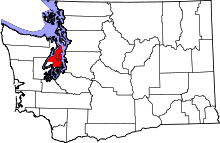 | |
| CDPs | ||
| Other unincorporated communities | ||
| Indian reservation | ||
This article is issued from Wikipedia - version of the 7/25/2016. The text is available under the Creative Commons Attribution/Share Alike but additional terms may apply for the media files.