Cherry Street streetcar line
| Cherry Street | |
|---|---|
|
Tracks passing in front of Cherry Street Hotel | |
| Overview | |
| Status | completed |
| Locale | Toronto, Ontario |
| Termini |
King Street (junction) Distillery Loop opposite Distillery Lane |
| Services | 514 Cherry |
| Operation | |
| Operator(s) | Toronto Transit Commission |
| Rolling stock | CLRV, ALRV, Flexity |
| Technical | |
| Line length | 0.7 kilometres (0.43 mi) |
| Track gauge | 4 ft 10 7⁄8 in (1,495 mm) - TTC Gauge |

The Cherry Street streetcar line is a streetcar branch line on a separated right-of-way in Toronto, Ontario. At its southern end, the branch ends at the Distillery Loop (also known as the Cherry Street Loop). It was built by Waterfront Toronto, in cooperation with the Toronto Transit Commission, to serve the West Don Lands neighbourhood and the Distillery District. Service on the line started on June 19, 2016 as route 514 Cherry, which also serves King Street and Dufferin Street.[1]
History

In 2007, the plan for the Cherry Street streetcar line was finalized.[2] Construction began in 2012 on the line along Sumach Street and Cherry Street, from King Street to Distillery Lane. This section was projected to cost $90 million CAD. In April and May 2014, the TTC constructed the junction to the Cherry Street line at the corner of King Street East and Sumach Street.[3]
Operation on the Cherry Street streetcar line was planned to begin in 2016 after the conversion of the 2015 Pan American Games Athletes' Village to apartments[4] and the opening of a George Brown College student residence.[5] This new West Don Lands neighbourhood is expected to have 6,000 units once opened.[6]
A few problems were reported within several months of the line's opening. Traffic lights were poorly timed at the intersections at Cherry & Front streets and Cherry Street & Eastern Avenue. As happened along Queens Quay, painted turn lane lines were not clear enough to discourage motorists from accidentally getting onto the streetcar right-of-way and then being trapped there. Because of squealing wheels, streetcars were replaced by buses overnight along the Cherry Street line.[7][8]
Line description
The line, from King Street to Distillery Lane, is approximately 700 metres long, and has three stops on it.[9] The northern portion of the Cherry Street line is along Sumach Street from Eastern Avenue to a junction with the King Street line.[3]
Both streetcar tracks run on the east side of the street with a tree-lined median separating them from two automobile lanes and bike lanes on either side of them. The entire width is 32.5 metres, including sidewalks 5 metres wide.[9]
Distillery Loop
Distillery Loop | |
|---|---|
 | |
| Location |
Cherry Street, Toronto, Ontario Canada |
| Coordinates | 43°39′02″N 79°21′24″W / 43.65056°N 79.35667°WCoordinates: 43°39′02″N 79°21′24″W / 43.65056°N 79.35667°W |
| Operated by | Toronto Transit Commission |
| Line(s) |
|
| Construction | |
| Structure type | Streetcar loop |
| Disabled access | Yes |
| History | |
| Opening | June 19, 2016 |
Distillery Loop, the southerly terminus of the line, is located south of Mill Street north of the railway viaduct on the east side of Cherry Street. It is across the street from Distillery Lane in the Distillery District.[3]
The loop runs anticlockwise. With the junction at Sumach Street and King Street, the loop can turn streetcars coming from either direction along King Street.
Decorative features at the loop include paving blocks, a small grove of young trees, and a small flower bed between the track and the street. At the railway viaduct on the southern side of the loop stands the inactive Cherry Street Tower which once controlled the eastern approach to Union Station.[10]
The southbound approach to Distillery Loop has a wheel greaser that is automatically activated by GPS; however, the greaser can only work with the Flexity streetcars.[8]
![]() Media related to Distillery Loop at Wikimedia Commons
Media related to Distillery Loop at Wikimedia Commons
Future
Waterfront Toronto’s plan is to extend the Cherry Street line south of the Gardiner Expressway into the Port Lands. It would meet with the proposed East Bayfront LRT running from Union Station along Queens Quay East to temporarily terminate in a loop west of Parliament Street.[1]
Older history
Between 1917 and 1924, the former Toronto Railway Company and, after 1921, the Toronto Transportation Commission operated the Ashbridge streetcar line into the Port Lands. It connected to the streetcar grid at Queen Street, just west of Broadview Avenue and ran south to Commissioners Street then west to Cherry Street. The line was abandoned because a bridge it used to cross over the railway corridor and the Keating Channel became unsafe for streetcar use.[11]
References
- 1 2 Adrian Morrow (2012-05-25). "A tiny perfect streetcar line is being laid along Cherry Street". The Globe and Mail. Retrieved 2012-07-19.
There’s a new streetcar line under construction in Toronto, the first in more than a decade and a surprising development during the tenure of a mayor who is outspokenly opposed to light rail.
- ↑ "STREETCARS ON CHERRY STREET AND SUMACH STREET SERVING THE WEST DON LANDS DEVELOPMENT" (PDF). Toronto Transit Commission. 2007-12-06. Retrieved 2012-07-20.
- 1 2 3 Steve Munro (2014-06-25). "King & Sumach: Connecting to Cherry Street (Update 9: June 25, 2014)". Steve Munro. Archived from the original on 2015-03-04. Retrieved 2014-06-25.
- ↑ Tess Kalinowski (October 1, 2014). "TTC won't run streetcars on Cherry until at least 2016". Toronto Star. Retrieved January 2016.
A planned extension of the King streetcar service down Cherry will wait until after the Pan Am Games and the conversion of the Athletes Village to condos.
Check date values in:|access-date=(help) - ↑ "Student Residence". STUDENT LIFE. George Brown College. Retrieved January 2016.
TTC Streetcar stop right at the residence
Check date values in:|access-date=(help) - ↑ Tess Kalinowski, Transportation reporter (March 17, 2016). "TTC touts Cherry trolley as 'creative and ingenious solution' to crowding on King St.". Toronto Star. Retrieved March 17, 2016.
- ↑ Eric Morse (13 November 2016). "CRBA agenda hijacked by streetcar problems". The Bulletin. Retrieved 2016-11-15.
- 1 2 Steve Munro (14 November 2016). "The Travails of Cherry Street". Retrieved 2016-11-14.
- 1 2 Tess Kalinowski (2007-12-11). "Transit-first street plan hailed". Toronto Star. Retrieved 2012-07-19.
Unlike Toronto's other streetcar routes, which traditionally run in mixed traffic and board passengers from platforms in the middle of the road, the Cherry St. plan calls for putting all the transit on the east side of the street, running in two directions, with a tree-lined platform separating it from other traffic.
"Two figures incorrect in Cherry St. transit plan". Toronto Star. 2007-12-12. Retrieved 2012-07-19.The transitway envisioned for this section is 700 metres.
- ↑ Steve Munro (17 September 2013). "Cherry Street Track Construction". Retrieved 2016-05-27.
- ↑ James Bow (2012-04-03). "The Ashbridge Streetcar (Deceased)". Transit Toronto. Retrieved 2012-07-19.
External links
![]() Media related to Cherry Street streetcar line at Wikimedia Commons
Media related to Cherry Street streetcar line at Wikimedia Commons
- First TTC Streetcar Tested on new Cherry Street Loop on YouTube (April 20, 2016)
| Bus | 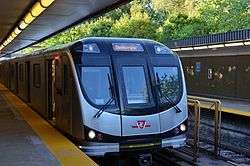 _(14918534190).jpg) | |
|---|---|---|
| Subway | ||
| Streetcars | ||
| History | ||
| Predecessors |
| |
| Facilities | ||
| Proposed | ||
| Miscellaneous | ||
Italics indicate a project under construction | ||