Cherokee Path
|
Cherokee Path, Sterling Land Grant | |
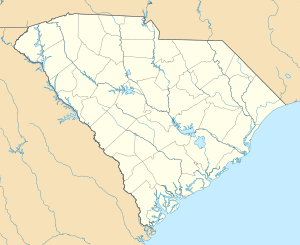  | |
| Location | 5 miles southeast of St. Matthews on South Carolina Highway 6, St. Matthews, South Carolina |
|---|---|
| Coordinates | 33°38′11″N 80°42′28″W / 33.63639°N 80.70778°WCoordinates: 33°38′11″N 80°42′28″W / 33.63639°N 80.70778°W |
| Area | 2 acres (0.81 ha) |
| NRHP Reference # | 76001696[1] |
| Added to NRHP | May 13, 1976 |
The Cherokee Path (or Keowee path) was the primary route from Charleston to Columbia, South Carolina in Colonial America, connecting all of the Cherokee territories.
History
In the 17th century the Cherokee Path was used by English and French fur traders.
The path was mapped in 1730 by George Hunter, the Surveyor-General of the Province of South Carolina. At that time it ran 130 miles (210 km) from Charlestown to the colonial settlement of Ninety Six, then to Fort Prince George and the Cherokee village of Keowee, the principal town of the Cherokee Lower settlements (in present day Oconee, Greenville, Pickens and Anderson counties).
From Keowee, the path branched out into the Unaka Mountains, usually following streams and valleys, to Clayton, Georgia and up to Franklin and Murphy in North Carolina (the Middle settlements) and across to the Cherokee towns in Tennessee (the Overhill settlements).
Fort Loudoun, constructed by South Carolina troops in 1756, was along the path. Cherokee Path was used as a military road during the American Revolution.
Cherokee Path, Sterling Land Grant
The Cherokee Path, Sterling Land Grant is a section of the historic path located near St. Matthews, Calhoun County, South Carolina. In 1704, George Sterling received a proprietary land grant for 570 acres of land along Ox Creek, later called Lyon’s Creek, and became one of the area’s first white settlers in what was to become Orangeburg District and later Calhoun County. His family's plantation was often a stopping place for Native Americans and other travelers along the Cherokee Path. Calhoun County is one of the few counties in South Carolina where portions of the original path remain visible. The site of the grant itself is a deserted, overgrown field dotted with scattered trees.[2][3] Two acres, crossed by the Cherokee Path, is the portion of the Sterling land nominated to the listed in the National Register of Historic Places in 1976.[1]
Present-day
South Carolina Highway 11 (the Cherokee Foothills Scenic Highway) traces some of the original path.
See also
References
- 1 2 National Park Service (2010-07-09). "National Register Information System". National Register of Historic Places. National Park Service.
- ↑ "Cherokee Path, Sterling Land Grant, Calhoun County (S.C. Hwy. 6, St. Matthews vicinity)". National Register Properties in South Carolina. South Carolina Department of Archives and History. Retrieved 25 February 2014.
- ↑ Katherine G. Hendrix and Jeanne W. Ulmer (July 1975). "Cherokee Path, Sterling Land Grant" (PDF). National Register of Historic Places nomination. NRHP. Retrieved 25 February 2014.
External links
- Information with photos and maps from the South Carolina Genealogical Society
| Topics |   | |
|---|---|---|
| Lists by county |
| |
| Lists by city | ||
| Other lists | ||