Chaukhutia
| Chaukhutia | |
|---|---|
| Town | |
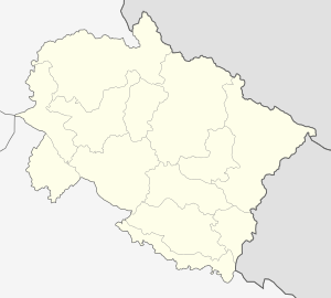 Chaukhutia  Chaukhutia Location in Uttarakhand, India | |
| Coordinates: 29°53′05″N 79°21′05″E / 29.88472°N 79.35139°ECoordinates: 29°53′05″N 79°21′05″E / 29.88472°N 79.35139°E | |
| Country |
|
| State | Uttarakhand |
| Division | Kumaun |
| District | Almora |
| Languages | |
| • Official | Kumaoni |
| Time zone | IST (UTC+5:30) |
| Vehicle registration | UK 01 |
| Website |
uk |
Chaukhutia is a town in Almora district of Uttarakhand. It is located on the bank of the river Ramganga. This picturesque place derives its name from a Kumaoni word "Chau-khut" which means four feet.
In Chaukhutia's context four feet means four ways or directions. The first way is towards Ramnagar, second towards Karanprayag, third towards Ranikhet and Almora and the fourth way is towards Tadagtaal, Kheera. From here the entire region is easily accessible.
Temples and history
Kali Temple, popularly known as Agneri Devi Temple, is dedicated to Hindu Goddess Kali, and is situated around one-half km from Chaukhutia in Jaurasi road near Dhudalia village on the bank of Ramganga River. Every year Ashtami Mela (a fair) is organised at the temple. Thousands of people witness a large number of animal sacrifices, mainly buffaloes and goats, in Navratris in the month of March-April. Lakhanpur temple is 6 km from Chaukhutia in Jaurasi-Chaukhutia road. This temple belongs to the Katyuri kings. A small fair is also held here every year in October-November. Vaishno Devi's temple and the ancient forts and ruins of Katyuri dynasty make Chaukhutia interesting for visitors.
This is also an agricultural valley, where rice, wheat and mangoes are grown. Nearby towns include Masi (13km) and Dwarahat (22km). Chaukhutia is also known as Vairaat. The story is that the present Chaukhutia was the capital of King Virata of Mahabharata. Pandav five brothers and their wives took that place, and when they were going to heaven for moksha they stayed in the area for a few days. Bheem washed her cloth in Tadagtaal Lake but when he was leaving the taal he mark four finger hole in taal (lake) so tadag river came from there. Which meets in ramganga (the Tadagtaal Lake is a pure place in Uttarakhand). This is smaller then Nainital Lake.
Locality
Villages Nearby - More than 50 villages are in the Chaukhutia region. Chakhutia is a center of those villages, including Gwelchora, Chandikhet, Dhudalia, Sungaon, Ganai, Bhatkot, Shakle, Jhalla, Haat, Udlikhan, Digaut, Pipaldhar, Birkhumu, Jamania and Rampur.Bakhli, Baskenia, Bakhali, Baralgaw , Godi, Amsyari, Tedagaun , kotuda, Rampur, Maneyia, Taal, Kheeda, Pakhakhareek, Nawad, Jamrad, Asethi, Bhijlim, Bagdi, Prempuri, Akheti, Jukanauli, Gwali, Ghangholi, Basbhida, Dwarahat, Malla Tajpur, Naigad, Khata, Aamdai, Songau, Agargau, Jourashi, Bhalt Gaon, Bhoara Gaon, Chaani, Dang, Jaurasi, Jala, Farika, Gajar, Jairambakhal, Khadaktaya, Agarmanral, and others.
Gallery
-

Picture from Chaukhutia bridge
-

Vairat valley as seen from Chaukhutia-Maasi road
Sources
- https://web.archive.org/web/20090704061713/http://www.indiatourism.com:80/uttaranchal-tourism/chaukhutia-tourism.html
- http://wikimapia.org/#lat=29.8835555&lon=79.3499994&z=15&l=0&m=a&v=2