Dwarahat
| Dwarahat | |
|---|---|
| town | |
 Dwarahat  Dwarahat Location in Uttarakhand, India | |
| Coordinates: 29°47′N 79°26′E / 29.78°N 79.43°ECoordinates: 29°47′N 79°26′E / 29.78°N 79.43°E | |
| Country |
|
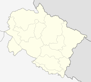
| State | Uttarakhand |
| District | Almora |
| Elevation | 1,510 m (4,950 ft) |
| Population (2011) | |
| • Total | 11,000 |
| Languages | |
| • Official | Hindi |
| Time zone | IST (UTC+5:30) |
| PIN | 263653 |
| Vehicle registration | UK |
| Website |
uk |
Dwarahat is a town and a nagar panchayat in Almora district in the state of Uttarakhand, India.
Geography
Dwarahat is located at 29°47′N 79°26′E / 29.78°N 79.43°E.[1] It has an average elevation of 1,510 metres (4954.068 feet).
Demographics
As of 2001 India census,[2] Dwarahat had a population of 2543. Males constitute 53% of the population and females 47%. Dwarahat has an average literacy rate of 82%, higher than the national average of 59.5%: male literacy is 86% and, female literacy is 78%. In Dwarahat, 10% of the population is under 6 years of age.
Education
A Government Engineering College " Kumaon Engineering College Dwarahat" established in 1991 in Dwarahat. Kumaon Engineering College is now renamed to Bipin Chandra Tripathi Kumaon Engineering College.
A Polytechnic College, Degree College, 'Dwarahat Inter College' Dwarahat,Govt. Inter college,M.d tiwari high school dwarahat, Dunagiri Modern school and the best school Shishu Mandir Dwarahat are situated here. Hence it is best education center for regional level since 1880.
Saraswati Shisu MAndir BAgwali Pokhar, Government Inter College Bagwali Pokhar, Government Girls Inter college Bagwali Pokhar, Diksha Mountesary S. S. School Dwarahat public school.
References
- ↑ Falling Rain Genomics, Inc - Dwarahat
- ↑ "Census of India 2001: Data from the 2001 Census, including cities, villages and towns (Provisional)". Census Commission of India. Archived from the original on 2004-06-16. Retrieved 2008-11-01.
External links
- Dwarahat, Official website
- The Paperhut Project - An interesting article on Dwarahat originally published in Outlook India
- Dunagiri For information about Dunagiri and other surrounding areas of Dwarahat