Charlotte Amalie West, U.S. Virgin Islands
| Charlotte Amalie West | |
|---|---|
| Village | |
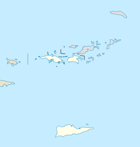 Charlotte Amalie West Location within the United States Virgin Islands | |
| Coordinates: 18°21′N 64°57′W / 18.350°N 64.950°WCoordinates: 18°21′N 64°57′W / 18.350°N 64.950°W | |
| Country | U.S. Virgin Islands |
| Island | Saint Thomas |
| Population (2000) | |
| • Total | 5,146 |
| ZIP code | 00801, 00802, 00803, 00804 |
| Area code(s) | 340 |
Charlotte Amalie West is a town in St. Thomas, U.S. Virgin Islands on the west side next to the Cyril E. King Airport, is the third largest town in the U.S. Virgin Islands (after Charlotte Amalie and Anna's Retreat). As of 2000, the population is 5,146.
Transportation
The Cyril E. King Airport serves Charlotte Amalie West
Climate
| Climate data for Charlotte Amalie West | |||||||||||||
|---|---|---|---|---|---|---|---|---|---|---|---|---|---|
| Month | Jan | Feb | Mar | Apr | May | Jun | Jul | Aug | Sep | Oct | Nov | Dec | Year |
| Average high °F (°C) | 86 (30) |
86 (30) |
86 (30) |
88 (31) |
88 (31) |
90 (32) |
90 (32) |
91 (33) |
90 (32) |
90 (32) |
88 (31) |
86 (30) |
88.3 (31.2) |
| Average low °F (°C) | 72 (22) |
72 (22) |
72 (22) |
74 (23) |
76 (24) |
77 (25) |
78 (26) |
78 (26) |
77 (25) |
76 (24) |
75 (24) |
73 (23) |
75 (23.8) |
| Average precipitation inches (mm) | 1.89 (48) |
1.51 (38.4) |
1.52 (38.6) |
2.39 (60.7) |
3.36 (85.3) |
2.35 (59.7) |
2.42 (61.5) |
3.50 (88.9) |
5.34 (135.6) |
5.57 (141.5) |
5.28 (134.1) |
2.74 (69.6) |
37.87 (961.9) |
| Source: [1] | |||||||||||||
References
- ↑ "Monthly Averages for Saint Thomas, VI (00801)". The Weather Channel. Retrieved May 13, 2009.
Charlotte Amalie (capital) | |
| Topics |
|
| Government | |
| Cities | |
| Islands | |
| Parks | |
This article is issued from Wikipedia - version of the 9/5/2016. The text is available under the Creative Commons Attribution/Share Alike but additional terms may apply for the media files.