Chachakumani (Cochabamba)
This article is about the mountain in the Cochabamba Department, Bolivia. For other uses, see Chachakumani (disambiguation).
| Chachakumani | |
|---|---|
 Chachakumani Location in Bolivia | |
| Highest point | |
| Elevation | 4,592 m (15,066 ft) [1] |
| Coordinates | 17°34′54″S 66°54′10″W / 17.58167°S 66.90278°WCoordinates: 17°34′54″S 66°54′10″W / 17.58167°S 66.90278°W |
| Geography | |
| Location |
Bolivia, Cochabamba Department |
| Parent range | Andes |
Chachakumani (Quechua chachakuma a medical plant,[2][3] -ni an Aymara suffix, "the one with the chachakuma plant, also spelled Chachacomani) is a 4,592-metre-high (15,066 ft) mountain in the Bolivian Andes. It is located in the Cochabamba Department, Tapacari Province. Chachakumani lies northwest of Janq'u Pukara and Ñuñu Qullu.[4]
References
- ↑ Bolivia 1:50,000 Leque 6241-III
- ↑ seccion.portalpatrimonio.cl Consejo Nacional de la Cultura y las Artes, Conociendo la Cultura Aymara: ... Chachakuma: pata uraqinakan alija, sutipax qichwawa, ... (Aymara text saying that Chachakuma is originally a Quechua word)
- ↑ Radio San Gabriel, "Instituto Radiofonico de Promoción Aymara" (IRPA) 1993, Republicado por Instituto de las Lenguas y Literaturas Andinas-Amazónicas (ILLLA-A) 2011, Transcripción del Vocabulario de la Lengua Aymara, P. Ludovico Bertonio 1612 (Spanish-Aymara-Aymara-Spanish dictionary)
- ↑ "Tapacari". INE, Bolivia. Retrieved March 23, 2016.
Capital: Cochabamba | ||
| Provinces | 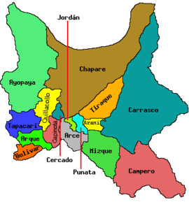 | |
| Municipalities (and seats) |
| |
This article is issued from Wikipedia - version of the 5/5/2016. The text is available under the Creative Commons Attribution/Share Alike but additional terms may apply for the media files.