Center Barnstead, New Hampshire
| Center Barnstead, New Hampshire | |
|---|---|
| Unincorporated community | |
 Center Barnstead  Center Barnstead | |
| Coordinates: 43°20′26″N 71°15′39″W / 43.34056°N 71.26083°WCoordinates: 43°20′26″N 71°15′39″W / 43.34056°N 71.26083°W | |
| Country | United States |
| State | New Hampshire |
| County | Belknap |
| Town | Barnstead |
| Elevation | 515 ft (157 m) |
| Time zone | Eastern (EST) (UTC-5) |
| • Summer (DST) | EDT (UTC-4) |
| ZIP code | 03225 |
| Area code(s) | 603 |
| GNIS feature ID | 866074[1] |
Center Barnstead is an unincorporated community in the town of Barnstead in Belknap County, New Hampshire. It is the largest of several villages in the town.
New Hampshire Route 28 bypasses the village to the northwest, connecting Pittsfield to the southwest and Alton to the northeast. New Hampshire Route 126 begins at Route 28 and passes through the village before continuing southeast towards Strafford and Barrington. The village is located along the Suncook River and was a station along the former Suncook Valley Railroad. Center Barnstead has a separate ZIP code (03225) from the rest of the town of Barnstead.
References
Municipalities and communities of Belknap County, New Hampshire, United States | ||
|---|---|---|
| City | 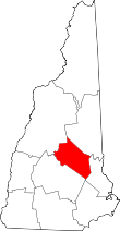 | |
| Towns | ||
| CDPs | ||
| Other villages | ||
| Footnotes | ‡This populated place also has portions in an adjacent county or counties | |
This article is issued from Wikipedia - version of the 7/10/2016. The text is available under the Creative Commons Attribution/Share Alike but additional terms may apply for the media files.