Cedarville, Arkansas
| Cedarville, Arkansas | |
|---|---|
| City | |
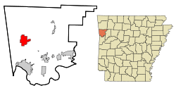 Location in Crawford County and the state of Arkansas | |
| Coordinates: 35°34′56″N 94°21′39″W / 35.58222°N 94.36083°WCoordinates: 35°34′56″N 94°21′39″W / 35.58222°N 94.36083°W | |
| Country | United States |
| State | Arkansas |
| County | Crawford |
| Area | |
| • Total | 9.0 sq mi (23.3 km2) |
| • Land | 9.0 sq mi (23.3 km2) |
| • Water | 0 sq mi (0 km2) |
| Elevation | 784 ft (239 m) |
| Population (2010) | |
| • Total | 1,394 |
| • Density | 155/sq mi (59.9/km2) |
| Time zone | Central (CST) (UTC-6) |
| • Summer (DST) | CDT (UTC-5) |
| ZIP code | 72932 |
| Area code(s) | 479 |
| FIPS code | 05-12520 |
| GNIS feature ID | 0076564 |
Cedarville is a city in Crawford County, Arkansas, United States. It is part of the Fort Smith, Arkansas-Oklahoma Metropolitan Statistical Area. The population was 1,394 at the 2010 census.[1]
Geography
Cedarville is located in western Crawford County at 35°34′56″N 94°21′39″W / 35.58222°N 94.36083°W (35.582296, −94.360812),[2] on the southern edge of Ozark National Forest. Arkansas Highway 59 runs through the city, leading north 36 miles (58 km) towards Lincoln and south 10 miles (16 km) to Van Buren, the Crawford County seat.
According to the United States Census Bureau, Cedarville has a total area of 9.0 square miles (23.3 km2), all land.[1]
Demographics
| Historical population | |||
|---|---|---|---|
| Census | Pop. | %± | |
| 1930 | 58 | — | |
| 1940 | 111 | 91.4% | |
| 1950 | 43 | −61.3% | |
| 1960 | 52 | 20.9% | |
| 2000 | 1,133 | — | |
| 2010 | 1,394 | 23.0% | |
| Est. 2015 | 1,368 | [3] | −1.9% |
2014 Estimate[5] | |||
As of the census[6] of 2000, there were 1,133 people, 406 households, and 328 families residing in the city. The population density was 129.1 people per square mile (49.8/km²). There were 442 housing units at an average density of 50.3/sq mi (19.4/km²). The racial makeup of the city was 94.53% White, 0.18% Black or African American, 2.74% Native American, 0.26% Asian, 0.18% from other races, and 2.12% from two or more races. 0.97% of the population were Hispanic or Latino of any race.
There were 407 households out of which 39.9% had children under the age of 18 living with them, 68.0% were married couples living together, 9.6% had a female householder with no husband present, and 19.0% were non-families. 15.8% of all households were made up of individuals and 5.3% had someone living alone who was 65 years of age or older. The average household size was 2.79 and the average family size was 3.10.
In the city the population was spread out with 29.3% under the age of 18, 7.9% from 18 to 24, 32.1% from 25 to 44, 22.6% from 45 to 64, and 8.1% who were 65 years of age or older. The median age was 33 years. For every 100 females there were 105.6 males. For every 100 females age 18 and over, there were 99.3 males.
The median income for a household in the city was $30,952, and the median income for a family was $33,409. Males had a median income of $30,385 versus $16,538 for females. The per capita income for the city was $14,346. About 10.7% of families and 15.8% of the population were below the poverty line, including 19.9% of those under age 18 and 19.4% of those age 65 or over.
Education
Public education for early childhood, elementary and secondary school students is primarily provided by the Cedarville School District, which leads to graduation from Cedarville High School. The school's mascot and athletic emblem is the Pirates with royal blue and gold as the school colors.
Notable people
- Ruth Whitaker, Arkansas State Senator, lived in Cedarville.[7]
References
- 1 2 "Geographic Identifiers: 2010 Demographic Profile Data (G001): Cedarville city, Arkansas". U.S. Census Bureau, American Factfinder. Retrieved June 18, 2014.
- ↑ "US Gazetteer files: 2010, 2000, and 1990". United States Census Bureau. 2011-02-12. Retrieved 2011-04-23.
- ↑ "Annual Estimates of the Resident Population for Incorporated Places: April 1, 2010 to July 1, 2015". Retrieved July 2, 2016.
- ↑ "Census of Population and Housing". Census.gov. Archived from the original on May 11, 2015. Retrieved June 4, 2015.
- ↑ "Annual Estimates of the Resident Population for Incorporated Places: April 1, 2010 to July 1, 2014". Retrieved June 4, 2015.
- ↑ "American FactFinder". United States Census Bureau. Archived from the original on 2013-09-11. Retrieved 2008-01-31.
- ↑ Ruth Reed Whitaker-obituary
Municipalities and communities of Crawford County, Arkansas, United States | ||
|---|---|---|
| Cities | 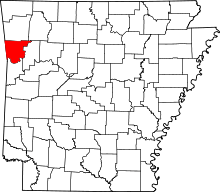 | |
| Towns | ||
| Unincorporated communities | ||