Catherine, Colorado
| Catherine, Colorado | |
|---|---|
| Census-designated place | |
 Catherine  Catherine | |
| Coordinates: 39°24′11″N 107°7′45″W / 39.40306°N 107.12917°WCoordinates: 39°24′11″N 107°7′45″W / 39.40306°N 107.12917°W | |
| Country |
|
| State |
|
| County | Garfield County |
| Area | |
| • Total | 0.87 sq mi (2.25 km2) |
| • Land | 0.87 sq mi (2.25 km2) |
| • Water | 0.0 sq mi (0.0 km2) |
| Elevation | 6,340 ft (1,930 m) |
| Population (2010) | |
| • Total | 228 |
| • Density | 263/sq mi (101.4/km2) |
| Time zone | MST (UTC-7) |
| • Summer (DST) | MDT (UTC-6) |
| Area code(s) | 970 |
| FIPS code | 08-12460 |
| GNIS feature ID | 2583220 |
Catherine is a census-designated place (CDP) in Garfield County, Colorado, United States. The population as of the 2010 census was 228.[1]
It is located in the southeast corner of Garfield County, in the valley of the Roaring Fork River. Colorado State Highway 82 forms the northern edge of the CDP; it leads northwest 16 miles (26 km) to Glenwood Springs, the Garfield County seat, and southeast 24 miles (39 km) to Aspen. Catherine is bordered to the west by Mulford and to the east by El Jebel in Eagle County. The town of Carbondale is 5 miles (8 km) to the west.
According to the U.S. Census Bureau, the Catherine CDP has an area of 0.87 square miles (2.25 km2), all of it land.[1]
See also
References
- 1 2 "Geographic Identifiers: 2010 Demographic Profile Data (G001): Catherine CDP, Colorado". American Factfinder. U.S. Census Bureau. Retrieved November 16, 2016.
| Wikimedia Commons has media related to Catherine, Colorado. |
Municipalities and communities of Garfield County, Colorado, United States | ||
|---|---|---|
| Cities | 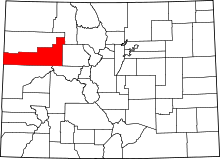 | |
| Towns | ||
| CDPs | ||
| Unincorporated communities | ||
This article is issued from Wikipedia - version of the 11/16/2016. The text is available under the Creative Commons Attribution/Share Alike but additional terms may apply for the media files.