Caryville, Tennessee
| Caryville, Tennessee | |
|---|---|
| Town | |
|
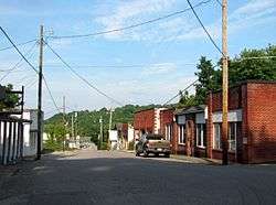
Main Street in Caryville | |
 Location of Caryville, Tennessee | |
| Coordinates: 36°19′12″N 84°12′58″W / 36.32000°N 84.21611°W | |
| Country | United States |
| State | Tennessee |
| County | Campbell |
| Area | |
| • Total | 5.5 sq mi (14.1 km2) |
| • Land | 5.2 sq mi (13.5 km2) |
| • Water | 0.3 sq mi (0.7 km2) |
| Elevation | 1,093 ft (333 m) |
| Population (2010) | |
| • Total | 2,297 |
| • Density | 441.7/sq mi (170.5/km2) |
| Time zone | Eastern (EST) (UTC-5) |
| • Summer (DST) | EDT (UTC-4) |
| ZIP code | 37714 |
| Area code(s) | 423 |
| FIPS code | 47-11360[1] |
| GNIS feature ID | 1279837[2] |
Caryville is a town in Campbell County, Tennessee, United States. The population was 2,297 at the 2010 census.
History
Originally known as Wheeler's Station, the town was renamed in honor of Judge William Carey, a prominent local landowner, in 1866.[3]
Geography
Caryville is located at 36°19′12″N 84°12′58″W / 36.32000°N 84.21611°W (36.319933, -84.216040).[4] The town is situated in a valley between Cross Mountain to the west and a series of rugged hills to the east. Cove Lake State Park lies immediately north of the town, and includes an artificial lake created by the impoundment of Cove Creek by Caryville Dam. Two major federal highways, Interstate 75 and U.S. Route 25W, intersect in Caryville.
According to the United States Census Bureau, the town has a total area of 5.5 square miles (14 km2), of which, 5.2 square miles (13 km2) of it is land and 0.2 square miles (0.52 km2) of it (4.58%) is water.
Demographics
| Historical population | |||
|---|---|---|---|
| Census | Pop. | %± | |
| 1880 | 212 | — | |
| 1970 | 648 | — | |
| 1980 | 2,039 | 214.7% | |
| 1990 | 1,751 | −14.1% | |
| 2000 | 2,243 | 28.1% | |
| 2010 | 2,297 | 2.4% | |
| Est. 2015 | 2,200 | [5] | −4.2% |
| Sources:[6][7] | |||
As of the census[1] of 2000, there were 2,243 people, 897 households, and 644 families residing in the town. The population density was 431.0 people per square mile (166.5/km²). There were 999 housing units at an average density of 192.0 per square mile (74.2/km²). The racial makeup of the town was 97.15% White, 0.27% African American, 0.53% Native American, 0.27% Asian, 0.18% Pacific Islander, 0.76% from other races, and 0.85% from two or more races. Hispanic or Latino of any race were 2.50% of the population.
There were 897 households out of which 33.2% had children under the age of 18 living with them, 54.7% were married couples living together, 12.8% had a female householder with no husband present, and 28.2% were non-families. 24.5% of all households were made up of individuals and 11.5% had someone living alone who was 65 years of age or older. The average household size was 2.50 and the average family size was 2.95.
In the town the population was spread out with 24.5% under the age of 18, 9.1% from 18 to 24, 31.1% from 25 to 44, 22.5% from 45 to 64, and 12.8% who were 65 years of age or older. The median age was 35 years. For every 100 females there were 96.1 males. For every 100 females age 18 and over, there were 94.5 males.
The median income for a household in the town was $28,307, and the median income for a family was $32,604. Males had a median income of $25,094 versus $19,500 for females. The per capita income for the town was $14,452. About 14.6% of families and 17.0% of the population were below the poverty line, including 23.7% of those under age 18 and 14.7% of those age 65 or over.
Economy
Caryville's economy consists mostly of restaurants, hotels and motels along the town's two exits (134 and 141) of Interstate 75.
References
- 1 2 "American FactFinder". United States Census Bureau. Archived from the original on 2013-09-11. Retrieved 2008-01-31.
- ↑ "US Board on Geographic Names". United States Geological Survey. 2007-10-25. Retrieved 2008-01-31.
- ↑ Dallas Bogan, "Careyville Got Its Name From William Carey, Land Owner, County Judge, Freight Line Operator," TNGenWeb.org. Originally published in the LaFollette Press.
- ↑ "US Gazetteer files: 2010, 2000, and 1990". United States Census Bureau. 2011-02-12. Retrieved 2011-04-23.
- ↑ "Annual Estimates of the Resident Population for Incorporated Places: April 1, 2010 to July 1, 2015". Retrieved July 2, 2016.
- ↑ "Census of Population and Housing: Decennial Censuses". United States Census Bureau. Retrieved 2012-03-04.
- ↑ "Incorporated Places and Minor Civil Divisions Datasets: Subcounty Resident Population Estimates: April 1, 2010 to July 1, 2012". Population Estimates. U.S. Census Bureau. Archived from the original on 17 June 2013. Retrieved 11 December 2013.
External links
 Media related to Caryville, Tennessee at Wikimedia Commons
- Municipal Technical Advisory Service entry for Caryville — information on local government, elections, and link to charter
Coordinates: 36°19′12″N 84°12′58″W / 36.319933°N 84.21604°W
Municipalities and communities of Campbell County, Tennessee, United States | ||
|---|---|---|
| Cities | ||
| Towns | ||
| CDP | ||
| Unincorporated communities | ||
| Footnotes | ‡ This populated place also has portions in an adjacent county or counties | |