Caro, Michigan
| Caro, Michigan | |
|---|---|
| City | |
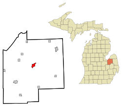 Location of Caro, Michigan | |
| Coordinates: 43°29′28″N 83°23′49″W / 43.49111°N 83.39694°WCoordinates: 43°29′28″N 83°23′49″W / 43.49111°N 83.39694°W | |
| Country | United States |
| State | Michigan |
| County | Tuscola |
| Incorporated | 1871 |
| Area[1] | |
| • Total | 2.80 sq mi (7.25 km2) |
| • Land | 2.79 sq mi (7.23 km2) |
| • Water | 0.01 sq mi (0.03 km2) |
| Elevation | 725 ft (221 m) |
| Population (2010)[2] | |
| • Total | 4,229 |
| • Estimate (2014[3]) | 4,116 |
| • Density | 1,515.8/sq mi (585.3/km2) |
| Time zone | Eastern (EST) (UTC-5) |
| • Summer (DST) | EDT (UTC-4) |
| ZIP code | 48723 |
| Area code(s) | 989 |
| FIPS code | 26-13420[4] |
| GNIS feature ID | 622746[5] |
| Website | http://www.carocity.net/ |
Caro is a city in and the county seat of Tuscola County, Michigan, United States.[6] The population was 4,229 at the 2010 census and 4,145 at the 2000 census (an increase of about 2%).
Caro is located northeast of Flint and east of Saginaw in Michigan's Thumb region.
History
Caro began as a logging camp on the Cass River established by Curtis Emerson in 1847.[7]
Later Samuel P. Sherman, who purchased 63 acres (250,000 m2) in the north half of the northwest quarter of section 3 in Indianfields Township on September 8, 1852. Prior to this, only two land sales had been recorded, both for lumbering or speculative purposes. His son, William E. Sherman, had worked in the lumber industry nearby on the Cass River for some time prior to 1852 and William's favorable report persuaded his father to visit in 1851 and afterwards purchased several tracts of land in addition to his initial purchase.
In the 1856-57 session of the Michigan Legislature, construction of a road was authorized from Bridgeport in Saginaw County northeast to Forestville in Sanilac County, with a route that would pass through what is now Caro. Once the road was cleared, commercial interests began to locate here. Melvin Gibbs, who had been keeping a hotel in an old log house, in 1858 put up a new frame building, known as the Gibbs House. In 1859, William E. Sherman built another hotel, which he named the Centerville House, based on the location being near the center of the county. The name Centerville became associated with the developing community.
In 1865, Centerville was selected as the county seat. A post office named Tuscola Center was established on April 25, 1866. To address confusion caused by the differing names, community leaders met in 1868 and at the suggestion of William E Sherman selected the name Caro, based on a variant spelling of the Egyptian city of Cairo.
Geography
According to the United States Census Bureau, the city has a total area of 2.80 square miles (7.25 km2), of which 2.79 square miles (7.23 km2) is land and 0.01 square miles (0.03 km2) is water.[1]
Caro is located in the northern portion of Indianfields Township has also incorporated some land in southern Almer Township. The Caro post office, with ZIP code 48723, also serves nearly all of Indianfields and Almer townships, as well as smaller portions of Wells Township to the east of Indianfields, Dayton Township to the southeast of Indianfields, Fremont Township to the south of Indianfields, Juniata Township to the west of Indianfields, Fairgrove Township to the northwest of Indianfields, Columbia Township, to the north of Almer, Elmwood Township to the northeast of Almer, and Ellington Township to the east of Almer.[8]
Transportation
The city is served by the Caro Municipal Airport, located approximately two miles southwest of the city. Founded in 1930, the airport was significantly improved under Michigan Department of Transportation grants throughout the 1980s and 1990s, to add and lengthen the runway and taxi-ways, as well as a new administration building and additional hangar space.
Demographics
| Historical population | |||
|---|---|---|---|
| Census | Pop. | %± | |
| 1880 | 1,282 | — | |
| 1890 | 1,701 | 32.7% | |
| 1900 | 2,006 | 17.9% | |
| 1910 | 2,272 | 13.3% | |
| 1920 | 2,704 | 19.0% | |
| 1930 | 2,554 | −5.5% | |
| 1940 | 3,070 | 20.2% | |
| 1950 | 3,464 | 12.8% | |
| 1960 | 3,534 | 2.0% | |
| 1970 | 4,322 | 22.3% | |
| 1980 | 4,317 | −0.1% | |
| 1990 | 4,054 | −6.1% | |
| 2000 | 4,145 | 2.2% | |
| 2010 | 4,229 | 2.0% | |
| Est. 2015 | 4,099 | [9] | −3.1% |
| U.S. Decennial Census | |||
2010 census
As of the census[2] of 2010, there were 4,229 people, 1,777 households, and 1,015 families residing in the city. The population density was 1,515.8 inhabitants per square mile (585.3/km2). There were 1,987 housing units at an average density of 712.2 per square mile (275.0/km2). The racial makeup of the city was 95.5% White, 0.7% African American, 0.4% Native American, 0.8% Asian, 1.2% from other races, and 1.5% from two or more races. Hispanic or Latino of any race were 5.3% of the population.
There were 1,777 households of which 28.6% had children under the age of 18 living with them, 36.9% were married couples living together, 15.4% had a female householder with no husband present, 4.9% had a male householder with no wife present, and 42.9% were non-families. 36.3% of all households were made up of individuals and 14.5% had someone living alone who was 65 years of age or older. The average household size was 2.22 and the average family size was 2.88.
The median age in the city was 39.6 years. 21.8% of residents were under the age of 18; 10.3% were between the ages of 18 and 24; 24.3% were from 25 to 44; 25% were from 45 to 64; and 18.8% were 65 years of age or older. The gender makeup of the city was 46.3% male and 53.7% female.
2000 census
As of the census[4] of 2000, there were 4,145 people, 1,738 households, and 1,042 families residing in the village. The population density was 1,746.0 per square mile (675.3/km²). There were 1,899 housing units at an average density of 799.9 per square mile (309.4/km²). The racial makeup of the village was 94.62% White, 0.55% African American, 1.01% Native American, 0.87% Asian, 0.05% Pacific Islander, 1.95% from other races, and 0.94% from two or more races. Hispanic or Latino of any race were 4.08% of the population.
There were 1,738 households out of which 29.6% had children under the age of 18 living with them, 42.6% were married couples living together, 13.5% had a female householder with no husband present, and 40.0% were non-families. 35.1% of all households were made up of individuals and 16.3% had someone living alone who was 65 years of age or older. The average household size was 2.31 and the average family size was 2.95.
In the village the population was spread out with 24.7% under the age of 18, 9.8% from 18 to 24, 26.3% from 25 to 44, 22.9% from 45 to 64, and 16.3% who were 65 years of age or older. The median age was 37 years. For every 100 females there were 82.4 males. For every 100 females age 18 and over, there were 78.8 males.
The median income for a household in the village was $31,226, and the median income for a family was $39,432. Males had a median income of $36,307 versus $25,833 for females. The per capita income for the village was $17,152. About 5.1% of families and 11.1% of the population were below the poverty line, including 11.4% of those under age 18 and 7.0% of those age 65 or over.

Caro industry
Caro is the home of a Pioneer Sugar Company facility. Local sugarbeet farmers retain joint ownership of the plant.
In 2003, Michigan Ethanol, a partner of Broin Companies, opened a corn ethanol production facility in southwest Caro. This plant is now owned by Poet Biorefining.
The Caro Center, a mental health facility operated by the state of Michigan, originally opened as a support center for individuals with epilepsy and operated as a self-supportive community, producing its own vegetables and maintaining livestock. Following, it converted to an institution for the developmentally disabled, and now operates as an inpatient psychiatric hospital for mentally ill adults.
The former Camp Tuscola, which was a state correctional facility until 2005, is now a residential re-entry program.[10]
Media
Radio
The thumb area is an unranked radio area. Local radio in Caro includes WKYO AM and WIDL FM.
Newspapers
- Daily editions of the Detroit Free Press and The Detroit News, four-day-per-week editions of the Bay City Times and Saginaw News,[11] as well as the "Tuscola County Advertiser" and Vassar Pioneer Times are available.
Broadcast television
Tuscola County lies inside the Flint/Tri-Cities Television Market. Only stations available on Comcast in the Caro area are listed below.
- WNEM 5 (CBS/MyNetworkTV)
- WJRT 12 (ABC)
- WDCQ 19 (PBS)
- WEYI 25 (NBC)
- WBSF 46 (The CW)
- WAQP 49 (TCT)
- WSMH 66 (Fox)
Caro today
On July 23, 2007 Governor Jennifer Granholm announced Caro as a community chosen by the Michigan State Housing Development Authority (MSHDA) to take part in the Blueprints for Downtowns program. Caro will receive a comprehensive, market-driven strategy toward developing an action-oriented downtown that will result in economic growth, job creation and private investments.[12]
Municipal status
Caro residents voted in favor of changing to the status of a city on November 3, 2009. Village President Tom Striffler was elected to the position of mayor. Elected to the city council were Mike Henry, Rick Lipan, Joe Greene, Charlotte Kish, Amanda Langmaid, and Richard Pouliot.[13] The first meeting of the new city council was held on November 13.[14]
Climate
This climatic region is typified by large seasonal temperature differences, with warm to hot (and often humid) summers and cold (sometimes severely cold) winters. According to the Köppen Climate Classification system, Caro has a humid continental climate, abbreviated "Dfb" on climate maps.[15]
July averages 71 °F (21 °C), with high temperatures reaching 90 °F (32 °C) an average of 17 days per year. The average high temperature in July is 86 °F (30 °C). January averages 23 °F (-5 °C), with an average monthly low of 15 °F (-9 °C).[16]
References
- 1 2 "US Gazetteer files 2010". United States Census Bureau. Archived from the original on 2012-07-14. Retrieved 2012-11-25.
- 1 2 "American FactFinder". United States Census Bureau. Retrieved 2012-11-25.
- ↑ "Population Estimates". United States Census Bureau. Retrieved 2013-06-03.
- 1 2 "American FactFinder". United States Census Bureau. Archived from the original on 2013-09-11. Retrieved 2008-01-31.
- ↑ U.S. Geological Survey Geographic Names Information System: Caro, Michigan
- ↑ "Find a County". National Association of Counties. Archived from the original on 2011-05-31. Retrieved 2011-06-07.
- ↑ Walter Romig, Michigan Place Names, p. 99
- ↑ 48723 5-Digit ZCTA, 487 3-Digit ZCTA - Reference Map - American FactFinder, U.S. Census Bureau, 2000 census
- ↑ "Annual Estimates of the Resident Population for Incorporated Places: April 1, 2010 to July 1, 2015". Retrieved July 2, 2016.
- ↑ Gilchrist, Tom. "New effort assists parolees with housing, employment." Bay City Times, 27 Feb 2007. Retrieved March 7, 2007
- ↑ How the launch of the MLive Media Group affects you, mlive.com, November 2, 2011, Retrieved November 3, 2011 Archived December 6, 2011, at the Wayback Machine.
- ↑ Archived June 7, 2015, at the Wayback Machine.
- ↑ Archived November 10, 2009, at the Wayback Machine.
- ↑ Joles, Amy. [Caro council meets as a city http://www.tuscolatoday.com/news/2009/nov/14/caro-council-meets-city[]], Tuscola County Advertiser, 2009-11-14. Accessed 2009-12-07.
- ↑ Climate Summary for Caro, Michigan
- ↑ "Caro, Michigan Travel Weather Averages (Weatherbase)". Weatherbase. Retrieved 2016-03-08.
Further reading
- History of Tuscola and Bay Counties, Michigan: with illustrations and biographical sketches of some of their prominent men and pioneers. Ann Arbor, Mich.: University of Michigan Library. 2005 [1883]. Retrieved 2009-03-08.
External links
- City website
- Local Newspaper -- The Tuscola County Advertiser
- Caro Chamber of Commerce
- Pumpkin Festival
Municipalities and communities of Tuscola County, Michigan, United States | ||
|---|---|---|
| Cities | 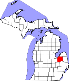 | |
| Villages | ||
| Charter township | ||
| General law townships | ||
| CDP | ||
| Other unincorporated communities | ||
| Footnotes | ‡This populated place also has portions in an adjacent county or counties | |