Carnhot
Coordinates: 50°15′22″N 5°09′47″W / 50.256°N 5.163°W
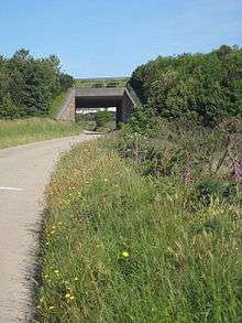
The A30 overbridge at Carnhot
Carnhot is a hamlet in the civil parish of Chacewater in Cornwall, England.[1] Carnot lies 2 miles (3.2 km) north-west of Chacewater on the road to Blackwater, Cornwall. Carnot is just to the south of the A30 road. [2]
Carnhot lies within Cornwall and West Devon Mining Landscape which is a World Heritage Site.
References
- ↑ Ordnance Survey One-inch Map of Great Britain; Truro and Falmouth, sheet 190. 1961
- ↑ "DEFRA Magic Map Application". DEFRA. Retrieved 10 January 2016.
Cornwall Portal | |
| Unitary authorities | |
| Major settlements |
|
| Rivers | |
| Topics | |
This article is issued from Wikipedia - version of the 1/10/2016. The text is available under the Creative Commons Attribution/Share Alike but additional terms may apply for the media files.