Caraway, Arkansas
| Caraway, Arkansas | |
|---|---|
| City | |
 Location in Craighead County and the state of Arkansas | |
| Coordinates: 35°45′33″N 90°19′23″W / 35.75917°N 90.32306°WCoordinates: 35°45′33″N 90°19′23″W / 35.75917°N 90.32306°W | |
| Country | United States |
| State | Arkansas |
| County | Craighead |
| Incorporated | 1923 |
| Area | |
| • Total | 2.3 sq mi (6 km2) |
| • Land | 2.3 sq mi (6 km2) |
| • Water | 0 sq mi (0 km2) |
| Elevation | 226 ft (69 m) |
| Population (2010) | |
| • Total | 1,279 |
| • Density | 556.1/sq mi (213.2/km2) |
| Time zone | Central (CST) (UTC-6) |
| • Summer (DST) | CDT (UTC-5) |
| ZIP code | 72419 |
| Area code(s) | 870 |
| FIPS code | 05-11410 |
| GNIS feature ID | 0057508 |
Caraway is a city[1] in Craighead County, Arkansas, United States. The population was 1,279 at the 2010 census. It is included in the Jonesboro, Arkansas Metropolitan Statistical Area.
History
The town originally began as a lumber camp known as White Switch in 1912. It was incorporated in 1923, taking its name from then-U.S. Senator Thaddeus Caraway.[2]
Geography
Caraway is located at 35°45′33″N 90°19′23″W / 35.75917°N 90.32306°W (35.759143, -90.323051).[3]
According to the United States Census Bureau, the town has a total area of 6.0 km² (2.3 mi²), all land.
List Of Highways
Demographics
| Historical population | |||
|---|---|---|---|
| Census | Pop. | %± | |
| 1930 | 425 | — | |
| 1940 | 477 | 12.2% | |
| 1950 | 970 | 103.4% | |
| 1960 | 821 | −15.4% | |
| 1970 | 952 | 16.0% | |
| 1980 | 1,165 | 22.4% | |
| 1990 | 1,178 | 1.1% | |
| 2000 | 1,349 | 14.5% | |
| 2010 | 1,279 | −5.2% | |
| Est. 2015 | 1,270 | [4] | −0.7% |
2014 Estimate[6] | |||
As of the census[7] of 2000, there were 1,349 people, 547 households, and 386 families residing in the town. The population density was 224.5/km² (581.4/mi²). There were 606 housing units at an average density of 100.9/km² (261.2/mi²). The racial makeup of the town was 97.63% White, 0.07% Native American, 0.07% Asian, 1.33% from other races, and 0.89% from two or more races. 2.89% of the population were Hispanic or Latino of any race.
There were 547 households out of which 34.9% had children under the age of 18 living with them, 54.1% were married couples living together, 13.2% had a female householder with no husband present, and 29.4% were non-families. 27.6% of all households were made up of individuals and 14.6% had someone living alone who was 65 years of age or older. The average household size was 2.41 and the average family size was 2.93.
In the town the population was spread out with 25.4% under the age of 18, 9.0% from 18 to 24, 25.8% from 25 to 44, 24.9% from 45 to 64, and 14.9% who were 65 years of age or older. The median age was 37 years. For every 100 females there were 87.9 males. For every 100 females age 18 and over, there were 80.9 males.
The median income for a household in the town was $22,279, and the median income for a family was $26,600. Males had a median income of $25,809 versus $17,000 for females. The per capita income for the town was $11,647. About 21.9% of families and 26.3% of the population were below the poverty line, including 37.1% of those under age 18 and 35.6% of those age 65 or over.
Notable People
- Nick Bacon, an army first sergeant during the Vietnam War and recipient of the Medal of Honor
References
- ↑ Local.Arkansas.gov - Caraway, retrieved September 3, 2012
- ↑ "Caraway (Craighead County)". Encyclopedia of Arkansas History and Culture.
- ↑ "US Gazetteer files: 2010, 2000, and 1990". United States Census Bureau. 2011-02-12. Retrieved 2011-04-23.
- ↑ "Annual Estimates of the Resident Population for Incorporated Places: April 1, 2010 to July 1, 2015". Retrieved July 2, 2016.
- ↑ "Census of Population and Housing". Census.gov. Archived from the original on May 11, 2015. Retrieved June 4, 2015.
- ↑ "Annual Estimates of the Resident Population for Incorporated Places: April 1, 2010 to July 1, 2014". Retrieved June 4, 2015.
- ↑ "American FactFinder". United States Census Bureau. Archived from the original on 2013-09-11. Retrieved 2008-01-31.
Municipalities and communities of Craighead County, Arkansas, United States | ||
|---|---|---|
| Cities | 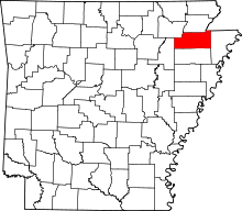 | |
| Towns | ||
| Unincorporated communities |
| |