Brookland, Arkansas
| Brookland, Arkansas | |
|---|---|
| City | |
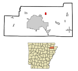 Location in Craighead County and the state of Arkansas | |
| Coordinates: 35°54′9″N 90°34′54″W / 35.90250°N 90.58167°WCoordinates: 35°54′9″N 90°34′54″W / 35.90250°N 90.58167°W | |
| Country | United States |
| State | Arkansas |
| County | Craighead |
| Area | |
| • Total | 2.05 sq mi (5.31 km2) |
| • Land | 2.05 sq mi (5.30 km2) |
| • Water | 0.008 sq mi (0.02 km2) |
| Elevation | 262 ft (80 m) |
| Population (2010) | |
| • Total | 1,642 |
| • Density | 803/sq mi (310.0/km2) |
| Time zone | Central (CST) (UTC-6) |
| • Summer (DST) | CDT (UTC-5) |
| ZIP code | 72417 |
| Area code(s) | 870 |
| FIPS code | 05-09100 |
| GNIS feature ID | 0076423 |
| Website |
www |
Brookland is a city[1] in Craighead County, Arkansas, United States. The population was 1,642 at the 2010 census.[2] It is included in the Jonesboro, Arkansas Metropolitan Statistical Area.
Geography
Brookland is located in northern Craighead County at 35°54′9″N 90°34′54″W / 35.90250°N 90.58167°W (35.902386, -90.581591).[3] Via U.S. Route 49 it is 8 miles (13 km) northeast of downtown Jonesboro, the county seat. Paragould is 12 miles (19 km) north via US 49.
According to the United States Census Bureau, the city has a total area of 2.0 square miles (5.3 km2), of which 0.008 square miles (0.02 km2), or 0.33%, is water.[2]
List of highways
Demographics
| Historical population | |||
|---|---|---|---|
| Census | Pop. | %± | |
| 1920 | 326 | — | |
| 1930 | 270 | −17.2% | |
| 1940 | 276 | 2.2% | |
| 1950 | 334 | 21.0% | |
| 1960 | 301 | −9.9% | |
| 1970 | 465 | 54.5% | |
| 1980 | 840 | 80.6% | |
| 1990 | 919 | 9.4% | |
| 2000 | 1,332 | 44.9% | |
| 2010 | 1,642 | 23.3% | |
| Est. 2015 | 2,977 | [4] | 81.3% |
2015 Estimate[6] | |||
As of the census[7] of 2000, there were 1,332 people, 499 households, and 384 families residing in the town. The population density was 1,220.1 inhabitants per square mile (471.8/km²). There were 537 housing units at an average density of 491.9 per square mile (190.2/km²). The racial makeup of the town was 97.52% White, 0.68% Black or African American, 0.38% Native American, 0.68% from other races, and 0.75% from two or more races. 1.05% of the population were Hispanic or Latino of any race.
There were 499 households out of which 43.7% had children under the age of 18 living with them, 59.3% were married couples living together, 14.4% had a female householder with no husband present, and 23.0% were non-families. 19.6% of all households were made up of individuals and 11.0% had someone living alone who was 65 years of age or older. The average household size was 2.67 and the average family size was 3.07.
In the town the population was spread out with 29.7% under the age of 18, 9.2% from 18 to 24, 31.8% from 25 to 44, 17.6% from 45 to 64, and 11.6% who were 65 years of age or older. The median age was 31 years. For every 100 females there were 95.0 males. For every 100 females age 18 and over, there were 87.2 males.
The median income for a household in the town was $33,125, and the median income for a family was $37,500. Males had a median income of $27,471 versus $18,864 for females. The per capita income for the town was $13,744. About 7.0% of families and 11.1% of the population were below the poverty line, including 17.4% of those under age 18 and 18.7% of those age 65 or over.
References
- ↑ Local.Arkansas.gov - Brookland, retrieved September 3, 2012
- 1 2 "Geographic Identifiers: 2010 Demographic Profile Data (G001): Brookland city, Arkansas". U.S. Census Bureau, American Factfinder. Retrieved June 18, 2014.
- ↑ "US Gazetteer files: 2010, 2000, and 1990". United States Census Bureau. 2011-02-12. Retrieved 2011-04-23.
- ↑ "Annual Estimates of the Resident Population for Incorporated Places: April 1, 2010 to July 1, 2015". Retrieved July 2, 2016.
- ↑ "Census of Population and Housing". Census.gov. Archived from the original on May 11, 2015. Retrieved June 4, 2015.
- ↑ "Annual Estimates of the Resident Population for Incorporated Places: April 1, 2010 to July 1, 2015". Retrieved June 26, 2016.
- ↑ "American FactFinder". United States Census Bureau. Archived from the original on 2013-09-11. Retrieved 2008-01-31.
External links
Municipalities and communities of Craighead County, Arkansas, United States | ||
|---|---|---|
| Cities | 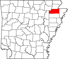 | |
| Towns | ||
| Unincorporated communities |
| |